|
|
| Line 68: |
Line 68: |
| }} | | }} |
| {{Production | | {{Production |
| |Company=L. R. Gabrie | | |Company=L. R. Gabriel |
| |Mine-Name=Gabriel | | |Mine-Name=Gabriel |
| |Date=1922-1942 | | |Date=1922-1942 |
Revision as of 10:41, January 5, 2022
Mine Index Number: 4140
| Company Name:
|
L. R. Gabriel
|
| Mine Name:
|
Gabriel Mine
|
| Start Date:
|
1916
|
End Date:
|
1943
|
| Type of Mine:
|
Underground
|
| Total acres shown:
|
11 The area was later partially surface-mined by various operators.
|
| Acres after map date:
|
Production indicates that less than 1 acre was mined after the map date.
|
General Area of mining acres shown:
|
|
|
|
Shaft, Slope, Drift or Tipple Location(s)
| Type
|
County
|
Township-Range
|
Section
|
Part Section
|
| Main slope
|
Williamson
|
9S 4E
|
32
|
NW NE NE
|
| Air shaft
|
Williamson
|
9S 4E
|
32
|
SW NE NE Not shown on accompanying map due to later surface mining.
|
Geology
Geological Problems Reported
Production
| Company
|
Mine Name
|
Date
|
Production (tons)
|
| Gabriel Brothers
|
Gabriel
|
1920-1922 #Production not reported 1922 for mines producing less than 10,000 tons Production not reported 1922 for mines producing less than 10,000 tons
|
2,000
|
|
|
Production Notes
Coal Report production (if available)
Sources of Data
| Microfilm, document 353143
|
8-21-1942
|
1:1200
|
1:1200
|
Not final
|
Annotated Bibliography (Data source - brief description of information)
| Coal Reports - Production, ownership, years of operation.
|
| Directory of Illinois Coal Mines (Williamson County) - Mine names, mine index, ownership, years of operation.
|
| Mine notes (Williamson County) - Mine type, slope location, seam, depth, thickness.
|
| Microfilm map, document 353143, reel 03142, frame 20 - Slope and shaft locations, mine outline, mining method.
|
Mine Notes
Mine Images
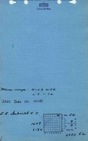
![[[:Gabriel|Gabriel]]](https://go.illinois.edu/ILMImages/williamson/thumbnails/m4140_il_1417_01_th.jpg) These files may not be true to scale and are not georgistered. These files may not be true to scale and are not georgistered.
|
Map Type:
|
State Archive
|
| Map ID:
|
IL_1417_01
|
| Company:
|
L. R. Gabriel
|
| Mine Name:
|
Gabriel
|
| Caption:
|
|
| Map Date:
|
08-21-1942
|
| Map Status:
|
Not Final
|
| Image Credit:
|
|
| Note:
|
|
| More Info:
|
M4140 il 1417 01
|
| Full Res Download:These files are true to scale and most are georegistered for gis software. These files may be a very large (>1GB) download!
|
https://go.illinois.edu/ILMImages/williamson/m4081 IL 1407 01.zip
|
Photographs