4118: Difference between revisions
(Created page with "{{Sidebar Info Query}} {{Header |checked=1st Entry |unlocated=No |shown_on_map=Yes |Mine-index=4118 |Coal_co=Polinski Coal Company |Mine Name Header=Polinski Mine |mine_type=S...") |
No edit summary |
||
| Line 1: | Line 1: | ||
{{Sidebar Info Query}} | {{Sidebar Info Query}} | ||
{{Header | {{Header | ||
|checked= | |checked=Checked OK | ||
|unlocated=No | |unlocated=No | ||
|shown_on_map=Yes | |shown_on_map=Yes | ||
| Line 84: | Line 84: | ||
}} | }} | ||
{{Annotated bibliography | {{Annotated bibliography | ||
|bibliography=USGS topographic map, 1965, photorevised 1990 - Mine outline. | |bibliography=USGS topographic map, Crab Orchard Quadrangle, 1965, photorevised 1990 - Mine outline. | ||
}} | }} | ||
==Mine Notes== | ==Mine Notes== | ||
Revision as of 16:35, January 10, 2022
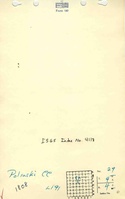
Mine Index Number: 4118
| Company Name: | Polinski Coal Company | ||
|---|---|---|---|
| Mine Name: | Polinski Mine | ||
| Start Date: | 1948 | End Date: | March 1950 |
| Type of Mine: | Surface | ||
| Total acres shown: | 18 Production indicates approximately 3 acres were mined. | ||
| Acres after map date: | General Area of mining acres shown: | ||
Shaft, Slope, Drift or Tipple Location(s)
| Type | County | Township-Range | Section | Part Section |
|---|
| Tipple / pit | Williamson | 9S 4E | 29 | SE SE NW |
Geology
| Thickness (ft) | |||||
|---|---|---|---|---|---|
| Seam | Depth (ft) | Min | Max | Ave | Mining Method |
| Herrin | 25-30 | 5.33-5.67 | Surface |
Geological Problems Reported
Production
| Company | Mine Name | Date | Production (tons) |
| Polinski Coal Company | Polinski | 1948-1950 | 28,228 |
Production Notes
Coal Report production (if available)
Sources of Data
| Source Map | Map Date | Original Scale | Digitized Scale | Map Type |
| Mine notes | Undated | 1:62500 | 1:24000 | Secondary source |
| USGS topographic map | 1965, PR 1990 | 1:24000 | 1:24000 | Secondary source |
Annotated Bibliography (Data source - brief description of information)
| Coal Reports - Production, ownership, years of operation, depth, thickness. |
| Directory of Illinois Coal Mines (Williamson County) - Mine names, mine index, ownership, years of operation. |
| Mine notes (Williamson County) - Mine type, mine location, mine outline (sketched map), seam, depth. |
| USGS topographic map, Crab Orchard Quadrangle, 1965, photorevised 1990 - Mine outline. |
Mine Notes
Mine Images

Photographs