4180: Difference between revisions
Kate.O'Brien (talk | contribs) (Created page with "{{Sidebar Info Query}} {{Header |checked=1st Entry |unlocated=No |shown_on_map=Yes |Mine-index=4180 |Coal_co=Shawneetown Coal Corporation |Mine Name Header=Shawneetown No. 1 M...") |
No edit summary |
||
| Line 1: | Line 1: | ||
{{Sidebar Info Query}} | {{Sidebar Info Query}} | ||
{{Header | {{Header | ||
|checked= | |checked=Checked OK | ||
|unlocated=No | |unlocated=No | ||
|shown_on_map=Yes | |shown_on_map=Yes | ||
| Line 12: | Line 12: | ||
|quad1=Rudement | |quad1=Rudement | ||
|year-start=1964 | |year-start=1964 | ||
|year-end=1964 | |year-end=October 1964 | ||
|Latitude=0 | |Latitude=0 | ||
|Longitude=0 | |Longitude=0 | ||
Revision as of 10:39, February 9, 2022
Mine Index Number: 4180
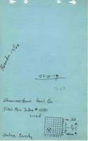
| Company Name: | Shawneetown Coal Corporation | ||
|---|---|---|---|
| Mine Name: | Shawneetown No. 1 Mine | ||
| Start Date: | 1964 | End Date: | October 1964 |
| Type of Mine: | Underground | ||
| Total acres shown: | Less than 1 | ||
| Acres after map date: | General Area of mining acres shown: | ||
Shaft, Slope, Drift or Tipple Location(s)
| Type | County | Township-Range | Section | Part Section |
|---|
| Main drift | Saline | 9S 7E | 33 | SE SE SW |
| Drift | Saline | 9S 7E | 33 | SE SE SW |
| Drift | Saline | 9S 7E | 33 | SE SE SW |
Geology
| Thickness (ft) | |||||
|---|---|---|---|---|---|
| Seam | Depth (ft) | Min | Max | Ave | Mining Method |
| Dekoven | 132 | 4.17 | RP |
Geological Problems Reported
Production
| Company | Mine Name | Date | Production (tons) |
| Shawneetown Coal Corporation | Shawneetown No. 1 | 1964-1964 | 568 |
Production Notes
Coal Report production (if available)
Sources of Data
| Source Map | Map Date | Original Scale | Digitized Scale | Map Type |
| Microfilm, document 352815 | 2-4-1965 | 1:4800 | 1:7944 | Final |
Annotated Bibliography (Data source - brief description of information)
| Coal Reports - Production, ownership, years of operation, depth, thickness. |
| Directory of Illinois Coal Mines (Saline County) - Mine names, mine index, ownership, years of operation. |
| Mine notes (Saline County) - Drift location, seam. |
| Microfilm map, document 352815, reel 03140, frame 368 - Drift location, mine outline, mining method. |
Mine Notes
Mine Images
Photographs