4104: Difference between revisions
No edit summary |
Alan.Myers (talk | contribs) No edit summary |
||
| Line 14: | Line 14: | ||
|year-start=1938 | |year-start=1938 | ||
|year-end=December 1953 | |year-end=December 1953 | ||
|Latitude= | |Latitude=37.71074731 | ||
|Longitude= | |Longitude=-88.75417294 | ||
|Zoom=15 | |Zoom=15 | ||
}} | }} | ||
| Line 54: | Line 54: | ||
|Date=1938-1939 | |Date=1938-1939 | ||
|Production=3,378 | |Production=3,378 | ||
|Sum=No | |||
}} | }} | ||
{{Production | {{Production | ||
| Line 60: | Line 61: | ||
|Date=1939-1939 | |Date=1939-1939 | ||
|Production=4,378 | |Production=4,378 | ||
|Sum=No | |||
}} | }} | ||
{{Production | {{Production | ||
| Line 66: | Line 68: | ||
|Date=1940-1953 | |Date=1940-1953 | ||
|Production=355,601 | |Production=355,601 | ||
|Sum=No | |||
| | |||
}} | }} | ||
{{Production | {{Production | ||
|Production=363,357 | |Production=363,357 | ||
|Sum=Yes | |||
}} | }} | ||
===Production Notes=== | ===Production Notes=== | ||
Revision as of 10:56, April 15, 2022
Mine Index Number: 4104
| Company Name: | Green Valley Coal Company | ||
|---|---|---|---|
| Mine Name: | Green Valley No. 1238 Mine | ||
| Start Date: | 1938 | End Date: | December 1953 |
| Type of Mine: | Underground | ||
| Total acres shown: | 83 | ||
| Acres after map date: | General Area of mining acres shown: | ||
|
This mine was later partially surface-mined by Amax Delta Mine (mine index 702). | |||
Shaft, Slope, Drift or Tipple Location(s)
| Type | County | Township-Range | Section | Part Section |
|---|
| Main slope | Williamson | 9S 4E | 27 | SE SE NW |
| Air shaft | Williamson | 9S 4E | 27 | SW SE NW |
Geology
| Thickness (ft) | |||||
|---|---|---|---|---|---|
| Seam | Depth (ft) | Min | Max | Ave | Mining Method |
| Springfield | 75-150 | 4.5-4.67 | MRP |
Geological Problems Reported
Production
| Company | Mine Name | Date | Production (tons) |
| Green Valley Coal Company | Green Valley | 1938-1939 | 3,378 |
| Winning Coal Company | Green Valley | 1939-1939 | 4,378 |
| Green Valley Coal Company | Green Valley No. 1238 | 1940-1953 | 355,601 |
| Total Production: 363,357 | |||
Production Notes
Coal Report production (if available)
Sources of Data
| Source Map | Map Date | Original Scale | Digitized Scale | Map Type |
| Microfilm, document 353125 | 3-1939 | 1:1200 | 1:2069 | Final |
Annotated Bibliography (Data source - brief description of information)
| Coal Reports - Production, ownership, years of operation, depth, thickness. |
| Directory of Illinois Coal Mines (Williamson County) - Mine names, mine index, ownership, years of operation. |
| Mine notes (Williamson County) - Mine type, slope location, seam, depth. |
| Microfilm map, document 353125, reel 03141, frame 354 - Slope and shaft locations, mine outline, mining method. |
Mine Notes
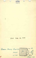
Mine Images
![[[:Green Valley No. 1238|Green Valley No. 1238]]](https://go.illinois.edu/ILMImages/williamson/thumbnails/m4104_il_1612_01_th.jpg)
Photographs