4125: Difference between revisions
No edit summary |
Alan.Myers (talk | contribs) No edit summary |
||
| Line 13: | Line 13: | ||
|year-start=1935 | |year-start=1935 | ||
|year-end=1944 | |year-end=1944 | ||
|Latitude= | |Latitude=37.70779387 | ||
|Longitude= | |Longitude=-88.80434604 | ||
|Zoom=15 | |Zoom=15 | ||
}} | }} | ||
| Line 54: | Line 54: | ||
|Date=1935-1944 | |Date=1935-1944 | ||
|Production=149,854 | |Production=149,854 | ||
|Sum=Yes | |||
| | |||
}} | }} | ||
===Production Notes=== | ===Production Notes=== | ||
Revision as of 11:23, April 15, 2022
Mine Index Number: 4125
| Company Name: | Willow Springs Coal Company | ||
|---|---|---|---|
| Mine Name: | Willow Springs Mine | ||
| Start Date: | 1935 | End Date: | 1944 |
| Type of Mine: | Underground | ||
| Total acres shown: | 36 | ||
| Acres after map date: | General Area of mining acres shown: | ||
Shaft, Slope, Drift or Tipple Location(s)
| Type | County | Township-Range | Section | Part Section |
|---|
| Main slope | Williamson | 9S 4E | 30 | SE NW SE |
| Air shaft | Williamson | 9S 4E | 30 | SE NW SE |
Geology
| Thickness (ft) | |||||
|---|---|---|---|---|---|
| Seam | Depth (ft) | Min | Max | Ave | Mining Method |
| Springfield | 60 | 4.5 | MRP |
Geological Problems Reported
A southwest-northeast trending fault was shown on a company map north of the slope and air shaft.
Production
| Company | Mine Name | Date | Production (tons) |
| Willow Springs Coal Company | Willow Springs | 1935-1944 | 149,854 |
| Total Production: 149,854 | |||
Production Notes
Coal Report production (if available)
Sources of Data
| Source Map | Map Date | Original Scale | Digitized Scale | Map Type |
| Microfilm, document 353050 | 1-5-1944 | 1:1200 | 1:1407 | Final |
Annotated Bibliography (Data source - brief description of information)
| Coal Reports - Production, ownership, years of operation. |
| Directory of Illinois Coal Mines (Williamson County) - Mine names, mine index, ownership, years of operation. |
| Mine notes (Williamson County) - Mine type, slope location, seam, depth, thickness. |
| Microfilm map, document 353050, reel 03141, frame 236 - Slope and shaft locations, mine outline, mining method. |
| Company map, ISGS map library, 4103.W52 i5.1-111 - Geologic problems. |
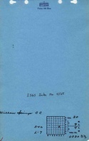
Mine Notes
Mine Images
![[[:Willow Springs|Willow Springs]]](https://go.illinois.edu/ILMImages/williamson/thumbnails/m4125_msha_527_01_th.jpg)
Photographs