4581: Difference between revisions
No edit summary |
Alan.Myers (talk | contribs) No edit summary |
||
| Line 14: | Line 14: | ||
|year-start=1948 | |year-start=1948 | ||
|year-end=December 1949 | |year-end=December 1949 | ||
|Latitude= | |Latitude=37.70026499 | ||
|Longitude= | |Longitude=-88.65127763 | ||
|Zoom=15 | |Zoom=15 | ||
}} | }} | ||
| Line 47: | Line 47: | ||
|Date=1948-1949 | |Date=1948-1949 | ||
|Production=25,958 | |Production=25,958 | ||
|Sum=Yes | |||
}} | }} | ||
===Production Notes=== | ===Production Notes=== | ||
Revision as of 15:02, April 15, 2022
Mine Index Number: 4581
| Company Name: | Johnson Coal Company | ||
|---|---|---|---|
| Mine Name: | Johnson No. 1 Mine | ||
| Start Date: | 1948 | End Date: | December 1949 |
| Type of Mine: | Surface | ||
| Total acres shown: | None | ||
| Acres after map date: | 4 | General Area of mining acres shown: | |
Shaft, Slope, Drift or Tipple Location(s)
| Type | County | Township-Range | Section | Part Section |
|---|
| Tipple / pit | Saline | 9S 5E | 34 | NW NW NW |
Geology
| Thickness (ft) | |||||
|---|---|---|---|---|---|
| Seam | Depth (ft) | Min | Max | Ave | Mining Method |
| Herrin | 25 | 4.5-5.0 | Surface |
Geological Problems Reported
Production
| Company | Mine Name | Date | Production (tons) |
| Johnson Coal Company | Johnson No. 1 | 1948-1949 | 25,958 |
| Total Production: 25,958 | |||
Production Notes
Coal Report production (if available)
Sources of Data
| Source Map | Map Date | Original Scale | Digitized Scale | Map Type |
| Mine notes | Undated | (text only) | 1:24000Point plotted onto 1:24,000 USGS quadrangle and digitized. | Secondary source |
Annotated Bibliography (Data source - brief description of information)
| Coal Reports - Production, ownership, years of operation, thickness. |
| Directory of Illinois Coal Mines (Saline County) - Mine names, mine index, ownership, years of operation. |
| Mine notes (Saline County) - Mine type, mine location, seam, depth, thickness. |
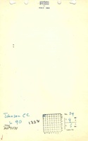
Mine Notes
Mine Images

Photographs