3828: Difference between revisions
Alan.Myers (talk | contribs) No edit summary |
No edit summary |
||
| (3 intermediate revisions by 3 users not shown) | |||
| Line 1: | Line 1: | ||
{{Sidebar Info Query}} | {{Sidebar Info Query}} | ||
{{Header | {{Header | ||
|checked=Checked OK | |||
|unlocated=No | |unlocated=No | ||
|shown_on_map=Yes | |shown_on_map=Yes | ||
|reason_nsm=The area was later surface mined by United Electric No. 4 Mine (mine index 3830), so a point designating this position is not shown on our accompanying map. | |reason_nsm=The area was later surface mined by United Electric No. 4 Mine (mine index [[3830]]), so a point designating this position is not shown on our accompanying map. | ||
|Mine-index=3828 | |Mine-index=3828 | ||
|Coal_co=Walton and Sheets | |Coal_co=Walton and Sheets | ||
| Line 9: | Line 10: | ||
|mine_type=Underground | |mine_type=Underground | ||
|mined-out-area=None | |mined-out-area=None | ||
|indicated=No | |||
|county1=Vermilion | |county1=Vermilion | ||
|quad1=Danville SW | |quad1=Danville SW | ||
| Line 15: | Line 17: | ||
|Latitude=40.1095520980001 | |Latitude=40.1095520980001 | ||
|Longitude=-87.627755355 | |Longitude=-87.627755355 | ||
|Zoom= | |Zoom=16 | ||
}} | }} | ||
==Shaft, Slope, Drift or Tipple Location(s)== | ==Shaft, Slope, Drift or Tipple Location(s)== | ||
| Line 43: | Line 45: | ||
|company_note={{#info:No production reported under this name; years of operation and production unknown|note}} | |company_note={{#info:No production reported under this name; years of operation and production unknown|note}} | ||
|Mine-Name=Walton and Sheets | |Mine-Name=Walton and Sheets | ||
|Sum=No | |||
}} | }} | ||
===Production Notes=== | ===Production Notes=== | ||
Latest revision as of 13:22, September 19, 2022
Mine Index Number: 3828
| Company Name: | Walton and Sheets | ||
|---|---|---|---|
| Mine Name: | Walton and Sheets | ||
| Start Date: | Unknown | End Date: | Unknown |
| Type of Mine: | Underground | ||
| Total acres shown: | None | ||
| Acres after map date: | General Area of mining acres shown: | ||
|
The area was later surface mined by United Electric No. 4 Mine (mine index 3830), so a point designating this position is not shown on our accompanying map. | |||
Shaft, Slope, Drift or Tipple Location(s)
| Type | County | Township-Range | Section | Part Section |
|---|
| Slope | Vermilion | 19N 12W | 17 | NW SE SE |
Geology
| Thickness (ft) | |||||
|---|---|---|---|---|---|
| Seam | Depth (ft) | Min | Max | Ave | Mining Method |
| Danville | RP |
Geological Problems Reported
Production
| Company | Mine Name | Date | Production (tons) |
| Walton and Sheets No production reported under this name; years of operation and production unknown | Walton and Sheets | ||
Production Notes
Coal Report production (if available)
Sources of Data
| Source Map | Map Date | Original Scale | Digitized Scale | Map Type |
| Coal Section mine notes | Undated | 1:62500 | 1:24000 | Secondary source |
Annotated Bibliography (Data source - brief description of information)
| Coal Reports - Production, ownership, years of operation. |
| Directory of Illinois Coal Mines (Vermilion County) - Mine names, mine index, ownership, years of operation. |
| Mine notes (Vermilion County) - Mine type, slope location. |
Mine Notes
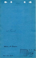
Mine Images
Photographs