0502: Difference between revisions
No edit summary |
No edit summary |
||
| Line 1: | Line 1: | ||
{{Sidebar Info Query}} | {{Sidebar Info Query}} | ||
{{Header | {{Header | ||
|checked= | |checked=Checked OK | ||
|unlocated=No | |unlocated=No | ||
|shown_on_map=Yes | |shown_on_map=Yes | ||
| Line 9: | Line 9: | ||
|mine_type=Underground | |mine_type=Underground | ||
|mined-out-area=552 | |mined-out-area=552 | ||
|indicated=No | |||
|county1=St. Clair | |county1=St. Clair | ||
|quad1=French Village | |quad1=French Village | ||
|quad2=Millstadt | |quad2=Millstadt | ||
|year-start=1889 | |year-start=1889 | ||
|year-end=1932 | |year-end=March 1932 | ||
|Latitude=38.507552628 | |Latitude=38.507552628 | ||
|Longitude=-90.00965144 | |Longitude=-90.00965144 | ||
Revision as of 11:02, September 23, 2022
Mine Index Number: 0502
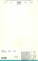
| Company Name: | Alcoa Ore Company | ||
|---|---|---|---|
| Mine Name: | Alcoa Mine | ||
| Start Date: | 1889 | End Date: | March 1932 |
| Type of Mine: | Underground | ||
| Total acres shown: | 552 | ||
| Acres after map date: | General Area of mining acres shown: | ||
Shaft, Slope, Drift or Tipple Location(s)
| Type | County | Township-Range | Section | Part Section |
|---|
| Main shaft | St. Clair | 1N 8W | 29 | NW SW NE |
| Air shaft | St. Clair | 1N 8W | 29 | NE SE NW |
| Murphy No. 2 shaft | St. Clair | 1N 8W | 29 | NE NW SE |
| Air shaft | St. Clair | 1N 8W | 29 | NE NW SE |
Geology
| Thickness (ft) | |||||
|---|---|---|---|---|---|
| Seam | Depth (ft) | Min | Max | Ave | Mining Method |
| Herrin | 51 | 6.0 | MRP |
Geological Problems Reported
The roof shale had numerous concretions, which ranged up to 18 inches in diameter. Some areas of the mine had many slips.
Production
| Company | Mine Name | Date | Production (tons) |
| Frank Murphy | Murphy No. 2 | 1889-1896 | 13,900 |
| Frederick Murphy | Branch | 1896-1909 | 177,970 |
| Reeb Coal Company | Murphy | 1909-1916 | 91,944 |
| Radium Coal Company | Radium | 1916-1920 | 326,949 |
| Aluminum Ore Company | Aluminum Ore | 1920-1929 | 1,715,689 |
| Alcoa Ore Company | Alcoa | 1929-1932 Mine listed "idle" until 1938. | 680,585 |
| Total Production: 3,007,037 | |||
Production Notes
Coal Report production (if available)
Sources of Data
| Source Map | Map Date | Original Scale | Digitized Scale | Map Type |
| Microfilm, document 351041 | 3-3-1938 | 1:2400 | 1:4634 | Final |
| Microfilm, document 351101 | Undated | 1:1200 | 1:1490 | Undated |
Annotated Bibliography (Data source - brief description of information)
| Coal Reports - Production, ownership, years of operation. |
| Directory of Illinois Coal Mines (St. Clair County) - Mine names, mine index, ownership, years of operation. |
| Microfilm map, document 351041, reel 03134, frames 130-132 - Shaft locations, mine outline, method. |
| Mine notes (St. Clair County) - Thickness, depth, seam, mine type, shaft location, geologic problems. |
| Microfilm, document 351101, reel 03134, frame 216 - Mine outline, shaft locations (Murphy Mine). |
Mine Notes
Mine Images


Photographs