3508: Difference between revisions
No edit summary |
No edit summary |
||
| (2 intermediate revisions by one other user not shown) | |||
| Line 1: | Line 1: | ||
{{Sidebar Info Query}} | {{Sidebar Info Query}} | ||
{{Header | {{Header | ||
|checked=Checked OK | |||
|unlocated=No | |unlocated=No | ||
|shown_on_map=Yes | |shown_on_map=Yes | ||
| Line 9: | Line 10: | ||
|mined-out-area=45 | |mined-out-area=45 | ||
|after_map=6 | |after_map=6 | ||
|indicated=No | |||
|county1=St. Clair | |county1=St. Clair | ||
|quad1=Freeburg | |quad1=Freeburg | ||
|year-start= | |datemod=Pre | ||
|year-start=1874 | |||
|year-end=1888 | |year-end=1888 | ||
|Latitude=38.4658844790001 | |Latitude=38.4658844790001 | ||
| Line 52: | Line 55: | ||
|Date=pre1874-1885 | |Date=pre1874-1885 | ||
|Production=102,719 {{#info: Production and ownership prior to 1882 are unknown. The mine was included in the 1874 Atlas of St. Clair County. The Coal Report of 1882 indicates 30 acres were mined.|note}} | |Production=102,719 {{#info: Production and ownership prior to 1882 are unknown. The mine was included in the 1874 Atlas of St. Clair County. The Coal Report of 1882 indicates 30 acres were mined.|note}} | ||
|Sum=No | |||
}} | }} | ||
{{Production | {{Production | ||
| Line 58: | Line 62: | ||
|Date=1885-1886 | |Date=1885-1886 | ||
|Production=20,258 {{#info: Production since map date|note}} | |Production=20,258 {{#info: Production since map date|note}} | ||
|Sum=No | |||
}} | }} | ||
{{Production | {{Production | ||
| Line 64: | Line 69: | ||
|Date=1886-1887 | |Date=1886-1887 | ||
|Production=11,897 {{#info: Production since map date|note}} | |Production=11,897 {{#info: Production since map date|note}} | ||
|Sum=No | |||
}} | }} | ||
{{Production | {{Production | ||
| Line 71: | Line 77: | ||
|Date=1887-1888 | |Date=1887-1888 | ||
|Production=5,640 {{#info: Production since map date|note}} | |Production=5,640 {{#info: Production since map date|note}} | ||
|Sum=No | |||
| | |||
}} | }} | ||
{{Production | {{Production | ||
|Production=140,514 | |Production=140,514 | ||
|Sum=Yes | |||
}} | }} | ||
===Production Notes=== | ===Production Notes=== | ||
| Line 112: | Line 117: | ||
}} | }} | ||
{{Annotated bibliography | {{Annotated bibliography | ||
|bibliography= | |bibliography=Atlas of St. Clair County, 1874, Warner and Beers - Years of operation. | ||
}} | }} | ||
{{Annotated bibliography | {{Annotated bibliography | ||
| Line 129: | Line 134: | ||
{{Photo Query}} | {{Photo Query}} | ||
{{Editwithform}} | {{Editwithform}} | ||
{{Editwithform}} | {{Editwithform}} | ||
Latest revision as of 11:11, October 1, 2022
Mine Index Number: 3508
| Company Name: | Consolidated Coal Company of St. Louis | ||
|---|---|---|---|
| Mine Name: | Heinrich Mine | ||
| Start Date: | Pre 1874 | End Date: | 1888 |
| Type of Mine: | Underground | ||
| Total acres shown: | 45 | ||
| Acres after map date: | 6 | General Area of mining acres shown: | |
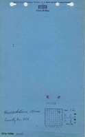
Shaft, Slope, Drift or Tipple Location(s)
| Type | County | Township-Range | Section | Part Section |
|---|
| Main shaft | St. Clair | 1S 8W | 12 | SE NW NE |
| Air shaft | St. Clair | 1S 8W | 12 | SW NE NE |
Geology
| Thickness (ft) | |||||
|---|---|---|---|---|---|
| Seam | Depth (ft) | Min | Max | Ave | Mining Method |
| Herrin | 95-100 | 6.0-6.5 | RPB |
Geological Problems Reported
Production
| Company | Mine Name | Date | Production (tons) |
| Heinrich Brothers | Heinrich | pre1874-1885 | 102,719 Production and ownership prior to 1882 are unknown. The mine was included in the 1874 Atlas of St. Clair County. The Coal Report of 1882 indicates 30 acres were mined. |
| Heinrich Brothers | Heinrich | 1885-1886 | 20,258 Production since map date |
| Consolidated Coal Company of St. Louis | Heinrich | 1886-1887 | 11,897 Production since map date |
| Heinrich (lessee) | Heinrich | 1887-1888 | 5,640 Production since map date |
| Total Production: 140,514 | |||
Production Notes
Coal Report production (if available)
Sources of Data
| Source Map | Map Date | Original Scale | Digitized Scale | Map Type |
| Microfilm, document 351007, frame 80 | 6-13-1885 | 1:960 | 1:1721 | Not final |
| Microfilm, document 351007, frame 81 | undated | 1:2400 | 1:3476 | Undated |
Annotated Bibliography (Data source - brief description of information)
| Coal Reports - Production, ownership, years of operation. |
| Directory of Illinois Coal Mines (St. Clair County) - Mine names, mine index, ownership, years of operation, depth thickness. |
| Mine notes (St. Clair County) - Mine type. |
| Federal Land Bank Report - Depth, thickness. |
| Atlas of St. Clair County, 1874, Warner and Beers - Years of operation. |
| Microfilm, document 351007, reel 03134, frame 80 - Shaft locations, mine outline, mining method. |
| Microfilm, document 351007, reel 03134, frame 81 - Shaft locations, mine placement. |
Mine Notes
Mine Images


Photographs