|
|
| Line 79: |
Line 79: |
| }} | | }} |
| {{Production | | {{Production |
| |Company=Superior Mining Company | | |Company=Superior Mining Company {{#info:The 1930 map's title block lists the operator as West Virginia Coal Company of Missouri. Production was not listed in the Coal Reports under that name.|note}} |
| |Mine-Name=Valley | | |Mine-Name=Valley |
| |Date=1918-1921 | | |Date=1918-1921 |
Revision as of 16:56, October 4, 2022
Mine Index Number: 3615
| Company Name:
|
Superior Mining Company
|
| Mine Name:
|
Valley Mine
|
| Start Date:
|
1901
|
End Date:
|
January 1921
|
| Type of Mine:
|
Underground
|
| Total acres shown:
|
104
|
| Acres after map date:
|
|
General Area of mining acres shown:
|
|
|
Valley Mine was connected underground to Superior Mine (mine index 0078) for haulage, as well as to Victor Mine (mine index 4331).
|
Shaft, Slope, Drift or Tipple Location(s)
| Type
|
County
|
Township-Range
|
Section
|
Part Section
|
| Main shaft
|
St. Clair
|
2N 9W
|
36
|
SE SE SE
|
| Air shaft
|
St. Clair
|
2N 9W
|
36
|
SE SE SE
|
Geology
Geological Problems Reported
Production
| Company
|
Mine Name
|
Date
|
Production (tons)
|
| [[Superior Mining Company The 1930 map's title block lists the operator as West Virginia Coal Company of Missouri. Production was not listed in the Coal Reports under that name.]]
|
Valley
|
1918-1921
|
102,570
|
|
|
Property "Company" (as page type) with input value "Superior Mining Company The 1930 map's title block lists the operator as West Virginia Coal Company of Missouri. Production was not listed in the Coal Reports under that name." contains invalid characters or is incomplete and therefore can cause unexpected results during a query or annotation process.
|
|
|
|
|
| Total Production: 729,912
|
Production Notes
Coal Report production (if available)
Sources of Data
| State archive, IL_221
|
2-2-1930
|
1:2400
|
1:2400
|
Final
|
Annotated Bibliography (Data source - brief description of information)
| Coal Reports - Production, ownership, years of operation.
|
| Directory of Illinois Coal Mines (St. Clair County) - Mine names, mine index, ownership, years of operation.
|
| State archive, IL_221 - Shaft locations, mine outline, method.
|
| Mine notes (St. Clair County) - Depth, seam, mine type, shaft location.
|
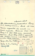
Mine Notes
Mine Images
Company Map: IL_221
Map Date: 2-2-1930
Coal Co.: Superior Mining Company
Mine Name: Valley Mine
Image Credit: Illinois Department of Natural Resources - Office of Mines and Minerals
Full Res Download
Photographs