4564: Difference between revisions
No edit summary |
No edit summary |
||
| (3 intermediate revisions by the same user not shown) | |||
| Line 1: | Line 1: | ||
{{Sidebar Info Query}} | {{Sidebar Info Query}} | ||
{{Header | {{Header | ||
|checked=Checked | |checked=Checked OK | ||
|unlocated=No | |unlocated=No | ||
|shown_on_map=Yes | |shown_on_map=Yes | ||
|Mine-index=4564 | |Mine-index=4564 | ||
|Coal_co= | |Coal_co=Raymond Prewitt Coal Company | ||
|Mine Name Header=Prewitt Mine | |Mine Name Header=Prewitt Mine | ||
|mine_type=Surface | |mine_type=Surface | ||
|mined-out-area=2 | |||
|indicated=No | |indicated=No | ||
|county1=Williamson | |county1=Williamson | ||
|quad1=Herrin | |quad1=Herrin | ||
|year-start= | |year-start=1955 | ||
|year-end= | |year-end=February 1955 | ||
|Latitude=37.77550451 | |Latitude=37.77550451 | ||
|Longitude=-89.0107852 | |Longitude=-89.0107852 | ||
| Line 32: | Line 33: | ||
{{Geology seam | {{Geology seam | ||
|Seam=Herrin | |Seam=Herrin | ||
|thick-ave=9.0 | |||
|mining-method=Surface | |||
}} | }} | ||
===Geological Problems Reported=== | ===Geological Problems Reported=== | ||
| Line 38: | Line 41: | ||
{{Production header}} | {{Production header}} | ||
{{Production | |||
|Company=Raymond Prewitt Coal Company | |||
|Mine-Name=Prewitt | |||
|Date=1955-1955 | |||
|Production=2,300 | |||
|Sum=Yes | |||
}} | |||
===Production Notes=== | ===Production Notes=== | ||
| Line 52: | Line 62: | ||
}} | }} | ||
{{Annotated bibliography header}} | {{Annotated bibliography header}} | ||
{{Annotated bibliography | |||
|bibliography=Coal Reports - Production, ownership, years of operation, mining method, seam, thickness. | |||
}} | |||
{{Annotated bibliography | {{Annotated bibliography | ||
|bibliography=Coal Section files, strip mine updates - Mine name, mine outline, mining method. | |bibliography=Coal Section files, strip mine updates - Mine name, mine outline, mining method. | ||
Latest revision as of 15:49, November 4, 2022
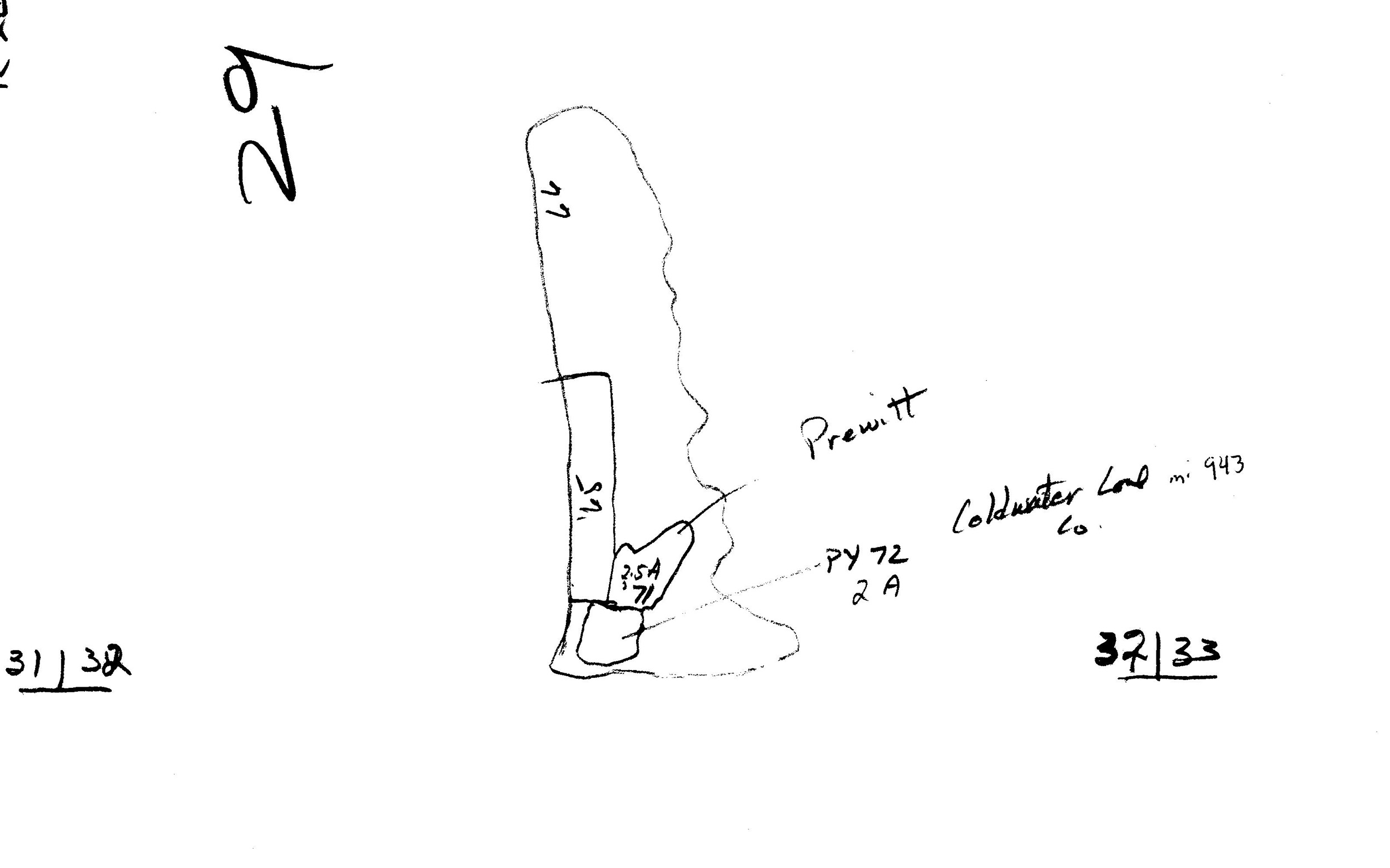
Mine Index Number: 4564
| Company Name: | Raymond Prewitt Coal Company | ||
|---|---|---|---|
| Mine Name: | Prewitt Mine | ||
| Start Date: | 1955 | End Date: | February 1955 |
| Type of Mine: | Surface | ||
| Total acres shown: | 2 | ||
| Acres after map date: | General Area of mining acres shown: | ||
Shaft, Slope, Drift or Tipple Location(s)
| Type | County | Township-Range | Section | Part Section |
|---|
| Pit | Williamson | 8S 2E | 32 | SE SW SE |
Geology
| Thickness (ft) | |||||
|---|---|---|---|---|---|
| Seam | Depth (ft) | Min | Max | Ave | Mining Method |
| Herrin | 9.0 | Surface |
Geological Problems Reported
Production
| Company | Mine Name | Date | Production (tons) |
| Raymond Prewitt Coal Company | Prewitt | 1955-1955 | 2,300 |
| Total Production: 2,300 | |||
Production Notes
Coal Report production (if available)
Sources of Data
| Source Map | Map Date | Original Scale | Digitized Scale | Map Type |
| Coal Section files, strip mine updates | 1976 | 1:8400 | 1:8400 | Secondary source |
Annotated Bibliography (Data source - brief description of information)
| Coal Reports - Production, ownership, years of operation, mining method, seam, thickness. |
| Coal Section files, strip mine updates - Mine name, mine outline, mining method. |
Mine Notes
Mine Images
Photographs