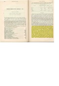
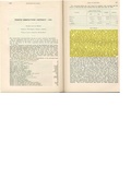
Herrin Quadrangle
MINING IN THE HERRIN QUADRANGLE
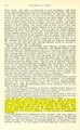
The earliest known coal mining in Williamson County began around 1870 near Carterville. The Carbondale Coal & Coke Company operated at least two mines nearby, the Dodd shaft (mine index 6910) and the Laflin slope (mine index 5973). The Herrin Coal reportedly averaged 9 feet thick in this area, and was often 60 feet deep or less. The Springfield Coal was also mined in this quadrangle, mostly in surface mines, but some small underground mines were operated in this seam as well.
The most recent mining in the Herrin Quadrangle ended in 2003, when the S. Coal Company’s Cambria No. 1 Mine (mine index 1027) closed. Several other surface mines stripped coal up to the early 1980s, some mining both the Herrin and the Springfield Coals. In many cases, they only took the pillars left from previous underground mining in the Herrin Coal.
Map and Directory PDF Download
Coal Mines In Illinois Herrin Quadrangle
Mines that Appear on the Herrin Quadrangle
Unlocated Mines
Williamson County
Franklin County
There are no known Unlocated mines in this county
Pages in category "Herrin Quadrangle"
The following 200 pages are in this category, out of 290 total.
(previous page) (next page)0
1
- 1005
- 1007
- 1027
- 199007
- 199008a
- 199008b
- 199013
- 199014
- 199015
- 199019a
- 199019b
- 199020
- 199021
- 199022
- 199023
- 199024a
- 199024b
- 199030
- 199037
- 199038
- 199040
- 199041
- 199042a
- 199042b
- 199044
- 199061
- 199066
- 199070
- 199072
- 199073
- 199077
- 199078
- 199081a
- 199081b
- 199084
- 199085
- 199087a
- 199087c
- 199090
- 199093
- 199094
- 199095
- 199098a
- 199106
- 199107
- 199109
- 199112
- 199114
- 199120
- 199124
- 199125
- 199134
- 199140
- 199143
- 199144b
- 199145
- 199150
- 199152
- 199153
- 199156
- 199159a
- 199159b
- 199167
- 199174
- 199181
- 199182a
- 199187
- 199188
- 199190
- 199198
- 199202
- 199206
- 199208
- 199218
- 199222
- 199233
- 199236
- 199237
- 199240
- 199241
- 199252
- 199261
- 199262
- 199m3990
2
3
4
9
Media in category "Herrin Quadrangle"
The following 146 files are in this category, out of 146 total.
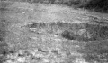 M-952 Madison CC Dewaine IL caves on hill side.jpg 4,348 × 2,580; 1.1 MB
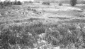
 M-959 Taylor No 1 Carterville Subsidence along RR tracks 1.jpg 4,344 × 2,547; 1.13 MB
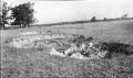
 M-960 Taylor No 1 Carterville sub in hilly area-mound left foreground over pillar.jpg 2,500 × 1,467; 481 KB
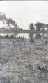 M-961 Carterville A mine Pond 200 ft dia 3ft deep.jpg 1,443 × 2,500; 508 KB
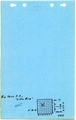
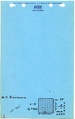
 M-991 Coop 17 fig 12.jpg 2,500 × 1,471; 575 KB
 M00165 coalreport1900 p206.pdf 1,558 × 1,195; 368 KB
 M0057 coalreport 1907.pdf 587 × 966; 74 KB
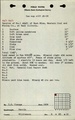
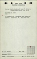
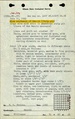
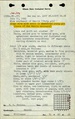
 M0057 minenotes.pdf 739 × 1,202, 28 pages; 6.75 MB
 M0062 coalreport1900 p206-207.pdf 1,558 × 1,195; 371 KB
 M0062 fieldnotes.pdf 754 × 1,197, 2 pages; 338 KB
 M0062 minenotes.pdf 737 × 1,160, 14 pages; 2.53 MB
 M0063 fieldnotes.pdf 750 × 1,197; 187 KB
 M0063 minenotes.pdf 722 × 1,166, 15 pages; 2.84 MB
 M0064 minenotes.pdf 722 × 1,166, 16 pages; 3.88 MB
 M0145 coalreport 1917p249.pdf 602 × 991; 94 KB
 M0145 minenotes.pdf 739 × 1,202, 33 pages; 8.52 MB
 M0147 coalreport 1917.pdf 602 × 991; 98 KB
 M0147 minenotes.pdf 739 × 1,202, 24 pages; 6.37 MB
 M0156 coalreport1906 p355.pdf 1,683 × 1,285; 453 KB
 M0156 coalreport1907 p350.pdf 587 × 966; 111 KB
 M0156 fieldnotes.pdf 747 × 1,193; 195 KB
 M0156 minenotes.pdf 737 × 1,160, 23 pages; 4.36 MB
 M0158 fieldnotes.pdf 750 × 1,197, 2 pages; 269 KB
 M0158 minenotes.pdf 731 × 1,162, 13 pages; 2.43 MB
 M0159 minenotes.pdf 731 × 1,162, 13 pages; 2.55 MB
 M0163 fieldnotes.pdf 752 × 1,197; 177 KB
 M0163 minenotes.pdf 722 × 1,166, 12 pages; 2.78 MB
 M0164 minenotes.pdf 722 × 1,166, 11 pages; 2.11 MB
 M0165 minenotes.pdf 722 × 1,166, 17 pages; 3.97 MB
 M0166 minenotes.pdf 722 × 1,166, 12 pages; 2.55 MB
 M0167 minenotes.pdf 722 × 1,166, 26 pages; 6.08 MB
 M0324 fieldnotes.pdf 750 × 1,195; 152 KB
 M0324 minenotes.pdf 727 × 1,166, 5 pages; 989 KB
 M0421 coalreport 1908p348.pdf 629 × 970; 70 KB
 M0421 coalreport 1909p370.pdf 1,591 × 1,229; 394 KB
 M0421 fieldnotes.pdf 752 × 1,200, 8 pages; 745 KB
 M0421 minenotes.pdf 733 × 1,202, 27 pages; 7.03 MB
 M0428 minenotes.pdf 733 × 1,202, 16 pages; 3.91 MB
 M0435 fieldnotes.pdf 747 × 1,197; 129 KB
 M0435 minenotes.pdf 722 × 1,166, 9 pages; 1.92 MB
 M0436 coalreport1906 p353.pdf 1,675 × 1,256; 371 KB
 M0436 minenotes.pdf 731 × 1,162, 7 pages; 1.4 MB
 M0437 coalreport1909 p407-408.pdf 1,606 × 1,241, 2 pages; 689 KB
 M0437 fieldnotes.pdf 752 × 1,195; 170 KB
 M0437 minenotes.pdf 718 × 1,162, 17 pages; 3.87 MB
 M0449 coalreport1909 p407.pdf 1,606 × 1,241; 338 KB
 M0449 minenotes.pdf 722 × 1,166, 15 pages; 3.68 MB
 M0454 coalreport1897 p141.pdf 839 × 1,185; 96 KB
 M0454 coalreport1898 p220.pdf 1,585 × 1,168; 315 KB
 M0454 fieldnotes.pdf 747 × 1,195; 167 KB
 M0454 minenotes.pdf 731 × 1,162, 10 pages; 1.99 MB
 M0711 minenotes.pdf 731 × 1,162, 5 pages; 927 KB
 M0735 minenotes.pdf 731 × 1,204, 5 pages; 1.12 MB
 M0812 coalreport1906 p355.pdf 1,683 × 1,285; 447 KB
 M0812 minenotes.pdf 722 × 1,166, 10 pages; 1.71 MB
 M0813 coalreport1917 p276.pdf 602 × 991; 76 KB
 M0813 minenotes.pdf 722 × 1,166, 9 pages; 1.84 MB
 M0814 minenotes.pdf 722 × 1,166, 3 pages; 694 KB
 M0815 fieldnotes.pdf 747 × 1,197, 4 pages; 562 KB
 M0815 minenotes.pdf 731 × 1,162, 4 pages; 692 KB
 M0817 minenotes.pdf 727 × 1,166, 3 pages; 537 KB
 M0858 minenotes.pdf 722 × 1,166, 13 pages; 2.49 MB
 M0882 minenotes.pdf 756 × 1,210, 15 pages; 3.27 MB
 M0943 minenotes.pdf 731 × 1,162, 5 pages; 747 KB
 M0955 minenotes.pdf 727 × 1,166, 14 pages; 3.57 MB
 M1005 minenotes.pdf 754 × 1,295, 5 pages; 944 KB
 M1007 minenotes.pdf 766 × 1,304, 4 pages; 705 KB
 M1027 minenotes.pdf 760 × 1,247, 3 pages; 607 KB
 M2071 coalreport 1910p410.pdf 583 × 943; 90 KB
 M2071 coalreport 1915p227.pdf 1,539 × 1,270; 389 KB
 M2071 minenotes.pdf 731 × 1,204, 6 pages; 1.79 MB
 M3549 fieldnotes.pdf 747 × 1,195; 136 KB
 M3549 minenotes.pdf 727 × 1,166, 2 pages; 420 KB
 M3943 minenotes.pdf 722 × 1,166, 3 pages; 548 KB
 M3945 fieldnotes.pdf 747 × 1,195; 158 KB
 M3945 minenotes.pdf 722 × 1,166, 4 pages; 850 KB
 M3947 minenotes.pdf 722 × 1,166, 4 pages; 788 KB
 M3948 minenotes.pdf 722 × 1,166, 6 pages; 1.37 MB
 M3954 minenotes.pdf 722 × 1,166, 8 pages; 1.63 MB
 M3955 minenotes.pdf 722 × 1,166, 6 pages; 1.22 MB
 M3956 minenotes.pdf 731 × 1,162, 3 pages; 474 KB
 M3957 fieldnotes.pdf 752 × 1,189; 121 KB
 M3957 minenotes.pdf 722 × 1,166, 5 pages; 1.12 MB
 M3960 minenotes.pdf 722 × 1,166, 4 pages; 782 KB
 M3961 minenotes.pdf 722 × 1,166, 5 pages; 968 KB
 M3962 minenotes.pdf 722 × 1,166, 3 pages; 547 KB
 M3963 minenotes.pdf 722 × 1,166, 3 pages; 680 KB
 M3965 minenotes.pdf 731 × 1,162, 6 pages; 1 MB
 M3966 fieldnotes.pdf 747 × 1,195; 223 KB
 M3966 minenotes.pdf 731 × 1,162, 7 pages; 1.17 MB
 M3967 minenotes.pdf 731 × 1,162, 4 pages; 721 KB
 M3968 minenotes.pdf 731 × 1,162, 4 pages; 751 KB
 M3969 minenotes.pdf 731 × 1,162, 13 pages; 2.53 MB
 M3970 minenotes.pdf 731 × 1,162; 150 KB
 M3971 minenotes.pdf 731 × 1,162, 3 pages; 563 KB
 M3972 minenotes.pdf 731 × 1,162, 4 pages; 743 KB
 M3978 minenotes.pdf 731 × 1,162, 14 pages; 2.39 MB
 M3981 minenotes.pdf 727 × 1,166, 2 pages; 382 KB
 M3982 minenotes.pdf 722 × 1,166, 3 pages; 628 KB
 M3983 fieldnotes.pdf 747 × 1,187; 457 KB
 M3983 minenotes.pdf 727 × 1,166, 2 pages; 436 KB
 M3984 minenotes.pdf 727 × 1,166, 4 pages; 824 KB
 M3986 minenotes.pdf 727 × 1,166, 3 pages; 522 KB
 M3987 minenotes.pdf 727 × 1,166, 2 pages; 437 KB
 M3988 minenotes.pdf 727 × 1,166, 3 pages; 547 KB
 M3990 minenotes.pdf 727 × 1,166, 3 pages; 531 KB
 M3991 minenotes.pdf 727 × 1,166, 4 pages; 829 KB
 M3992 fieldnotes.pdf 747 × 1,193, 2 pages; 285 KB
 M3992 minenotes.pdf 727 × 1,166, 8 pages; 1.66 MB
 M3993 minenotes.pdf 727 × 1,166, 4 pages; 791 KB
 M3994 minenotes.pdf 727 × 1,166, 4 pages; 752 KB
 M3995 minenotes.pdf 727 × 1,166, 4 pages; 749 KB
 M3996 minenotes.pdf 766 × 1,210, 4 pages; 1.52 MB
 M3997 minenotes.pdf 727 × 1,166, 4 pages; 753 KB
 M3998 minenotes.pdf 727 × 1,166, 12 pages; 2.38 MB
 M3999 fieldnotes.pdf 747 × 1,193; 182 KB
 M3999 minenotes.pdf 727 × 1,166, 3 pages; 526 KB
 M4000 minenotes.pdf 727 × 1,166, 2 pages; 434 KB
 M4002 minenotes.pdf 727 × 1,166, 2 pages; 441 KB
 M4004 minenotes.pdf 727 × 1,166, 6 pages; 1.17 MB
 M4005 fieldnotes.pdf 752 × 1,195; 167 KB
 M4005 minenotes.pdf 727 × 1,166, 3 pages; 519 KB
 M4006 minenotes.pdf 727 × 1,166, 3 pages; 516 KB
 M4007 minenotes.pdf 727 × 1,166, 2 pages; 318 KB
 M4021 minenotes.pdf 727 × 1,166, 3 pages; 580 KB
 M4023 fieldnotes.pdf 747 × 1,193, 3 pages; 353 KB
 M4023 minenotes.pdf 727 × 1,166, 3 pages; 538 KB
 M4024 fieldnotes.pdf 747 × 1,195; 145 KB
 M4024 minenotes.pdf 727 × 1,166, 3 pages; 553 KB
 M4161 minenotes.pdf 766 × 1,210, 2 pages; 644 KB
 M4300 fieldnotes.pdf 750 × 1,187, 2 pages; 315 KB
 M4302 fieldnotes.pdf 747 × 1,185, 4 pages; 1,006 KB
 M4432 fieldnotes.pdf 752 × 1,197; 180 KB
 M4432 minenotes.pdf 766 × 1,210, 2 pages; 1.12 MB
 M4433 minenotes.pdf 766 × 1,210, 2 pages; 1,010 KB
 M4437 fieldnotes.pdf 752 × 1,197, 2 pages; 292 KB
 M4440 minenotes.pdf 766 × 1,210, 4 pages; 1.73 MB
 M4515 minenotes.pdf 760 × 1,208, 4 pages; 2.02 MB
 M4516 minenotes.pdf 760 × 1,208, 3 pages; 1.05 MB
 M4518 fieldnotes.pdf 743 × 1,185; 190 KB
 M4518 minenotes.pdf 766 × 1,210, 3 pages; 1.47 MB
 M4519 minenotes.pdf 766 × 1,210, 2 pages; 556 KB
 M4522 minenotes.pdf 766 × 1,210, 6 pages; 2.55 MB
 M4567 fieldnotes.pdf 747 × 1,185; 188 KB
 M4568 fieldnotes.pdf 747 × 1,185; 188 KB
 M6650 minenotes.pdf 872 × 1,239; 69 KB


