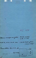
Mine Index Number: 0436
| Company Name:
|
Franklin County Coal Company
|
| Mine Name:
|
Walnut Ridge No. 3 Mine
|
| Start Date:
|
1906
|
End Date:
|
October 1923
|
| Type of Mine:
|
Underground
|
| Total acres shown:
|
233
|
| Acres after map date:
|
|
General Area of mining acres shown:
|
|
|
|
Shaft, Slope, Drift or Tipple Location(s)
| Type
|
County
|
Township-Range
|
Section
|
Part Section
|
| Main shaft (8.5 x 15 ft)
|
Williamson
|
8S 2E
|
30
|
NE SE SW
|
| Air shaft (8.5 x 13.5 ft)
|
Williamson
|
8S 2E
|
30
|
NE SE SW
|
Geology
| Herrin
|
137-155
|
|
|
8.0-11.0
|
RPP
|
Geological Problems Reported
The coal was fairly uniform in thickness.
Production
| Company
|
Mine Name
|
Date
|
Production (tons)
|
|
|
|
|
|
| Total Production: 1,933,832
|
Production Notes
Coal Report production (if available)
Sources of Data
| Microfilm, document 353295
|
8-30-1925
|
1:2400
|
1:4965
|
Final
|
Annotated Bibliography (Data source - brief description of information)
| Coal Reports - Production, ownership, years of operation, mining method, depth, thickness.
|
| Directory of Illinois Coal Mines (Williamson County) - Mine names, mine index, ownership, years of operation.
|
| Mine notes (Williamson County) - Mine type, shaft location, seam, geologic problems.
|
| Microfilm map, document 353295, reel 03142, frame 254 - Shaft locations, mine outline, mining method.
|
Mine Notes
Mine Images
![[[:Walnut Ridge No. 3|Walnut Ridge No. 3]]](https://wikiimage.isgs.illinois.edu/ilmines/williamson/thumbnails/m0436_th.jpg) These files may not be true to scale and are not georgistered. These files may not be true to scale and are not georgistered.
|
Map Type:
|
Microfilm
|
| Map ID:
|
353295 3142 254 ,30x
|
| Company:
|
Franklin County Coal Company
|
| Mine Name:
|
Walnut Ridge No. 3
|
| Caption:
|
|
| Map Date:
|
08/30/1925
|
| Map Status:
|
Not Final
|
| Image Credit:
|
|
| Note:
|
|
| More Info:
|
M0436.jpg
|
| Full Res Download:These files are true to scale and most are georegistered for gis software. These files may be a very large (>1GB) download!
|
https://wikiimage.isgs.illinois.edu/ilmines/williamson/m0436.zip
|
Photographs