Mine Index Number: 0882
| Company Name:
|
Forsyth-Energy, Inc.
|
| Mine Name:
|
Energy Mine
|
| Start Date:
|
1947
|
End Date:
|
November 1972
|
| Type of Mine:
|
Surface
|
| Total acres shown:
|
3,365 (1,686 in Herrin Coal and 1,679 in Springfield Coal) The area shown is too large for the reported production. Other mines may have operated in this area, both surface and underground, resulting in the larger outline. See the back of this report for unlocated mines. This area may also include some workings for mine index 0814.
|
| Acres after map date:
|
|
General Area of mining acres shown:
|
|
|
|
Shaft, Slope, Drift or Tipple Location(s)
| Type
|
County
|
Township-Range
|
Section
|
Part Section
|
| Tipple / pit
|
Williamson
|
9S 2E
|
4
|
NW SW NE
|
| Pits
|
Williamson
|
8S 2E
|
28, 33, 34, 35
|
|
| Pits
|
Williamson
|
9S 2E
|
2, 3, 4, 5, 8, 9, 10
|
|
Geology
| Herrin
|
20-42
|
|
|
5.08-8.0
|
Surface
|
| Springfield
|
40-55
|
|
|
3.17-3.5
|
Surface
|
Geological Problems Reported
Production
| Company
|
Mine Name
|
Date
|
Production (tons)
|
|
|
|
|
|
| Total Production: 9,983,659
|
Production Notes
Coal Report production (if available)
Sources of Data
| Company, 4103.W52 i5.1-180
|
5-1-1971
|
1:2400 or 24000
|
1:2400
|
Secondary source
|
| Company
|
10-8-1956
|
1:2400
|
1:2400
|
Not final
|
| Company
|
5-27-1954
|
1:2400
|
1:2400
|
Not final
|
| USGS topographic map
|
1976
|
1:24000
|
1:24000
|
Secondary source
|
Annotated Bibliography (Data source - brief description of information)
| Coal Reports - Production, ownership, years of operation, seam, depth, thickness.
|
| Directory of Illinois Coal Mines (Williamson County) - Mine names, mine index, ownership, years of operation.
|
| Mine notes (Williamson County) - Mine type, mine location.
|
| Company map, ISGS map library, 4103.W52 i5.1-180 - Mine outline (Herrin & Springfield Coals).
|
| Company map, Old Ben Archive Collection - Mine outline (Springfield Coal).
|
| Company map, Old Ben Archive Collection - Mine outline (Springfield Coal).
|
| USGS topographic map, Johnston City Quadrangle, 1963, Photo-inspected 1976 - Mine outline.
|
Mine Notes
Mine Images
![[[:Morgan|Morgan]]](https://wikiimage.isgs.illinois.edu/ilmines/williamson/thumbnails/m0882c_th.jpg) These files may not be true to scale and are not georgistered. These files may not be true to scale and are not georgistered.
|
Map Type:
|
Company
|
| Map ID:
|
Old Ben Archive
|
| Company:
|
Morgan Mines, Inc.
|
| Mine Name:
|
Morgan
|
| Caption:
|
mine outline (Springfield Coal)
|
| Map Date:
|
05-27-1954
|
| Map Status:
|
Not Final
|
| Image Credit:
|
|
| Note:
|
|
| More Info:
|
M0882c.jpg
|
| Full Res Download:These files are true to scale and most are georegistered for gis software. These files may be a very large (>1GB) download!
|
https://wikiimage.isgs.illinois.edu/ilmines/williamson/m0882c.zip
|
![[[:Energy|Energy]]](https://wikiimage.isgs.illinois.edu/ilmines/williamson/thumbnails/m0882b_th.jpg) These files may not be true to scale and are not georgistered. These files may not be true to scale and are not georgistered.
|
Map Type:
|
|
| Map ID:
|
Old Ben Archives
|
| Company:
|
Peabody Coal Company
|
| Mine Name:
|
Energy
|
| Caption:
|
mine outline (Springfield Coal)
|
| Map Date:
|
10-08-1956
|
| Map Status:
|
Not Final
|
| Image Credit:
|
|
| Note:
|
|
| More Info:
|
M0882b.jpg
|
| Full Res Download:These files are true to scale and most are georegistered for gis software. These files may be a very large (>1GB) download!
|
https://wikiimage.isgs.illinois.edu/ilmines/williamson/m0882b.zip
|
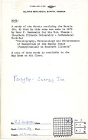
![[[:Energy|Energy]]](https://wikiimage.isgs.illinois.edu/ilmines/williamson/thumbnails/m0882a_th.jpg) These files may not be true to scale and are not georgistered. These files may not be true to scale and are not georgistered.
|
Map Type:
|
|
| Map ID:
|
4103.W52i5.1-180
|
| Company:
|
Forsyth-Energy, Inc.
|
| Mine Name:
|
Energy
|
| Caption:
|
mine outline (Herrin & Springfield Coals)
|
| Map Date:
|
05-01-1971
|
| Map Status:
|
Secondary
|
| Image Credit:
|
|
| Note:
|
|
| More Info:
|
M0882a.jpg
|
| Full Res Download:These files are true to scale and most are georegistered for gis software. These files may be a very large (>1GB) download!
|
https://wikiimage.isgs.illinois.edu/ilmines/williamson/m0882a.zip
|
Photographs