Mine Index Number: 0814
| Company Name:
|
Forsyth-Carterville Coal Company
|
| Mine Name:
|
Forsyth-Carterville Mine
|
| Start Date:
|
1946
|
End Date:
|
August 1961
|
| Type of Mine:
|
Surface
|
| Total acres shown:
|
663
|
| Acres after map date:
|
|
General Area of mining acres shown:
|
|
|
|
Shaft, Slope, Drift or Tipple Location(s)
| Type
|
County
|
Township-Range
|
Section
|
Part Section
|
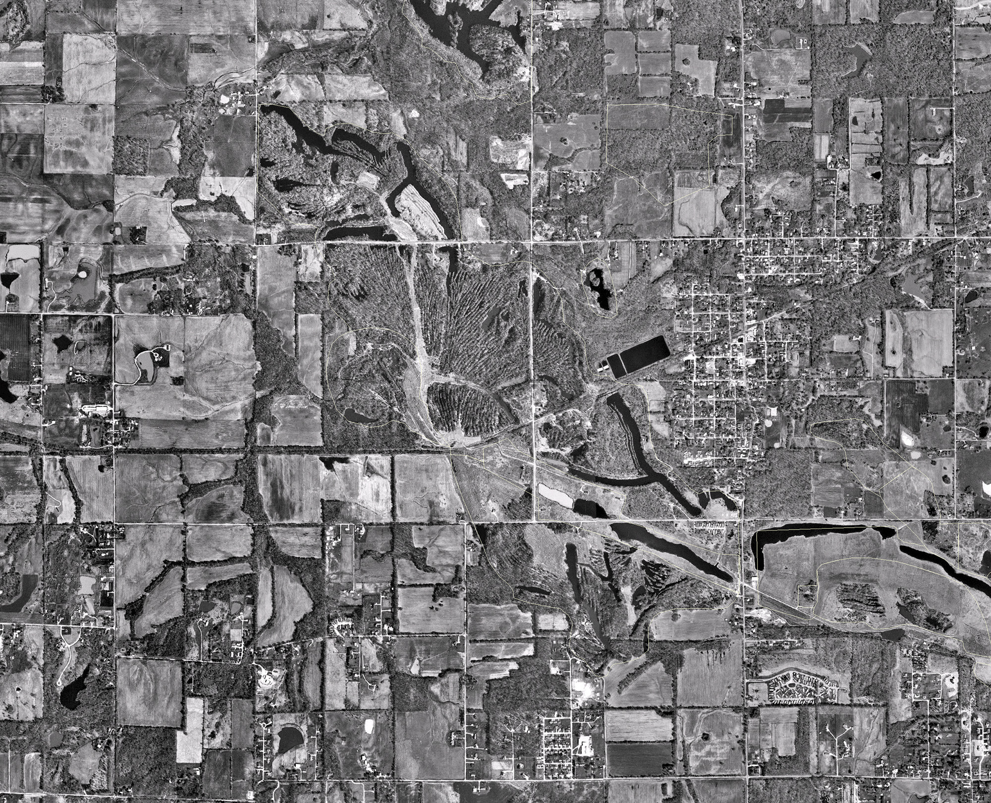
| Tipple / pit Surface mining for this mine took place in Sections 30, 31 & 32 of T8S-R1E and Section 5 of T9S-R1E.
|
Williamson
|
9S 1E
|
4
|
NW NW SE
|
| Tipple Surface mining for this mine took place in Sections 30, 31 & 32 of T8S-R1E and Section 5 of T9S-R1E.
|
Williamson
|
8S 1E
|
31
|
NW NW SE
|
Geology
| Springfield
|
40 (20-55)
|
|
|
3.33 (3.17-3.5)
|
Surface
|
Geological Problems Reported
Production
| Company
|
Mine Name
|
Date
|
Production (tons)
|
|
|
|
|
|
| Total Production: 2,704,006
|
Production Notes
Coal Report production (if available)
Sources of Data
| USGS digital orthophoto quadrangle
|
1999
|
1:24000
|
1:24000
|
Secondary source
|
Annotated Bibliography (Data source - brief description of information)
| Coal Reports - Production, ownership, years of operation, seam, depth, thickness.
|
| Directory of Illinois Coal Mines (Williamson County) - Mine names, mine index, ownership, years of operation.
|
| Mine notes (Williamson County) - Mine type, tipple location, mining method, seam, depth, thickness.
|
| USGS digital orthophoto map, Herrin Quadrangle, 1999 - Mine outline, mining method.
|
Mine Notes
Mine Images
 These files may not be true to scale and are not georgistered. These files may not be true to scale and are not georgistered.
|
Map Type:
|
|
| Map ID:
|
USGS digital orthophoto
|
| Company:
|
|
| Mine Name:
|
|
| Caption:
|
|
| Map Date:
|
1999
|
| Map Status:
|
|
| Image Credit:
|
|
| Note:
|
|
| More Info:
|
M0814.jpg
|
| Full Res Download:These files are true to scale and most are georegistered for gis software. These files may be a very large (>1GB) download!
|
https://wikiimage.isgs.illinois.edu/ilmines/williamson/m0814.zip
|
Photographs