De Soto Quadrangle
Mining in the De Soto Quadrangle
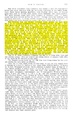
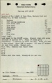
Mining in the De Soto Quadrangle began in 1881 with the opening of the Inland Mine (mine index 2481) and ended when the Cambria Mine ([[1027}mine index 1027]]) closed in 2004. The Herrin Coal was the most commonly mined seam, because it was thick, ranging up to 14 feet thick in places, and shallow, sometimes as little as 25 feet beneath the surface. The Herrin Coal was commonly 8 to 10 feet thick, allowing mines with poor roof conditions to leave up to 2 feet of top coal to support the roof. In some cases, areas of the mines had poor quality coal, so that the thicker coal was not all minable. In parts of the Ward Mine (mine index 267), the top coal was poor quality, and the blue band was 11 to 13 inches of dirty coal (high ash content), so that only the middle 4.5 to 5 feet of the total 8 to 9 feet thick seam was mined. Some surface mines took advantage of the small interval between the Herrin and Springfield Coals (often as little as 25 to 30 feet) to mine both seams. The Springfield Coal was thinner than the Herrin Coal, generally 3.5 to 4 feet thick. Because the Springfield Coal was usually less than 5 feet thick, it was more often surface-mined than developed in underground mines. The Murphysboro Coal was also mined, exclusively in the southern half of the quadrangle.
Map and Directory PDF Download
Coal Mines In Illinois De Soto Quadrangle
Mines that Appear on the De Soto Quadrangle
Unlocated Mines
Jackson County
Williamson County
Franklin County
Pages in category "De Soto Quadrangle"
The following 113 pages are in this category, out of 113 total.
1
- 1005
- 1027
- 199007
- 199008a
- 199008b
- 199013
- 199014
- 199038
- 199041
- 199042a
- 199042b
- 199044
- 199070
- 199072
- 199073
- 199077
- 199081a
- 199081b
- 199084
- 199085
- 199087c
- 199090
- 199093
- 199094
- 199095
- 199098a
- 199106
- 199109
- 199112
- 199114
- 199120
- 199124
- 199125
- 199134
- 199140
- 199143
- 199144b
- 199145
- 199150
- 199153
- 199155
- 199156
- 199159a
- 199159b
- 199174
- 199181
- 199182a
- 199187
- 199188
- 199190
- 199202
- 199206
- 199208
- 199218
- 199222
- 199233
- 199236
- 199237
- 199240
- 199261
9
M
Media in category "De Soto Quadrangle"
The following 13 files are in this category, out of 13 total.
 M0147 coalreport 1917.pdf 602 × 991; 98 KB
 M0147 minenotes.pdf 739 × 1,202, 24 pages; 6.37 MB
 M0163 minenotes.pdf 722 × 1,166, 12 pages; 2.78 MB
 M0164 minenotes.pdf 722 × 1,166, 11 pages; 2.11 MB
 M0435 fieldnotes.pdf 747 × 1,197; 129 KB
 M0435 minenotes.pdf 722 × 1,166, 9 pages; 1.92 MB
 M0814 minenotes.pdf 722 × 1,166, 3 pages; 694 KB
 M1005 minenotes.pdf 754 × 1,295, 5 pages; 944 KB
 M1027 minenotes.pdf 760 × 1,247, 3 pages; 607 KB
 M2071 coalreport 1910p410.pdf 583 × 943; 90 KB
 M2071 coalreport 1915p227.pdf 1,539 × 1,270; 389 KB
 M2071 minenotes.pdf 731 × 1,204, 6 pages; 1.79 MB
 M3943 minenotes.pdf 722 × 1,166, 3 pages; 548 KB