Mine Index Number: 0167
| Company Name:
|
Madison Coal Corporation
|
| Mine Name:
|
Madison No. 8 Mine or Brush Mine
|
| Start Date:
|
1890
|
End Date:
|
September 1923
|
| Type of Mine:
|
Underground
|
| Total acres shown:
|
1,238 This area includes mining by the Robert Dick Mine (mine index 6800). The two mines were connected underground and the boundaries could not be discerned.
|
| Acres after map date:
|
|
General Area of mining acres shown:
|
|
|
|
Shaft, Slope, Drift or Tipple Location(s)
| Type
|
County
|
Township-Range
|
Section
|
Part Section
|
| Main shaft (10 x 22 ft) The Brush Mine also connected with the Robert Dick Mine (mine index 6800) for additional ventilation and for hoisting capacity nearer to the later workings of the mine. The connections were probably circa 1912, when mining ceased in the Robert Dick Mine. These shafts were in the SE 28-T8S-R1E. The main shaft probably contained a compartment devoted to ventilation. The shaft dimensions support this hypothesis.
|
Williamson
|
8S 1E
|
35
|
SW NW NW
|
Geology
Geological Problems Reported
The roof was generally a white shale that did not hold up well. In some cases, these developed into sinkholes that opened up to the surface. Wherever possible, 18 inches of top coal was left to support the gray shale roof. In some areas, the roof was black shale, and this held up well. Rolls were present, generally in the northwest part of the mine where they were numerous. These rolls sometimes cut down into the coal so that only 2 feet of coal remained. Some of these areas were designated on the source map as “very bad coal”.
Production
| Company
|
Mine Name
|
Date
|
Production (tons)
|
|
|
|
|
|
| Total Production: 8,928,389
|
Production Notes
Coal Report production (if available)
Sources of Data
| Microfilm, document 353109
|
9-27-1923
|
1:2400
|
1:4634
|
Final
|
Annotated Bibliography (Data source - brief description of information)
| Coal Reports - Production, ownership, years of operation, mining method, thickness.
|
| Directory of Illinois Coal Mines (Williamson County) - Mine names, mine index, ownership, years of operation.
|
| Mine notes (Williamson County) - Mine type, shaft location, seam, depth, geologic problems.
|
| Microfilm map, document 353109, reel 03141, frames 330 & 331 - Shaft location, mine outline, mining method, geologic problems.
|
Mine Notes
Mine Images
![[[:Madison No. 8|Madison No. 8]]](https://wikiimage.isgs.illinois.edu/ilmines/williamson/thumbnails/m0167_th.jpg) These files may not be true to scale and are not georgistered. These files may not be true to scale and are not georgistered.
|
Map Type:
|
Microfilm
|
| Map ID:
|
353109 3141 330-331, 28x
|
| Company:
|
Madison Coal Corporation
|
| Mine Name:
|
Madison No. 8
|
| Caption:
|
|
| Map Date:
|
09/27/1923
|
| Map Status:
|
Final
|
| Image Credit:
|
|
| Note:
|
Secondary Source for Mine Index 3945 - Outline for the south side
|
| More Info:
|
M0167.jpg
|
| Full Res Download:These files are true to scale and most are georegistered for gis software. These files may be a very large (>1GB) download!
|
https://wikiimage.isgs.illinois.edu/ilmines/williamson/m0167.zip
|
Photographs
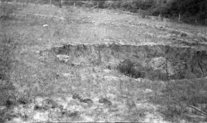
Caption: Caves on hillside
Credit: Illinois State Geological Survey
Library No.: M-952
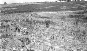
Caption: Subsidence along railroad tracks.
Credit: Illinois State Geological Survey
Library No.: M-959
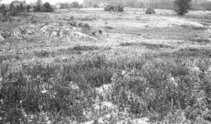
Caption: Subsidence in hilly area--mound (left foreground) over pillar.
Credit: Illinois State Geological Survey
Library No.: M-960


![[[:Madison No. 8|Madison No. 8]]](https://wikiimage.isgs.illinois.edu/ilmines/williamson/thumbnails/m0167_th.jpg)


