Mine Index Number: 0711
| Company Name:
|
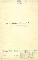
Consolidated Coal Company of St. Louis
|
| Mine Name:
|
Buckhorn Mine
|
| Start Date:
|
1938
|
End Date:
|
January 1947
|
| Type of Mine:
|
Underground
|
| Total acres shown:
|
431 in Herrin Coal and 51 in Springfield Coal
|
| Acres after map date:
|
|
General Area of mining acres shown:
|
|
|
|
Shaft, Slope, Drift or Tipple Location(s)
| Type
|
County
|
Township-Range
|
Section
|
Part Section
|
| Main slope
|
Williamson
|
8S 2E
|
21
|
SW NW NE
|
| Air shaft
|
Williamson
|
8S 2E
|
21
|
SE NE NW Shared with mine index 454, the New Monarch Mine, another Consolidated Coal Company of St. Louis mine.
|
| Shaft
|
Williamson
|
8S 2E
|
21
|
NE NE NW
|
| Blind Slope
|
Williamson
|
8S 2E
|
16
|
SW NW SE
|
| Blind slope
|
Williamson
|
8S 2E
|
16
|
NW NW SE
|
Geology
| Herrin
|
190
|
|
|
7.0-8.5
|
RPP,HERSome HER, mostly in southern part of section 16-T8S-R2E, from 8-19-1946 to 1-17-1947.
|
Geological Problems Reported
The source maps show three faults that trend northwest-southeast. These faults are in the western half of Section 16, T8S-R2E and the eastern half of Section 17, T8S-R2E and NW NE 21-T8S-R2E. In some cases, the faults interfered with mining and some reserves were left. In others, the fault was approached on both sides and most of the coal removed. Offsets were not shown on the map.
Production
| Company
|
Mine Name
|
Date
|
Production (tons)
|
|
|
|
|
|
| Total Production: 3,145,154
|
Production Notes
Coal Report production (if available)
Sources of Data
| Company, 4103.W52 i5.1-3
|
8-4-1946
|
1:2400
|
1:2400
|
Final
|
| Company, 4103.W52 i5.1-2, sh. 2
|
1-17-1947
|
1:2400
|
1:2400
|
Final
|
| Microfilm, document 353196
|
2-1-1945
|
1:2400
|
1:4965
|
Not final The mined area shown on the accompanying map is the approximate size expected for the production reported. This suggests that the mine outline is complete. Most of the mining after the map date was in the Springfield Coal or removing pillars in the Herrin Coal.
|
Annotated Bibliography (Data source - brief description of information)
| Coal Reports - Production, ownership, years of operation, seam, depth, thickness.
|
| Directory of Illinois Coal Mines (Williamson County) - Mine names, mine index, ownership, years of operation.
|
| Mine notes (Williamson County) - Mine type, slope location, seam.
|
| Company map, ISGS map library, 4103.W52 i5.1-3 - Mine outline, slope locations, mining method (Springfield Coal).
|
| Company map, ISGS map library, 4103.W52 i5.1-2, sh. 2 - Mine outline, slope locations, mining method (HER, Herrin Coal).
|
| Microfilm map, document 353196, reel 03142, frames 103 and 104 - Shaft and slope locations, mine outline, mining method, geologic problems.
|
Mine Notes
Mine Images
![[[:Buckhorn|Buckhorn]]](https://wikiimage.isgs.illinois.edu/ilmines/williamson/thumbnails/m0711c_th.jpg) These files may not be true to scale and are not georgistered. These files may not be true to scale and are not georgistered.
|
Map Type:
|
Microfilm
|
| Map ID:
|
353196 3142 103-4, 30x
|
| Company:
|
Consolidated Coal Company of St. Louis
|
| Mine Name:
|
Buckhorn
|
| Caption:
|
|
| Map Date:
|
2-1-1945
|
| Map Status:
|
Not final
|
| Image Credit:
|
|
| Note:
|
|
| More Info:
|
M0711c.jpg
|
| Full Res Download:These files are true to scale and most are georegistered for gis software. These files may be a very large (>1GB) download!
|
https://wikiimage.isgs.illinois.edu/ilmines/williamson/m0711c.zip
|
![[[:Buckhorn|Buckhorn]]](https://wikiimage.isgs.illinois.edu/ilmines/williamson/thumbnails/m0711b_th.jpg) These files may not be true to scale and are not georgistered. These files may not be true to scale and are not georgistered.
|
Map Type:
|
Company
|
| Map ID:
|
4103.W52 i5.1-2, sh. 2
|
| Company:
|
Consolidated Coal Company of St. Louis
|
| Mine Name:
|
Buckhorn
|
| Caption:
|
|
| Map Date:
|
1-17-1947
|
| Map Status:
|
FInal
|
| Image Credit:
|
|
| Note:
|
|
| More Info:
|
M0711b.jpg
|
| Full Res Download:These files are true to scale and most are georegistered for gis software. These files may be a very large (>1GB) download!
|
https://wikiimage.isgs.illinois.edu/ilmines/williamson/m0711b.zip
|
![[[:Buckhorn|Buckhorn]]](https://wikiimage.isgs.illinois.edu/ilmines/williamson/thumbnails/m0711a_th.jpg) These files may not be true to scale and are not georgistered. These files may not be true to scale and are not georgistered.
|
Map Type:
|
Company
|
| Map ID:
|
4103.W52 i5.1-3
|
| Company:
|
Consolidated Coal Company of St. Louis
|
| Mine Name:
|
Buckhorn
|
| Caption:
|
|
| Map Date:
|
8-4-1946
|
| Map Status:
|
Final
|
| Image Credit:
|
|
| Note:
|
|
| More Info:
|
M0711a.jpg
|
| Full Res Download:These files are true to scale and most are georegistered for gis software. These files may be a very large (>1GB) download!
|
https://wikiimage.isgs.illinois.edu/ilmines/williamson/m0711a.zip
|
Photographs