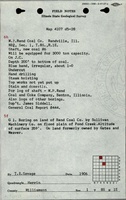
Mine Index Number: 0437
| Company Name:
|
Old Ben Coal Corporation
|
| Mine Name:
|
Old Ben No. 20 Mine
|
| Start Date:
|
1908
|
End Date:
|
March 1927
|
| Type of Mine:
|
Underground
|
| Total acres shown:
|
718
|
| Acres after map date:
|
|
General Area of mining acres shown:
|
|
|
|
Shaft, Slope, Drift or Tipple Location(s)
| Type
|
County
|
Township-Range
|
Section
|
Part Section
|
| Main shaft (9.5 x 18 ft)
|
Williamson
|
8S 1E
|
1
|
NE SW NW
|
| Air shaft
|
Williamson
|
8S 1E
|
1
|
NE SW NW
|
Geology
| Herrin
|
205
|
8.42
|
10.25
|
9.33
|
RPP
|
Geological Problems Reported
A 1917 gas explosion killed nine men. At least one fault was noted in the mine, and the source map shows northwest-southeast trending fault traces. Generally 1.33 to 2.0 feet of top coal was left to support the roof.
Production
| Company
|
Mine Name
|
Date
|
Production (tons)
|
|
|
|
|
|
| Total Production: 5,881,820
|
Production Notes
Coal Report production (if available)
Sources of Data
| Company
|
3-29-1976
|
1:2400
|
1:2400
|
Final
|
Annotated Bibliography (Data source - brief description of information)
| Coal Reports - Production, ownership, years of operation, mining method, geologic problems.
|
| Directory of Illinois Coal Mines (Williamson County) - Mine names, mine index, ownership, years of operation.
|
| Mine notes (Williamson County) - Mine type, shaft location, seam, depth, thickness, geologic problems.
|
| Company map, Old Ben Archive Collection - Shaft locations, mine outline, mining method, geologic problems.
|
Mine Notes
Mine Images
![[[:Old Ben No. 20|Old Ben No. 20]]](https://wikiimage.isgs.illinois.edu/ilmines/williamson/thumbnails/m0437_th.jpg) These files may not be true to scale and are not georgistered. These files may not be true to scale and are not georgistered.
|
Map Type:
|
Company
|
| Map ID:
|
IL 995
|
| Company:
|
Old Ben Coal Corporation
|
| Mine Name:
|
Old Ben No. 20
|
| Caption:
|
|
| Map Date:
|
03/29/1976
|
| Map Status:
|
FInal
|
| Image Credit:
|
|
| Note:
|
|
| More Info:
|
M0437.jpg
|
| Full Res Download:These files are true to scale and most are georegistered for gis software. These files may be a very large (>1GB) download!
|
https://wikiimage.isgs.illinois.edu/ilmines/williamson/m0437.zip
|
Photographs