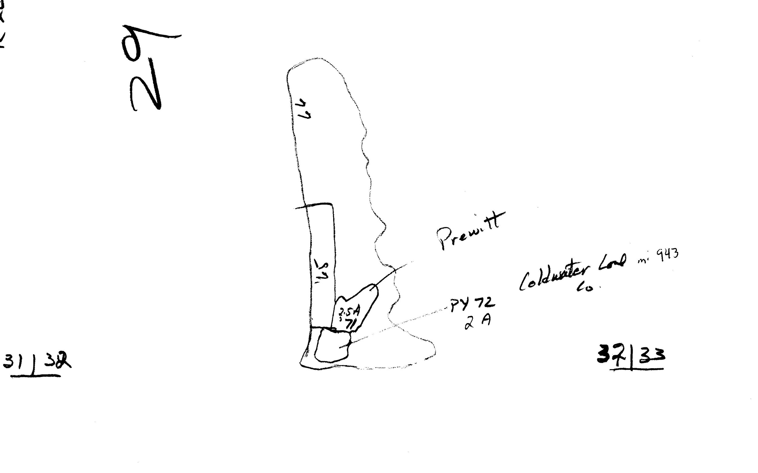
Mine Index Number: 0943
| Company Name:
|
Cold Water Coal Company
|
| Mine Name:
|
Cold Water No. 2 Mine
|
| Start Date:
|
1970
|
End Date:
|
February 1980
|
| Type of Mine:
|
Surface
|
| Total acres shown:
|
68 The Cold Water Mines pulled pillars from two abandoned underground mines, the Energy No. 2 Mine (mine index 0158) and Miller & Arvipas Mine (mine index 3965), as well as surface mining virgin coal.
|
| Acres after map date:
|
|
General Area of mining acres shown:
|
|
|
|
Shaft, Slope, Drift or Tipple Location(s)
| Type
|
County
|
Township-Range
|
Section
|
Part Section
|
| Pit
|
Williamson
|
8S 2E
|
32
|
E ½
|
Geology
| Herrin
|
20-50
|
|
|
7.0-9.0
|
Surface
|
Geological Problems Reported
Production
| Company
|
Mine Name
|
Date
|
Production (tons)
|
|
|
|
|
|
| Total Production: 106,432
|
Production Notes
Coal Report production (if available)
Sources of Data
| Coal Section strip mine updates
|
1976
|
1:8400
|
1:8400
|
Secondary source
|
Annotated Bibliography (Data source - brief description of information)
| Coal Reports - Production, ownership, years of operation, depth, thickness.
|
| Directory of Illinois Coal Mines (Williamson County) - Mine names, mine index, ownership, years of operation.
|
| Mine notes (Williamson County) - Mine type, mine location, seam, mining method.
|
| Coal Section strip mine updates, tracings of aerial photographs - Mine outline.
|
Mine Notes
Mine Images
 These files may not be true to scale and are not georgistered. These files may not be true to scale and are not georgistered.
|
Map Type:
|
DOQ
|
| Map ID:
|
m0943a.jpg - DOQ
|
| Company:
|
|
| Mine Name:
|
|
| Caption:
|
|
| Map Date:
|
1999
|
| Map Status:
|
Secondary
|
| Image Credit:
|
|
| Note:
|
|
| More Info:
|
M0943a.jpg
|
| Full Res Download:These files are true to scale and most are georegistered for gis software. These files may be a very large (>1GB) download!
|
https://wikiimage.isgs.illinois.edu/ilmines/williamson/m0943a.zip
|
 These files may not be true to scale and are not georgistered. These files may not be true to scale and are not georgistered.
|
Map Type:
|
Strip Mine Update
|
| Map ID:
|
Strip Mine Update
|
| Company:
|
|
| Mine Name:
|
|
| Caption:
|
|
| Map Date:
|
|
| Map Status:
|
Secondary
|
| Image Credit:
|
|
| Note:
|
|
| More Info:
|
M0943.jpg
|
| Full Res Download:These files are true to scale and most are georegistered for gis software. These files may be a very large (>1GB) download!
|
https://wikiimage.isgs.illinois.edu/ilmines/williamson/m0943.zip
|
Photographs