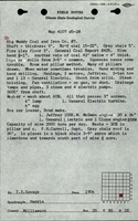
Mine Index Number: 0454
| Company Name:
|
Consolidated Coal Company of St. Louis
|
| Mine Name:
|
New Monarch Mine
|
| Start Date:
|
1897
|
End Date:
|
July 1940
|
| Type of Mine:
|
Underground
|
| Total acres shown:
|
2,032 in Herrin Coal and less than 1 acre in the Springfield Coal.
|
| Acres after map date:
|
|
General Area of mining acres shown:
|
|
|
|
Shaft, Slope, Drift or Tipple Location(s)
| Type
|
County
|
Township-Range
|
Section
|
Part Section
|
| Main shaft
|
Williamson
|
8S 2E
|
20
|
NW SW SE
|
| Air shaft
|
Williamson
|
8S 2E
|
20
|
NW SW SE
|
| Air shaft
|
Williamson
|
8S 2E
|
21
|
SE NE NW Shared with mine index 0711, the Buckhorn Mine, another Consolidated Coal Company of St. Louis mine.
|
| Blind slope A blind slope (slope which does not reach the surface) extended from the workings in the Herrin Coal to the Springfield Coal.
|
Williamson
|
8S 2E
|
20
|
NE SE SW
|
Geology
| Herrin
|
150
|
6.0
|
9.5
|
8.75-9.0
|
MRP
|
Geological Problems Reported
Several faults were noted on the source map. Two trended northwest-southeast and one trended northeast-southwest. A 1925 explosion killed two miners in an entry where ventilation had failed. The roof was a massive gray sandy shale, cut by vertical joints. When exposed by mining, the roof tended to fall in thick layers. Top coal (16 to 24 inches) was left to support the roof, but this top coal was mined on retreat. A death occurred in 1910 as a result of pillars being pulled. Local hollows in the floor and rolls in the roof were present.
Production
| Company
|
Mine Name
|
Date
|
Production (tons)
|
|
|
|
|
|
| Total Production: 16,038,930
|
Production Notes
Coal Report production (if available)
Sources of Data
| Company, state archive, IL_1686
|
7-19-1940
|
1:2400
|
1:2400
|
Final
|
| Company, Old Ben Archive Collection
|
4-1-1940
|
1:2400
|
1:2400
|
Not final
|
Annotated Bibliography (Data source - brief description of information)
| Coal Reports - Production, ownership, years of operation.
|
| Directory of Illinois Coal Mines (Williamson County) - Mine names, mine index, ownership, years of operation.
|
| Mine notes (Williamson County) - Mine type, shaft locations, seam, depth, thickness, geologic problems.
|
| Company map, state archive, IL_1686 - Mine outline, mining method.
|
| Company map, Old Ben Archive Collection - Shaft and slope locations, mine outline (west and east sides), mining method.
|
Mine Notes
Mine Images
![[[:New Monarch|New Monarch]]](https://wikiimage.isgs.illinois.edu/ilmines/williamson/thumbnails/m0454_th.jpg) These files may not be true to scale and are not georgistered. These files may not be true to scale and are not georgistered.
|
Map Type:
|
Company
|
| Map ID:
|
Old Ben
|
| Company:
|
Consolidated Coal Company of St. Louis
|
| Mine Name:
|
New Monarch
|
| Caption:
|
|
| Map Date:
|
4-1-1940
|
| Map Status:
|
Not Final
|
| Image Credit:
|
|
| Note:
|
|
| More Info:
|
M0454.jpg
|
| Full Res Download:These files are true to scale and most are georegistered for gis software. These files may be a very large (>1GB) download!
|
https://wikiimage.isgs.illinois.edu/ilmines/williamson/m0454.zip
|
![[[:New Monarch|New Monarch]]](https://wikiimage.isgs.illinois.edu/ilmines/williamson/thumbnails/m0454_IL_1686_geo_th.jpg) These files may not be true to scale and are not georgistered. These files may not be true to scale and are not georgistered.
|
Map Type:
|
Archive
|
| Map ID:
|
IL_1686
|
| Company:
|
Consolidated Coal Company of St. Louis
|
| Mine Name:
|
New Monarch
|
| Caption:
|
|
| Map Date:
|
07/19/1940
|
| Map Status:
|
Final
|
| Image Credit:
|
Illinois Department of Natural Resources - Office of Mines and Minerals
|
| Note:
|
|
| More Info:
|
M0454 IL 1686 geo
|
| Full Res Download:These files are true to scale and most are georegistered for gis software. These files may be a very large (>1GB) download!
|
https://wikiimage.isgs.illinois.edu/ilmines/williamson/m0454 IL 1686 geo.zip
|
Photographs