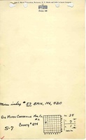
Mine Index Number: 0057
| Company Name:
|
Franklin County Coal Company
|
| Mine Name:
|
Royalton No. 7 Mine
|
| Start Date:
|
1906
|
End Date:
|
September 1951
|
| Type of Mine:
|
Underground
|
| Total acres shown:
|
3,915
|
| Acres after map date:
|
|
General Area of mining acres shown:
|
|
|
|
Shaft, Slope, Drift or Tipple Location(s)
| Type
|
County
|
Township-Range
|
Section
|
Part Section
|
| Main shaft (10 x 16 ft)
|
Franklin
|
7S 1E
|
28
|
SW SW NW
|
| Air shaft (9 x 8 ft)
|
Franklin
|
7S 1E
|
28
|
SW SW NW
|
Geology
| Herrin
|
210-320
|
|
10.5
|
9.83
|
RPP
|
Geological Problems Reported
A major fault was present, with a 200-400 foot gouge zone and 35 feet of throw. The roof consisted of a dense sandy gray shale that tended to fall in irregular masses. Generally 24 to 36 inches of top coal was left to support and protect the roof. Considerable gas seeped out of the face. The coal seam in this mine did not have the flexure noted in other Franklin County mines, just a gentle undulation with no steep grades to hinder haulage. The coal contained a very small number of slips. A few pyrite balls and streaks were present in the lower bench. The underclay did not heave.
Production
| Company
|
Mine Name
|
Date
|
Production (tons)
|
|
|
|
|
|
| Total Production: 21,669,824
|
Production Notes
Coal Report production (if available)
Sources of Data
| Microfilm, Document 351432
|
10-8-1951
|
1:2400
|
1:3476
|
Final
|
Annotated Bibliography (Data source - brief description of information)
| Coal Reports - Production, ownership, years of operation, shaft sizes, depth, thickness.
|
| Directory of Illinois Coal Mines (Franklin County) - Mine names, mine index, ownership, years of operation.
|
| Mine notes (Franklin County) - Mine type, shaft locations, seam, thickness, geologic problems.
|
| Microfilm map, document 351432, reel 03136, frames 95-98 - Shaft locations, mine outline, mining method.
|
Mine Notes
Mine Images
![[[:Royalton No. 7|Royalton No. 7]]](https://wikiimage.isgs.illinois.edu/ilmines/franklin/thumbnails/m0057_th.jpg) These files may not be true to scale and are not georgistered. These files may not be true to scale and are not georgistered.
|
Map Type:
|
Microfilm
|
| Map ID:
|
351432, 03136, 95-98
|
| Company:
|
Franklin County Coal Company
|
| Mine Name:
|
Royalton No. 7
|
| Caption:
|
|
| Map Date:
|
10-8-1951
|
| Map Status:
|
Final
|
| Image Credit:
|
|
| Note:
|
|
| More Info:
|
M0057.jpg
|
| Full Res Download:These files are true to scale and most are georegistered for gis software. These files may be a very large (>1GB) download!
|
https://wikiimage.isgs.illinois.edu/ilmines/franklin/m0057.zip
|
Photographs