Category:Franklin-County
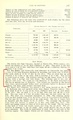
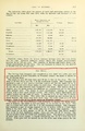
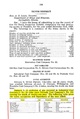
County Coal Data
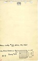
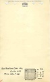
Mines that Appear in Franklin-County
- 9998 & 9999 = Unknown dates
Unlocated Mines in Franklin-County
Mine that have known coal production but no known location
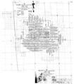
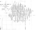
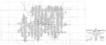
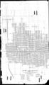
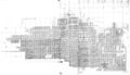
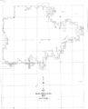
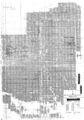
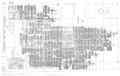
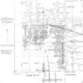
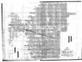
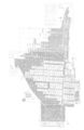
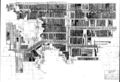
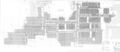
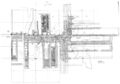
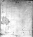
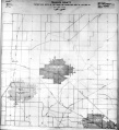
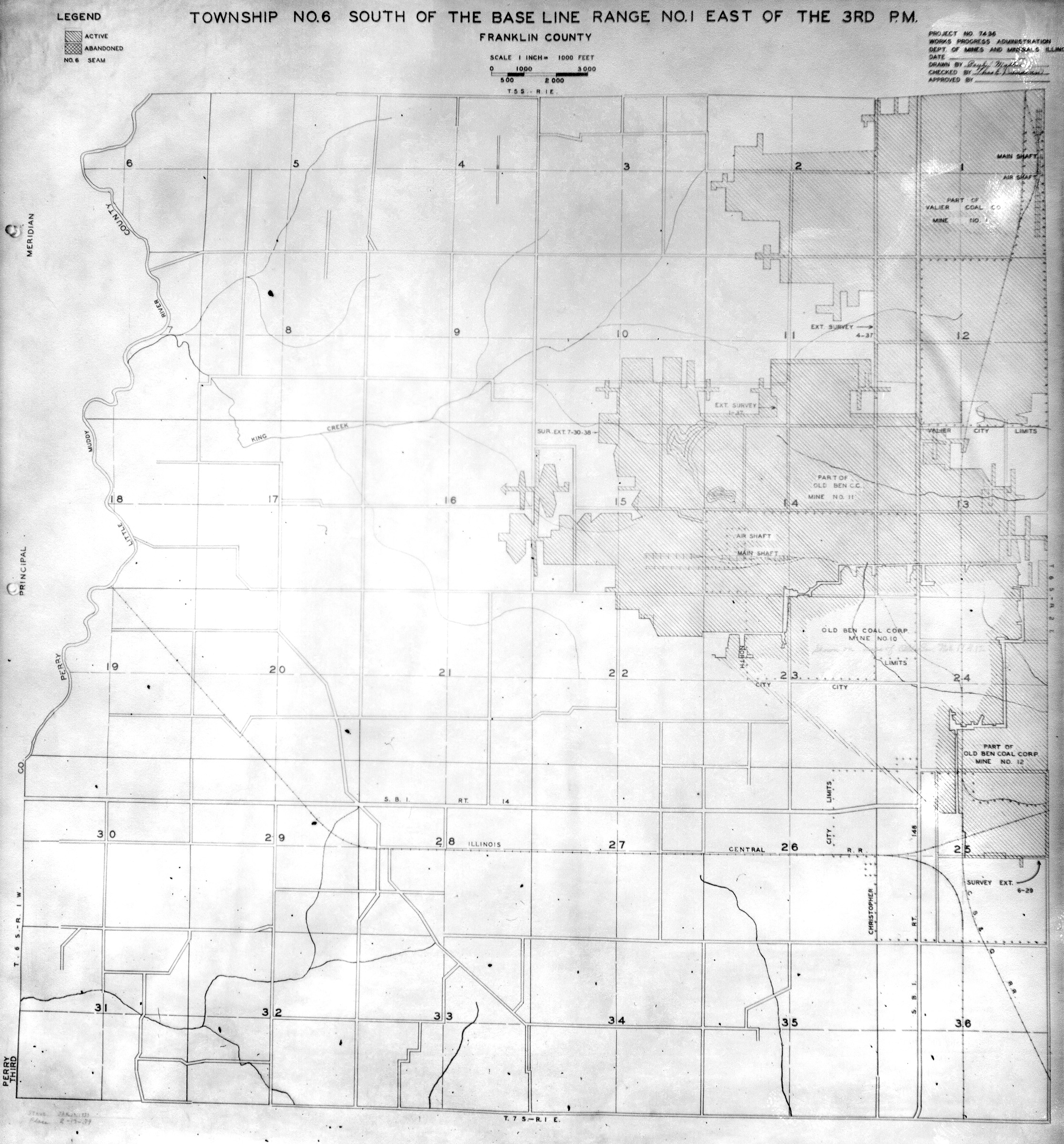
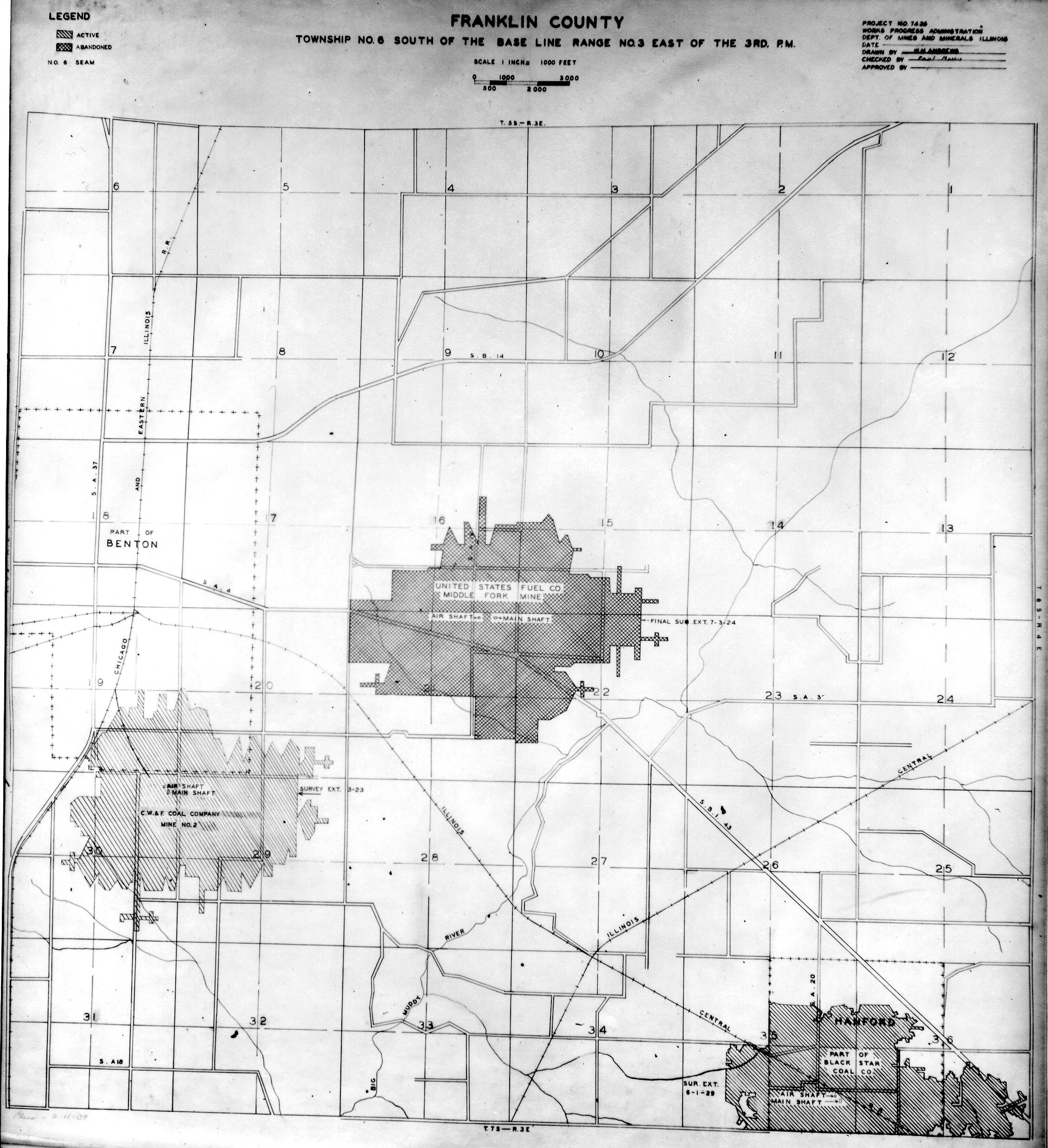
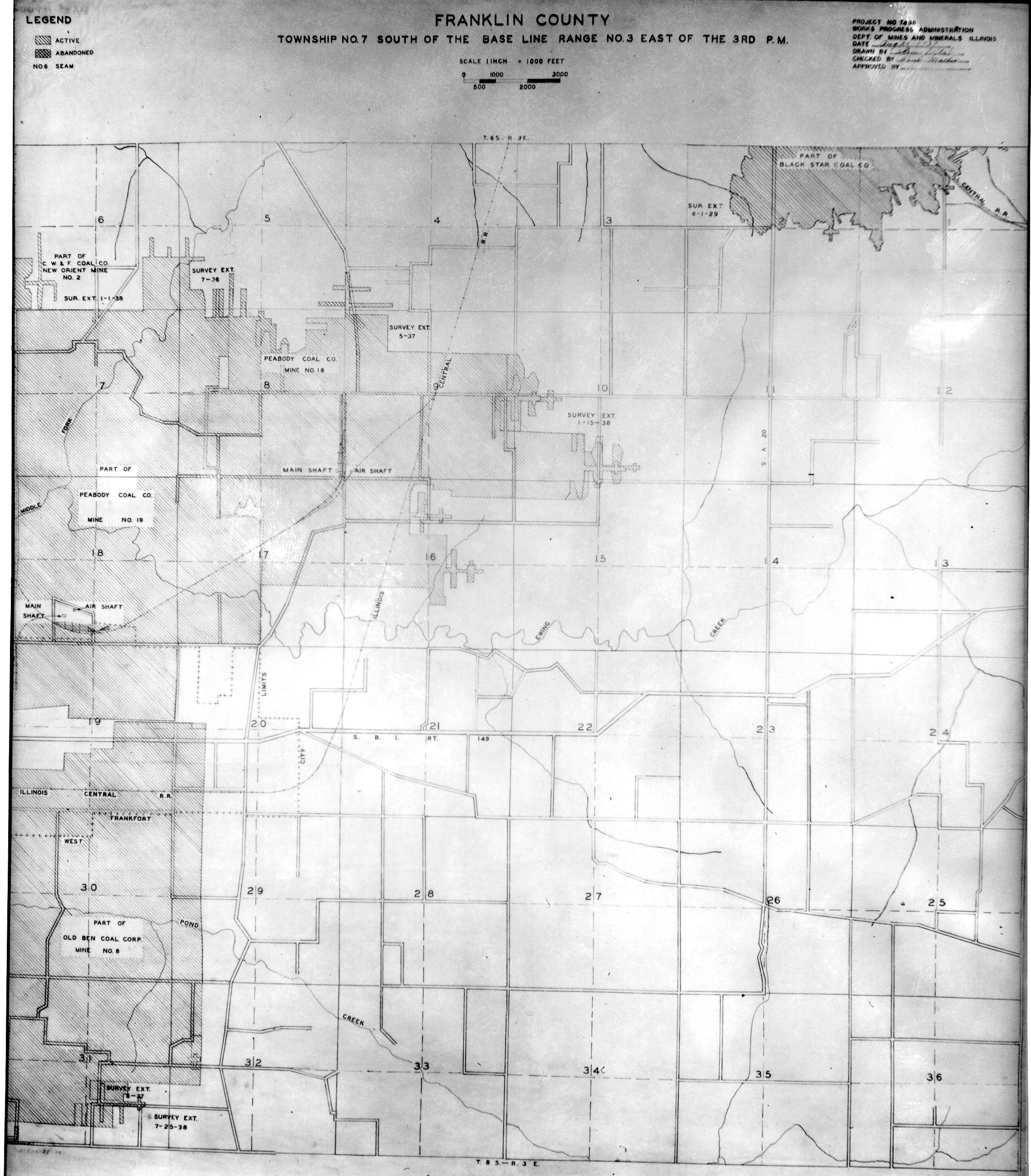
Historical Mined Out Area Maps
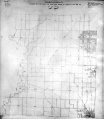
WPA
These maps were constructed as part of the nationwide Works Projects Administration (WPA), generally between 1934 and 1937 with some later updates or revisions,
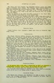
Disclaimer
Maps for some locations might have multiple versions/seams, please inspected these areas closely for differences.
Notes and corrections were made by ISGS staff.
These maps are reproductions from microfilm, they may be of poor quality with text difficult to read.


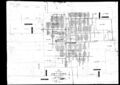
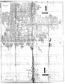
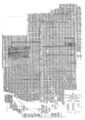
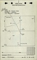
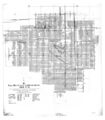
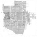
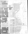
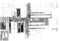
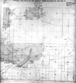
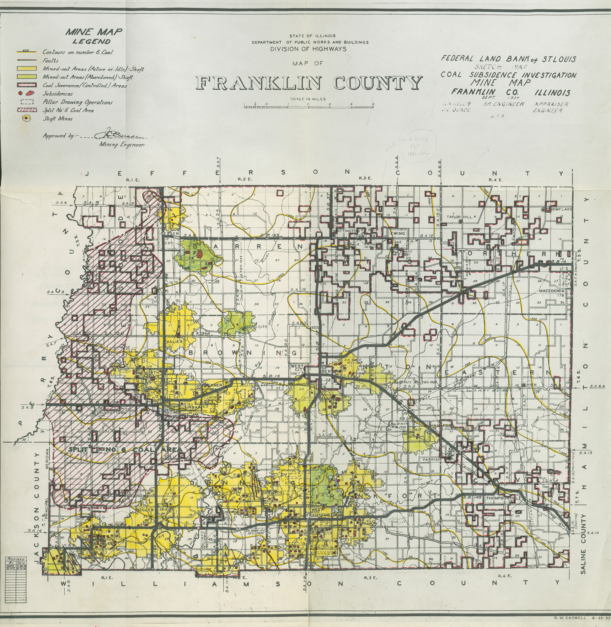
Federal Land Bank of St. Louis, Preliminary Reports on Subsidence Investigations
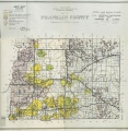
Federal Land Bank of St. Louis, Preliminary Reports on Subsidence Investigations (refered by Coal Section Staff as "Quade Maps")
Mining engineers working for the Federal Land Bank of St. Louis mapped areas of subsidence due to coal mining in the early 1930s. These reports often include county maps of mine properties with mined-out areas including shaft locations, as well as subsidence areas.
Disclaimer
Maps for some locations might have multiple versions/seams, please inspected these areas closely for differences.
These maps are accompanied by a report, please download and inspect this document.
Notes and corrections were made by ISGS staff.

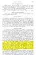
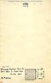
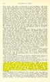
Photographs


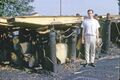
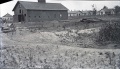
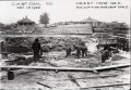
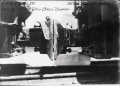
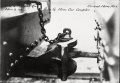
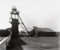
![<b>Caption:</b> Barn of mining company lowered 4 feet at one end [right side]. It has been partially restored.<br><b>Credit:</b> Illinois State Geological Survey<br><b>Date:</b> Pre-1914<br><b>Library No.:</b> M-993](/wiki/File:M-993_Old_Ben_8_mine_W_Frankfort_rt_end_4ft_lower.jpg)
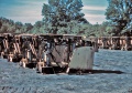
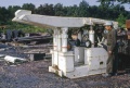
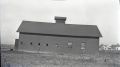
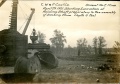
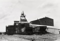
![<b>Caption:</b> Barn of mining company lowered 4 feet at one end [right side]. It has been partially restored.<br><b>Credit:</b> Illinois State Geological Survey<br><b>Date:</b> Pre-1914<br><b>Publication:</b> Fig. 47 Cooperative Bulletin 17 – Subsidence in Illinois<br><b>Library No.:</b> M-994](/wiki/File:M-994_Old_Ben_8_mine_W_Frankfort_Coop_17_Fig_47_rt_end_4ft_lower.jpg)


Pages in category "Franklin-County"
The following 66 pages are in this category, out of 66 total.
0
M
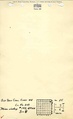
- FileList:M0053mrg.jpg
- FileList:M0057.jpg
- FileList:M0366
- FileList:M0421.jpg
- FileList:M0428mrg.jpg
- FileList:M0432mrg
- FileList:M0735.jpg
- FileList:M0962 ms 15
- FileList:M1039 2019
- FileList:M1039 2020
- FileList:M1039 2021
- FileList:M1039 2022
- FileList:M1039 2024
- FileList:M1047 2019
- FileList:M1047 2020
- FileList:M1047 2022
- FileList:M1047 2024
- FileList:M2071.jpg
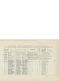
Media in category "Franklin-County"
The following 147 files are in this category, out of 147 total.
 1960s Old Ben 21 Rheinstahl-Wanheim 4 leg chocks MI 863.jpg 3,000 × 1,997; 209 KB
 1964 Rheinstahl-Wanheim 6 leg Chocks Old Ben 21 used Face 3 2.jpg 2,530 × 1,776; 515 KB
 1964 Rheinstahl-Wanheim 6 leg Chocks Old Ben 21 used Face 3.jpg 2,530 × 1,686; 545 KB
 1969 Jun-1970 Apr Old Ben 21 Face 6 Gullick Chocks 1.jpg 2,863 × 2,291; 575 KB
 1969 Jun-1970 Apr Old Ben 21 Face 6 Gullick Chocks 2.jpg 3,000 × 2,414; 511 KB
 1969 Jun-1970 Apr Old Ben 21 Face 6 Gullick Chocks 3.jpg 3,000 × 2,411; 471 KB
 1969 Jun-1970 Apr Old Ben 21 Joy-Gullick 600 ton Chocks used on Face 6 4.jpg 3,000 × 2,005; 220 KB
 1969 Jun-1970 Apr Old Ben 21 Joy-Gullick 600 ton Chocks used on Face 6.jpg 3,000 × 2,027; 248 KB
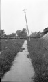 M-825 Coop 17 fig 26 broken sidewalk tilted pole Old Ben 8 - 8ft coal at 450ft.jpg 2,544 × 4,340; 1.07 MB
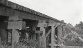 M-992 Coop 17 Fig 40 trestle 1.5ft submine.jpg 2,500 × 1,460; 366 KB
 M-993 Old Ben 8 mine W Frankfort rt end 4ft lower.jpg 2,500 × 1,440; 509 KB
 M-994 Old Ben 8 mine W Frankfort Coop 17 Fig 47 rt end 4ft lower.jpg 2,500 × 1,397; 379 KB
 M0050 coalreport 1906.pdf 779 × 1,237; 397 KB
 M0050 coalreport 1907.pdf 587 × 966, 2 pages; 161 KB
 M0050 minenotes.pdf 739 × 1,193, 23 pages; 6.16 MB
 M0050.jpg 2,963 × 3,390; 2.4 MB
 M0051 coalreport 1908.pdf 629 × 970; 86 KB
 M0051 minenotes.pdf 733 × 1,202, 15 pages; 3.55 MB
 M0051mrg.jpg 1,803 × 3,390; 2.91 MB
 M0052 coalreport 1908.pdf 629 × 970; 70 KB
 M0052 minenotes.pdf 727 × 1,200, 21 pages; 5.15 MB
 M0052.jpg 3,390 × 2,875; 2.04 MB
 M0053 coalreport 1905.pdf 633 × 977, 6 pages; 464 KB
 M0053 coalreport 1909.pdf 1,595 × 1,233, 3 pages; 1.11 MB
 M0053 coalreport 1913.pdf 793 × 1,187, 2 pages; 3.59 MB
 M0053 coalreport 1917p252.pdf 602 × 991; 92 KB
 M0053 coalreport 1918expl.pdf 883 × 1,295, 2 pages; 149 KB
 M0053 minenotes.pdf 733 × 1,202, 33 pages; 8.15 MB
 M0056 coalreport 1907.pdf 587 × 966; 116 KB
 M0056 coalreport 1909.pdf 716 × 1,193, 2 pages; 760 KB
 M0056 minenotes.pdf 739 × 1,193, 18 pages; 4.76 MB
 M0056.jpg 3,390 × 1,436; 1.12 MB
 M0057 coalreport 1907.pdf 587 × 966; 74 KB
 M0057 minenotes.pdf 739 × 1,202, 28 pages; 6.75 MB
 M0058 coalreport 1907.pdf 587 × 966; 126 KB
 M0058 minenotes.pdf 739 × 1,193, 15 pages; 3.59 MB
 M0058.jpg 1,942 × 3,390; 2.1 MB
 M0134 coalreport 1917.pdf 602 × 991; 88 KB
 M0134 minenotes.pdf 739 × 1,193, 31 pages; 8.24 MB
 M0134.jpg 3,390 × 2,403; 1.89 MB
 M0136 coalreport 1917.pdf 602 × 991, 2 pages; 159 KB
 M0136 coalreport 1930.pdf 637 × 966; 70 KB
 M0136 minenotes.pdf 739 × 1,193, 36 pages; 9.61 MB
 M0136.jpg 3,390 × 1,957; 2.14 MB
 M0139 coalreport 1914.pdf 825 × 1,264; 568 KB
 M0139 minenotes.pdf 739 × 1,193, 19 pages; 5.3 MB
 M0139.jpg 3,390 × 2,452; 1.76 MB
 M0140 coalreport 1909.pdf 781 × 1,208; 419 KB
 M0140 minenotes.pdf 733 × 1,202, 20 pages; 5.13 MB
 M0140.jpg 2,732 × 3,390; 815 KB
 M0140b.jpg 2,649 × 3,390; 3.44 MB
 M0143 coalreport 1910.pdf 583 × 943, 2 pages; 194 KB
 M0143 coalreport 1921.pdf 847 × 1,310; 1.65 MB
 M0143 coalreport 1924.pdf 635 × 997; 69 KB
 M0143 coalreport 1947.pdf 1,270 × 902, 2 pages; 415 KB
 M0143 coalreport1929 p190.pdf 639 × 1,000; 985 KB
 M0143 minenotes.pdf 733 × 1,202, 22 pages; 5.95 MB
 M0143.jpg 2,374 × 3,390; 4.45 MB
 M0143a.jpg 2,405 × 3,390; 4.25 MB
 M0145 coalreport 1917p249.pdf 602 × 991; 94 KB
 M0145 minenotes.pdf 739 × 1,202, 33 pages; 8.52 MB
 M0147 coalreport 1917.pdf 602 × 991; 98 KB
 M0147 minenotes.pdf 739 × 1,202, 24 pages; 6.37 MB
 M0256 coalreport 1907p329.pdf 587 × 966; 90 KB
 M0256 coalreport 1908p347.pdf 629 × 970; 85 KB
 M0256 coalreport 1909p374.pdf 1,606 × 1,241; 413 KB
 M0256 coalreport 1917p252.pdf 602 × 991; 81 KB
 M0256 coalreport 1928.pdf 656 × 979, 2 pages; 113 KB
 M0256 minenotes.pdf 733 × 1,202, 6 pages; 1.6 MB
 M0256mrg.jpg 3,390 × 2,141; 2.64 MB
 M0366 coalreport 1923p270.pdf 625 × 997; 56 KB
 M0366 coalreport 1926p205.pdf 639 × 1,016; 65 KB
 M0366 coalreport 1943p152.pdf 625 × 1,016; 72 KB
 M0366 coalreport 1947p175.pdf 902 × 1,270; 1.15 MB
 M0366 minenotes.pdf 733 × 1,202, 28 pages; 7.03 MB
 M0421 coalreport 1908p348.pdf 629 × 970; 70 KB
 M0421 coalreport 1909p370.pdf 1,591 × 1,229; 394 KB
 M0421 fieldnotes.pdf 752 × 1,200, 8 pages; 745 KB
 M0421 minenotes.pdf 733 × 1,202, 27 pages; 7.03 MB
 M0428 minenotes.pdf 733 × 1,202, 16 pages; 3.91 MB
 M0432 coalreport 1917.pdf 602 × 991; 79 KB
 M0432 minenotes.pdf 739 × 1,193, 14 pages; 3.81 MB
 M0433 coalreport 1910.pdf 583 × 943; 80 KB
 M0433 minenotes.pdf 733 × 1,202, 5 pages; 1.19 MB
 M0433a.jpg 3,356 × 3,390; 2.03 MB
 M0433mrg.jpg 3,390 × 2,533; 3.54 MB
 M0434 coalreport 1907p328.pdf 587 × 966; 103 KB
 M0434 minenotes.pdf 739 × 1,193, 11 pages; 9.15 MB
 M0434.jpg 2,958 × 3,390; 3.47 MB
 M0448 coalreport 1913p246.pdf 793 × 1,187; 1.46 MB
 M0448 minenotes.pdf 733 × 1,202, 19 pages; 5.39 MB
 M0505 coalreport 1913p246.pdf 793 × 1,187; 1.46 MB
 M0505 minenotes.pdf 733 × 1,202, 18 pages; 4.67 MB
 M0505.jpg 2,207 × 3,390; 1.78 MB
 M0665 coalreport 1912.pdf 795 × 1,241, 4 pages; 13.25 MB
 M0665 minenotes.pdf 739 × 1,193, 15 pages; 4.12 MB
 M0665wrp.jpg 3,371 × 3,390; 4.25 MB
 M0666 coalreport 1913p246.pdf 793 × 1,187; 1.46 MB
 M0666 coalreport 1918expl.pdf 883 × 1,295, 7 pages; 264 KB
 M0666 minenotes.pdf 739 × 1,193, 28 pages; 7.77 MB
 M0666.jpg 3,390 × 1,494; 1.9 MB
 M0735 minenotes.pdf 731 × 1,204, 5 pages; 1.12 MB
 M0847 minenotes.pdf 733 × 1,202, 46 pages; 12.6 MB
 M0847.jpg 3,390 × 2,889; 1.84 MB
 M0863 minenotes.pdf 739 × 1,193, 182 pages; 22.63 MB
 M0863wrp.jpg 3,390 × 2,317; 3.39 MB
 M0866 minenotes.pdf 739 × 1,193, 26 pages; 6.65 MB
 M0866.jpg 3,106 × 3,800; 4.87 MB
 M0879 minenotes.pdf 739 × 1,193, 83 pages; 27.61 MB
 M0879wrp.jpg 3,390 × 1,473; 1.69 MB
 M0962 minenotes.pdf 731 × 1,202, 39 pages; 10.26 MB
 M0975 minenotes.pdf 733 × 1,202, 72 pages; 30.77 MB
 M0975.jpg 3,390 × 2,303; 1.93 MB
 M0975b.jpg 3,390 × 2,378; 1.59 MB
 M2068 fieldnotes.pdf 747 × 1,191, 2 pages; 308 KB
 M2070 coalreport 1917p249.pdf 602 × 991; 92 KB
 M2070 minenotes.pdf 739 × 1,193, 15 pages; 3.76 MB
 M2070mrg.jpg 2,483 × 3,390; 1.06 MB
 M2071 coalreport 1910p410.pdf 583 × 943; 90 KB
 M2071 coalreport 1915p227.pdf 1,539 × 1,270; 389 KB
 M2071 minenotes.pdf 731 × 1,204, 6 pages; 1.79 MB
 M3985 fieldnotes.pdf 754 × 1,204, 2 pages; 270 KB
 Orient No 2 0001.jpg 3,996 × 2,737; 1.34 MB
 Orient No 2 0002.jpg 3,980 × 2,782; 1.07 MB
 Orient No 2 0003.jpg 2,650 × 1,832; 662 KB
 Orient No 2 0004.jpg 2,619 × 1,867; 478 KB
 Orient No 2 0005.jpg 2,607 × 1,861; 513 KB
 Orient No 2 0006.jpg 2,613 × 1,843; 511 KB
 Orient No 2 0007.jpg 2,613 × 1,837; 484 KB
 Orient No 2 0008.jpg 2,631 × 1,819; 497 KB
 Orient No 2 0009.jpg 2,199 × 1,756; 554 KB
 Orient No 2 0010.jpg 2,400 × 1,977; 521 KB
 Orient No 2 0011.jpg 2,220 × 1,784; 515 KB
 Orient No 2 0012.jpg 2,231 × 1,802; 423 KB
 Orient No 2 0013.jpg 1,700 × 2,187; 448 KB
 Orient No 2 0014.jpg 2,152 × 1,591; 369 KB
 Orient No 2 0015.jpg 2,225 × 1,814; 419 KB
 Orient No 2 0016.jpg 2,213 × 1,831; 343 KB
 Orient No 2 0017.jpg 1,995 × 1,364; 257 KB
 QUADE FRANKLIN.jpg 1,947 × 2,000; 1.57 MB
 WPA FRANKLIN 5S1E.jpg 2,244 × 2,576; 1.68 MB
 WPA FRANKLIN 5S2E.jpg 2,270 × 2,580; 1.99 MB
 WPA FRANKLIN 6S1E.jpg 2,232 × 2,400; 1.58 MB
 WPA FRANKLIN 6S2E.jpg 2,264 × 2,476; 1.8 MB
 WPA FRANKLIN 6S3E.jpg 2,260 × 2,476; 1.6 MB
 WPA FRANKLIN 7S2E.jpg 2,272 × 2,592; 1.86 MB
 WPA FRANKLIN 7S3E.jpg 2,276 × 2,604; 1.87 MB


