Mine Index Number: 0056
| Company Name:
|
Old Ben Coal Corporation
|
| Mine Name:
|
Old Ben No. 19 Mine
|
| Start Date:
|
1907
|
End Date:
|
March 1923
|
| Type of Mine:
|
Underground
|
| Total acres shown:
|
745
|
| Acres after map date:
|
|
General Area of mining acres shown:
|
|
|
|
Shaft, Slope, Drift or Tipple Location(s)
| Type
|
County
|
Township-Range
|
Section
|
Part Section
|
| Main shaft (10'x18')
|
Franklin
|
6S 2E
|
4
|
SE SW NE
|
| Air/escape shaft (10'x13')
|
Franklin
|
6S 2E
|
4
|
NE NW SE
|
Geology
| Herrin
|
567-580
|
7.0
|
10.0
|
7.67-9.0
|
RPP
|
Geological Problems Reported
Two gas explosions killed seven men in November-December 1908. The roof was gray shale over a large portion of the mine, and the roof over the remainder of the mine was 9 feet of limestone. Where gray shale made up the roof, 1.5 feet of top coal was left to support the roof. Rolls were fairly common, but not in sufficient number to seriously affect mining. The seam contained pyrite streaks and lenses, irregularly distributed. The floor clay heaved badly when wet.
Production
| Company
|
Mine Name
|
Date
|
Production (tons)
|
|
|
|
|
|
| Total Production: 4,135,065
|
Production Notes
Coal Report production (if available)
Sources of Data
| Company map
|
6-30-1924
|
1:2400
|
1:2400
|
Final
|
Annotated Bibliography (Data source - brief description of information)
| Coal Reports - Production, ownership, years of operation, shaft sizes, depth, thickness, geologic problems.
|
| Directory of Illinois Coal Mines (Franklin County) - Mine names, mine index, ownership, years of operation.
|
| ENR Document 85/01 - Mining method.
|
| Mine notes (Franklin County) - Mine type, shaft location, seam, depth, thickness, geologic problems.
|
| Company map, ISGS map library, Old Ben Coal Company Archive Collection - Shaft locations, mine outline, mining method.
|
Mine Notes
Mine Images
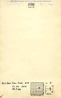
Company:
Map Date: 6-30-1924
Coal Co.: Old Ben Coal Corporation
Mine Name: Old Ben No. 19 Mine
Full Res Download
Photographs
Additional Notes