Mine Index Number: 2068
| Company Name:
|
Aaron King
|
| Mine Name:
|
King Mine
|
| Start Date:
|
1889
|
End Date:
|
1893
|
| Type of Mine:
|
Surface
|
| Total acres shown:
|
None production indicates less than 1 acre was mined.
|
| Acres after map date:
|
|
General Area of mining acres shown:
|
|
|
|
Shaft, Slope, Drift or Tipple Location(s)
| Type
|
County
|
Township-Range
|
Section
|
Part Section
|
| Pit
|
Franklin
|
5S 3E
|
16
|
SE SW SW
|
| Pit
|
Franklin
|
5S 3E
|
21
|
NE NW NW
|
Geology
Geological Problems Reported
Production
| Company
|
Mine Name
|
Date
|
Production (tons)
|
Production Notes
Coal Report production (if available)
Sources of Data
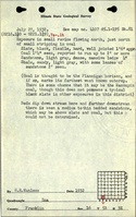
| ISGS field notes (H. R. Wanless)
|
7-27-1932
|
(text only)
|
1:24000 Point plotted onto 1:24,000 USGS topographic map and digitized.
|
Secondary source
|
Annotated Bibliography (Data source - brief description of information)
| Coal Reports - Production, ownership, years of operation, thickness.
|
| Directory of Illinois Coal Mines (Franklin County) - Mine names, mine index, ownership, years of operation.
|
| ISGS field notes (Franklin County) - Mine type, mine location, seam, thickness.
|
Mine Notes
Mine Images
Photographs
Additional Notes