Mine Index Number: 2070
| Company Name:
|
Franklin Mining Company
|
| Mine Name:
|
Ward Mine
|
| Start Date:
|
1917
|
End Date:
|
October 1934
|
| Type of Mine:
|
Underground
|
| Total acres shown:
|
792
|
| Acres after map date:
|
|
General Area of mining acres shown:
|
|
|
|
Shaft, Slope, Drift or Tipple Location(s)
| Type
|
County
|
Township-Range
|
Section
|
Part Section
|
| Main shaft (11.33'x17.2')
|
Franklin
|
6S 3E
|
17
|
SW SW NE
|
| Air shaft (11.33'x15.17')
|
Franklin
|
6S 3E
|
17
|
SE SW NE
|
Geology
| Herrin
|
623
|
6.0
|
|
6.5-8.0
|
RPP
|
Geological Problems Reported
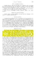
The seam contained some small slips, but the effect of these slips on mining was negligible. Pyrite stringers and calcite facings were also present. The coal contained rolls, some of which nearly cut out the coal.
Production
| Company
|
Mine Name
|
Date
|
Production (tons)
|
|
|
|
|
|
| Total Production: 4,012,202
|
Production Notes
Coal Report production (if available)
Sources of Data
| Microfilm, document 351452
|
4-26-1961 Mine survey extended to 11-30-1934
|
1:2400
|
1:4303
|
Final
|
Annotated Bibliography (Data source - brief description of information)
| Coal Reports - Production, ownership, years of operation, shaft sizes, thickness.
|
| Directory of Illinois Coal Mines (Franklin County) - Mine names, mine index, ownership, years of operation.
|
| Mine notes (Franklin County) - Mine type, shaft locations, seam, depth, thickness, geologic problems.
|
| Microfilm map, document 351452, reel 03136, frames 158, 159 - Shaft locations, mine outline, mining method.
|
Mine Notes
Mine Images
Microfilm: 351452
Map Date: 4-26-1961
Coal Co.: Franklin Mining Company
Mine Name: Ward Mine
Full Res Download
Photographs


