Mine Index Number: 0053
| Company Name:
|
Bell and Zoller Coal and Mining Company
|
| Mine Name:
|
Bell and Zoller No. 1 Mine
|
| Start Date:
|
1904
|
End Date:
|
December 1948
|
| Type of Mine:
|
Underground
|
| Total acres shown:
|
10,007 Boundaries between separate mines could not be distinguished. The area shown includes Bell & Zoller No. 2 Mine (mine index 145).
|
| Acres after map date:
|
|
General Area of mining acres shown:
|
|
|
|
Shaft, Slope, Drift or Tipple Location(s)
| Type
|
County
|
Township-Range
|
Section
|
Part Section
|
| Main shaft
|
Franklin
|
7S 1E
|
13
|
NE SW SE
|
| Material shaft
|
Franklin
|
7S 1E
|
13
|
SE SW SE
|
| Air shaft
|
Franklin
|
7S 1E
|
13
|
600 FSL, 1960 FEL
|
Geology
| Herrin
|
392-420
|
7.0
|
25.0
|
9.0-12.17
|
RPP,HERsome HER
|
Geological Problems Reported
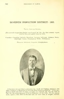
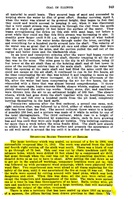
The mine had gas problems; 50 men died in a 1905 explosion, and in 1909, two explosions killed 29 men. The roof was a hard gray shale. Top coal was generally left to support and protect the roof. Some rolls were present in the seam. The seam had very frequent and prevalent flexures and swags that maintained a general southeast-northwest trending direction. This created serious haulage problems because of the steep grades. The top coal contained a considerable number of calcite seams. Pyrite balls were present but the distribution was very irregular. A squeeze occurred because of drawn pillars (1913), but generally the underclay floor did not heave.
Production
| Company
|
Mine Name
|
Date
|
Production (tons)
|
|
|
|
|
|
| Total Production: 40,022,521
|
Production Notes
Coal Report production (if available)
Sources of Data
| Microfilm, document 351444
|
12-21-1948
|
1:2400
|
1:441
|
Final
|
| Microfilm, document 351446
|
6-27-1951
|
1:2400
|
1:428
|
Final
|
Annotated Bibliography (Data source - brief description of information)
| Coal Reports - Production, ownership, years of operation, geologic problems.
|
| Directory of Illinois Coal Mines (Franklin County) - Mine names, mine index, ownership, years of operation.
|
| Mine notes (Franklin County) - Mine type, shaft locations, seam, depth, thickness, geologic problems.
|
| Microfilm map, document 351444, reel 03136, frames 116-123 - Shaft locations, mine outline, mining method.
|
Mine Notes
Mine Images
![[[:Bell and Zoller No. 1|Bell and Zoller No. 1]]](https://wikiimage.isgs.illinois.edu/ilmines/franklin/thumbnails/m0053mrg_th.jpg) These files may not be true to scale and are not georgistered. These files may not be true to scale and are not georgistered.
|
Map Type:
|
Microfilm
|
| Map ID:
|
351444 3136 116-23, 32x
|
| Company:
|
Bell and Zoller Coal and Mining Company
|
| Mine Name:
|
Bell and Zoller No. 1
|
| Caption:
|
|
| Map Date:
|
6-27-1951
|
| Map Status:
|
Final
|
| Image Credit:
|
|
| Note:
|
|
| More Info:
|
M0053mrg.jpg
|
| Full Res Download:These files are true to scale and most are georegistered for gis software. These files may be a very large (>1GB) download!
|
https://wikiimage.isgs.illinois.edu/ilmines/franklin/m0053mrg.zip
|
Photographs

![[[:Bell and Zoller No. 1|Bell and Zoller No. 1]]](https://wikiimage.isgs.illinois.edu/ilmines/franklin/thumbnails/m0053mrg_th.jpg)