Mine Index Number: 0140
| Company Name:
|
Black Star Coal Company
|
| Mine Name:
|
Logan Mine
|
| Start Date:
|
1909
|
End Date:
|
November 1929
|
| Type of Mine:
|
Underground
|
| Total acres shown:
|
911 Some moderate-sized unmined areas within the mine outline were not included on the accompanying map. The unmined areas were shown on the microfilm source map, which required rather substantial rubber-sheeting to fit to the topographic map and other company map. Because of these registration difficulties, these areas were not digitized or shown on the accompanying map.
|
| Acres after map date:
|
|
General Area of mining acres shown:
|
|
|
|
Shaft, Slope, Drift or Tipple Location(s)
| Type
|
County
|
Township-Range
|
Section
|
Part Section
|
| Main shaft (9.5'x15.5')
|
Franklin
|
6S 3E
|
35
|
NE SE SE
|
| Air shaft (9.5'x13.5')
|
Franklin
|
6S 3E
|
35
|
NE SE SE
|
Geology
| Herrin
|
693-716
|
6.0
|
8.33
|
6.5-7.2
|
MRP
|
Geological Problems Reported
The roof was predominantly black shale, but a light gray shale roof was common in the eastern part of the mine. This gray shale was present as heavy, soft lenses up to 10 feet wide and 30 feet long. The lenses had many slips and this made the gray shale a treacherous roof. Up to 14 inches of top coal was left to support the roof. The coal contained pyrite and calcite veins and fracture fillings, especially near the top of the seam.
Production
| Company
|
Mine Name
|
Date
|
Production (tons)
|
|
|
|
|
|
| Total Production: 4,228,415
|
Production Notes
Coal Report production (if available)
Sources of Data
| Company
|
11-9-1929
|
1:2400
|
1:2400
|
Final
|
| Microfilm, document 351422
|
6-1-1929
|
1:2400
|
1:5296
|
Not final
|
Annotated Bibliography (Data source - brief description of information)
| Coal Reports - Production, ownership, years of operation, shaft sizes, depth.
|
| Directory of Illinois Coal Mines (Franklin County) - Mine names, mine index, ownership, years of operation.
|
| Mine notes (Franklin County) - Mine type, shaft locations, seam, depth, thickness, geologic problems.
|
| Company map, state archives il_815_03_geo.tif - Mine outline, shaft locations, mining method.
|
| Microfilm map, document 351422, reel 03136, frames 67 & 68 - Shaft locations, mining method.
|
Mine Notes
Mine Images
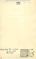
Company: IL_815
Map Date: 11-9-1929
Coal Co.: Black Star Coal Company
Mine Name: Logan Mine
Image Credit: Illinois Department of Natural Resources - Office of Mines and Minerals
Full Res Download
Microfilm: 351422
Map Date: 6-1-1929
Coal Co.: Black Star Coal Company
Mine Name: Logan Mine
Full Res Download
Photographs
Additional Notes