Mine Index Number: 0050
| Company Name:
|
Old Ben Coal Corporation
|
| Mine Name:
|
Old Ben No. 16 Mine
|
| Start Date:
|
1905
|
End Date:
|
1923
|
| Type of Mine:
|
Underground
|
| Total acres shown:
|
1,061.0
|
| Acres after map date:
|
20
|
General Area of mining acres shown:
|
20
|
|
|
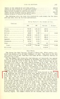
Shaft, Slope, Drift or Tipple Location(s)
| Type
|
County
|
Township-Range
|
Section
|
Part Section
|
| Main shaft (10 x 18 ft)
|
Franklin
|
5S 2E
|
19
|
SW SW NE
|
| Air shaft (10 x 15 ft)
|
Franklin
|
5S 2E
|
19
|
NW SW NE
|
Geology
| Herrin
|
644
|
8
|
9
|
8.5
|
RPP,HERsome HER
|
Geological Problems Reported
The roof was sandy gray shale that fell in large tabular masses. From 19 to 24 inches of top coal was left to support and protect the roof. A few rolls and slips were present in the seam. The mine had a considerable number of swags and hills. The coal thinned in the swags. A few rolls were present in the seam, and the rolls, when present, always occurred in the swags. Pyrite balls were irregularly dispersed through the mine, and some dirt bands were present in the seam. The floor was a very hard underclay 10 or more feet thick that rarely heaved.
Production
| Company
|
Mine Name
|
Date
|
Production (tons)
|
|
|
|
|
|
| Total Production: 6,444,273
|
Production Notes
Coal Report production (if available)
Sources of Data
| Company, Old Ben Archive Collection
|
6-30-1924
|
1:2400
|
1:2400
|
Final
|
Annotated Bibliography (Data source - brief description of information)
| Coal Reports - Production, ownership, years of operation, shaft sizes, depth.
|
| Directory of Illinois Coal Mines (Franklin County) - Mine names, mine index, ownership, years of operation.
|
| Mine notes (Franklin County) - Mine type, shaft location, seam, depth, thickness, geologic problems.
|
| Company map, Old Ben Archive Collection, State Archive, IL_820 - Shaft locations, mine outline, mining method.
|
Mine Notes
Mine Images
Company: IL_820
Map Date: 6-30-1924
Coal Co.: Old Ben Coal Corporation
Mine Name: Old Ben No. 16 Mine
Image Credit: Illinois Department of Natural Resources - Office of Mines and Minerals
Full Res Download
Photographs