Mine Index Number: 0134
| Company Name:
|
Brewerton Coal Company
|
| Mine Name:
|
Brewerton No. 22 Mine
|
| Start Date:
|
1917
|
End Date:
|
November 1934
|
| Type of Mine:
|
Underground
|
| Total acres shown:
|
495
|
| Acres after map date:
|
15
|
General Area of mining acres shown:
|
|
|
|
Shaft, Slope, Drift or Tipple Location(s)
| Type
|
County
|
Township-Range
|
Section
|
Part Section
|
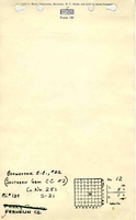
| Main shaft (11.33'x17.25')
|
Franklin
|
5S 1E
|
12
|
NW NW SE
|
| Air shaft (11'x15')
|
Franklin
|
5S 1E
|
12
|
NE NW SE
|
Geology
| Herrin
|
650-693
|
8.5
|
10.0
|
9.0-9.5
|
RPP,HERsome HER
|
Geological Problems Reported
The roof consisted of “white top”, a soft, heavy shale that fell after exposure to air. This shale reportedly was 28 to 30 feet thick. It was necessary to leave 1 to 3 feet of top coal to protect the roof from exposure to air; roof falls were rare because of this precaution. A few pyrite stringers were present in the top of the seam. Rolls and “hills” occurred throughout the mine. The hills caused considerable trouble, because much grading was required, and the weight of the roof was concentrated in the low areas, resulting in squeezes. The blue band was thick, up to 14 inches. The floor clay was more than 10 feet thick and heaved when wet. A squeeze in the western side of the mine was the result of robbing pillars. This floor clay was harder and more shaley than the usual fireclay floor under the Herrin Coal in other areas of the state, and was characterized by many small slips.
Production
| Company
|
Mine Name
|
Date
|
Production (tons)
|
|
|
|
|
|
| Total Production: 3,322,834
|
Production Notes
Coal Report production (if available)
Sources of Data
| Microfilm, document 351423
|
7-15-1934
|
1:2400
|
1:4634
|
Not final
|
Annotated Bibliography (Data source - brief description of information)
| Coal Reports - Production, ownership, years of operation, shaft sizes, depth.
|
| Directory of Illinois Coal Mines (Franklin County) - Mine names, mine index, ownership, years of operation.
|
| Mine notes (Franklin County) - Mine type, shaft locations, seam, depth, thickness, geologic problems.
|
| Microfilm map, document 351424, reel 03136, frames 69-72 - Shaft locations, mine outline, mining method.
|
Mine Notes
Mine Images
Microfilm: 351423
Map Date: 7-15-1934
Coal Co.: Brewerton Coal Company
Mine Name: Brewerton No. 22 Mine
Full Res Download
Photographs