Mine Index Number: 0136
| Company Name:
|
Old Ben Coal Corporation
|
| Mine Name:
|
Old Ben No. 22 Mine
|
| Start Date:
|
1918
|
End Date:
|
January 1960
|
| Type of Mine:
|
Underground
|
| Total acres shown:
|
5,912
|
| Acres after map date:
|
|
General Area of mining acres shown:
|
|
|
|
Shaft, Slope, Drift or Tipple Location(s)
| Type
|
County
|
Township-Range
|
Section
|
Part Section
|
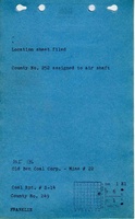
| Main shaft (15'x22.5')
|
Franklin
|
6S 1E
|
1
|
600 FSL, 100 FEL, SE NE
|
| Air shaft (17'x33.17')
|
Franklin
|
6S 2E
|
6
|
NW NW SW
|
Geology
| Herrin
|
577-602
|
6.0
|
11.5
|
8.0 (7.5-9.00)
|
RPP,HERsome HER
|
Geological Problems Reported
Gas was present in the mine (four men were killed in a 1930 explosion, one man was asphyxiated in 1945). The roof was a light gray shale that was full of slips, but it was considered troublesome only in the eastern part of the mine. Rolls were present. One roll was 20 feet long. A great number of calcite facings were present in the seam. In addition, there was a considerable number of tiny pyrite veinlets throughout the seam. The source map showed an area of (unminable) split coal in 11-T6S-R1E. The underclay floor was 8 inches to 10 feet thick and heaved when wet.
Production
| Company
|
Mine Name
|
Date
|
Production (tons)
|
|
|
|
|
|
| Total Production: 36,784,371
|
Production Notes
Coal Report production (if available)
Sources of Data
| Company, Old Ben Archive Collection
|
2-1-1960
|
1:2400
|
1:2400
|
Final
|
Annotated Bibliography (Data source - brief description of information)
| Coal Reports - Production, ownership, years of operation, seam, shaft sizes, thickness, geologic problems.
|
| Directory of Illinois Coal Mines (Franklin County) - Mine names, mine index, ownership, years of operation.
|
| ENR Document 85/01 - Mining method.
|
| Mine notes (Franklin County) - Mine type, shaft location, depth, thickness, geologic problems.
|
| Company map, Old Ben Archive Collection - Shaft locations, mine outline, mining method.
|
Mine Notes
Mine Images
Company: IL_813
Map Date: 2-1-1960
Coal Co.: Old Ben Coal Corporation
Mine Name: Old Ben No. 22 Mine
Image Credit: Illinois Department of Natural Resources - Office of Mines and Minerals
Full Res Download
Photographs