Mine Index Number: 0058
| Company Name:
|
Old Ben Coal Corporation
|
| Mine Name:
|
Old Ben No. 12 Mine
|
| Start Date:
|
1906
|
End Date:
|
March 1929
|
| Type of Mine:
|
Underground
|
| Total acres shown:
|
1,586
|
| Acres after map date:
|
|
General Area of mining acres shown:
|
|
|
|
Shaft, Slope, Drift or Tipple Location(s)
| Type
|
County
|
Township-Range
|
Section
|
Part Section
|
| Main shaft (10'x16')
|
Franklin
|
6S 2E
|
30
|
SW NW NW
|
| Air shaft (9'x13.5')
|
Franklin
|
6S 2E
|
30
|
NW NW NW
|
Geology
| Herrin
|
493-500
|
|
|
9.25
|
RPP,HERsome HER
|
Geological Problems Reported
This mine had difficulties with gas; one man was killed in a 1913 explosion, and nine were killed by a 1916 explosion. The roof was gray shale, reportedly 107 feet thick, which fell readily after exposure. Generally 14 to 30 inches of top coal was left to support the roof at the active face; this top coal and some of the pillars were mined on retreat. The seam contained pyrite and calcite lenses, but less than was common in the district. The underclay heaved when wet. A squeeze was noted in SE 19-T6S-R2E.
Production
| Company
|
Mine Name
|
Date
|
Production (tons)
|
|
|
|
|
|
| Total Production: 8,937,207
|
Production Notes
Coal Report production (if available)
Sources of Data
| Microfilm, document 351424
|
6-30-1929
|
1:2400
|
1:5296
|
Final
|
| Company, Old Ben Archive Collection
|
4-29-1953
|
1:4800
|
1:4800
|
Final
|
Annotated Bibliography (Data source - brief description of information)
| Coal Reports - Production, ownership, years of operation, shaft sizes, depth, thickness, mining method, geological problems.
|
| Directory of Illinois Coal Mines (Franklin County) - Mine names, mine index, ownership, years of operation.
|
| ENR Document 85/01 - Mining method.
|
| Mine notes (Franklin County) - Mine type, shaft location, seam, thickness, geological problems.
|
| Microfilm map, document 351424, reel 03136, frames 73-76 - Shaft locations, mine outline, mining method.
|
| Company map, Old Ben Coal Company Archive Collection, map of Old Ben No. 11 Mine (mine index 666) - Mine outline, northern part).
|
Mine Notes
Mine Images
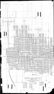
Microfilm: 351424
Map Date: 6-30-1929
Coal Co.: Old Ben Coal Corporation
Mine Name: Old Ben No. 12 Mine
Full Res Download
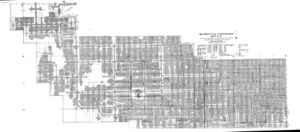
Company: IL_785
Map Date: 4-29-1953
Coal Co.: Old Ben Coal Corporation
Mine Name: Old Ben No. 11 Mine
Image Credit: Illinois Department of Natural Resources - Office of Mines and Minerals
Full Res Download
Photographs


