Mine Index Number: 0448
| Company Name:
|
Old Ben Coal Corporation
|
| Mine Name:
|
Old Ben No. 9 Mine
|
| Start Date:
|
1913
|
End Date:
|
February 1968
|
| Type of Mine:
|
Underground
|
| Total acres shown:
|
6,184
|
| Acres after map date:
|
|
General Area of mining acres shown:
|
|
|
|
Shaft, Slope, Drift or Tipple Location(s)
| Type
|
County
|
Township-Range
|
Section
|
Part Section
|
| Hoist shaft
|
Franklin
|
7S 3E
|
20
|
SE NE SE
|
| A shaft (material, air, escape)
|
Franklin
|
7S 3E
|
20
|
SE SW NE
|
| C shaft (auxiliary)
|
Franklin
|
7S 3E
|
29
|
NE SE SE
|
| D shaft (auxiliary, air, escape)
|
Franklin
|
7S 3E
|
27
|
SW SE SW
|
| E shaft (air, man/material)
|
Williamson
|
8S 3E
|
2
|
SW SW NW
|
Geology
| Herrin
|
440-482
|
6.0
|
9.3
|
9.0
|
HER,RPPRPP over most of mine; some pillars removed over most of the mine, in some areas very few pillars left.
|
Geological Problems Reported
The mine had some gas. An explosion in 1923 killed one man. Top coal (15 to 24 inches) was generally left to protect the gray shale roof. The underclay showed a tendency to heave and squeeze, sometimes even before mining was completed.
Production
| Company
|
Mine Name
|
Date
|
Production (tons)
|
|
|
|
|
|
| Total Production: 42,588,301
|
Production Notes
Coal Report production (if available)
Sources of Data
| State archive, msha_540_03
|
2-15-1968
|
1:4800
|
1:4800
|
Final
|
Annotated Bibliography (Data source - brief description of information)
| Coal Reports - Production, ownership, years of operation, depth, mining method, geologic problems.
|
| Directory of Illinois Coal Mines (Franklin County) - Mine names, mine index, ownership, years of operation.
|
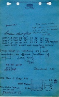
| Mine notes (Franklin County) - Mine type, shaft locations, seam, thickness, geologic problems.
|
| State archive map, msha_540_03 - Shaft locations, mine outline, mining method.
|
Mine Notes
Mine Images
Photographs


![[[:Old Ben No. 9|Old Ben No. 9]]](https://go.illinois.edu/ILMImages/williamson/thumbnails/m0448_MSHA_540_03_th.jpg)