3504: Difference between revisions
No edit summary |
No edit summary |
||
| (5 intermediate revisions by 3 users not shown) | |||
| Line 1: | Line 1: | ||
{{Sidebar Info Query}} | {{Sidebar Info Query}} | ||
{{Header | {{Header | ||
|checked=Checked OK | |||
|unlocated=No | |unlocated=No | ||
|shown_on_map=Yes | |shown_on_map=Yes | ||
| Line 8: | Line 9: | ||
|mine_type=Underground | |mine_type=Underground | ||
|mined-out-area=350 | |mined-out-area=350 | ||
|indicated=No | |||
|county1=St. Clair | |county1=St. Clair | ||
|quad1=French Village | |quad1=French Village | ||
| Line 15: | Line 17: | ||
|Latitude=38.550012467 | |Latitude=38.550012467 | ||
|Longitude=-90.003838516 | |Longitude=-90.003838516 | ||
|Zoom=13 | |||
}} | }} | ||
==Shaft, Slope, Drift or Tipple Location(s)== | ==Shaft, Slope, Drift or Tipple Location(s)== | ||
| Line 52: | Line 55: | ||
|Date=1900-1902 | |Date=1900-1902 | ||
|Production=129,107 | |Production=129,107 | ||
|Sum=No | |||
}} | }} | ||
{{Production | {{Production | ||
| Line 58: | Line 62: | ||
|Date=1902-1915 {{#info: Idle 1913 to 1915|note}} | |Date=1902-1915 {{#info: Idle 1913 to 1915|note}} | ||
|Production=1,403,513 | |Production=1,403,513 | ||
|Sum=No | |||
}} | }} | ||
{{Production | {{Production | ||
| Line 64: | Line 69: | ||
|Date=1915-1923 | |Date=1915-1923 | ||
|Production=735,657 | |Production=735,657 | ||
|Sum=No | |||
}} | }} | ||
{{Production | {{Production | ||
| Line 70: | Line 76: | ||
|Date=1935-1939 {{#info: Idle 1923 to 1935|note}} | |Date=1935-1939 {{#info: Idle 1923 to 1935|note}} | ||
|Production=90,151 | |Production=90,151 | ||
|Sum=No | |||
}} | }} | ||
{{Production | {{Production | ||
| Line 76: | Line 83: | ||
|Date=1939-1943 | |Date=1939-1943 | ||
|Production=64,315 | |Production=64,315 | ||
|Sum=No | |||
| | |||
}} | }} | ||
{{Production | {{Production | ||
|Production=2,422,743 | |Production=2,422,743 | ||
|Sum=Yes | |||
}} | }} | ||
===Production Notes=== | ===Production Notes=== | ||
Latest revision as of 16:18, March 28, 2023
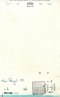
Mine Index Number: 3504
| Company Name: | New Royal Coal Company | ||
|---|---|---|---|
| Mine Name: | New Royal Mine | ||
| Start Date: | 1900 | End Date: | 1943 |
| Type of Mine: | Underground | ||
| Total acres shown: | 350 | ||
| Acres after map date: | General Area of mining acres shown: | ||
Shaft, Slope, Drift or Tipple Location(s)
| Type | County | Township-Range | Section | Part Section |
|---|
| Main shaft | St. Clair | 1N 8W | 8 | SE SE NE |
| Air shaft | St. Clair | 1N 8W | 8 | SE SE NE |
Geology
| Thickness (ft) | |||||
|---|---|---|---|---|---|
| Seam | Depth (ft) | Min | Max | Ave | Mining Method |
| Herrin | 198 | 7.0 | MRP |
Geological Problems Reported
Production
| Company | Mine Name | Date | Production (tons) |
| Beck-Walker Coal Company | Royal | 1900-1902 | 129,107 |
| Royal Coal Company | Royal | 1902-1915 Idle 1913 to 1915 | 1,403,513 |
| Columbia Collieries Company | Royal | 1915-1923 | 735,657 |
| G and E Coal Company | G and E | 1935-1939 Idle 1923 to 1935 | 90,151 |
| New Royal Coal Company | New Royal | 1939-1943 | 64,315 |
| Total Production: 2,422,743 | |||
Production Notes
Coal Report production (if available)
Sources of Data
| Source Map | Map Date | Original Scale | Digitized Scale | Map Type |
| Company, 4103.S31 i5.1-13 | 8-27-1943 | 1:2400 | 1:2400 | Final |
Annotated Bibliography (Data source - brief description of information)
| Coal Reports - Production, ownership, years of operation. |
| Directory of Illinois Coal Mines (St. Clair County) - Mine names, mine index, ownership, years of operation. |
| Mine notes (St. Clair County) - Mine type, seam, depth, thickness. |
| Company map, ISGS map library, 4103.S31 i5.1-13 - Shaft locations, mine outline, mining method. |
Mine Notes

Mine Images
![[[:New Royal|New Royal]]](https://wikiimage.isgs.illinois.edu/ilmines/st_clair/thumbnails/m3504_lib_geo_th.jpg)
Photographs