3550: Difference between revisions
No edit summary |
No edit summary |
||
| (3 intermediate revisions by one other user not shown) | |||
| Line 6: | Line 6: | ||
|Mine-index=3550 | |Mine-index=3550 | ||
|Coal_co=New Bell Heat Coal Company | |Coal_co=New Bell Heat Coal Company | ||
|Mine Name Header=New Bell Heat Mine | |Mine Name Header=New Bell Heat Mine | ||
|mine_type=Underground | |mine_type=Underground | ||
|mined-out-area=320 | |mined-out-area=320 | ||
| Line 18: | Line 18: | ||
|Latitude=38.548298146 | |Latitude=38.548298146 | ||
|Longitude=-90.036878703 | |Longitude=-90.036878703 | ||
|Zoom=13 | |||
}} | }} | ||
==Shaft, Slope, Drift or Tipple Location(s)== | ==Shaft, Slope, Drift or Tipple Location(s)== | ||
| Line 176: | Line 177: | ||
}} | }} | ||
{{Annotated bibliography | {{Annotated bibliography | ||
|bibliography=Microfilm map, document 350981, reel 03134, frames 45,46 - Shaft locations, mine outline (north), method. | |bibliography=Microfilm map, document 350981, reel 03134, frames 45,46 - Shaft locations, mine outline (north), mining method. | ||
}} | }} | ||
{{Annotated bibliography | {{Annotated bibliography | ||
|bibliography=Microfilm map, document 350979, reel 03134, frame 42 - Mine outline (east, extent of old works), method. | |bibliography=Microfilm map, document 350979, reel 03134, frame 42 - Mine outline (east, extent of old works), mining method. | ||
}} | }} | ||
{{Annotated bibliography | {{Annotated bibliography | ||
|bibliography=Microfilm map, document 350971, reel 03134, frames 30,31 - Mine ownership, mine outline (south), method. | |bibliography=Microfilm map, document 350971, reel 03134, frames 30,31 - Mine ownership, mine outline (south), mining method. | ||
}} | }} | ||
{{Annotated bibliography | {{Annotated bibliography | ||
Latest revision as of 12:13, April 11, 2023
Mine Index Number: 3550
| Company Name: | New Bell Heat Coal Company | ||
|---|---|---|---|
| Mine Name: | New Bell Heat Mine | ||
| Start Date: | Pre 1882 | End Date: | 1943 |
| Type of Mine: | Underground | ||
| Total acres shown: | 320 | ||
| Acres after map date: | 5 | General Area of mining acres shown: | |
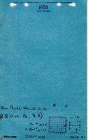
Shaft, Slope, Drift or Tipple Location(s)
| Type | County | Township-Range | Section | Part Section |
|---|
| Main shaft | St. Clair | 1N 9W | 12 | NE NE SE |
| Air shaft | St. Clair | 1N 9W | 12 | NE NE SE |
Geology
| Thickness (ft) | |||||
|---|---|---|---|---|---|
| Seam | Depth (ft) | Min | Max | Ave | Mining Method |
| Herrin | 173 | 6.3-7.0 | MRP,RPBsome RPB |
Geological Problems Reported
A source map designated some rooms in NW NW 13-T1N-R9W and NW NE NW 13-T1N-R9W as "caved".
Production
| Company | Mine Name | Date | Production (tons) |
| Sebastian Weisenborn | Harmony, Twelve Apostles | pre1882-1884 | 64,507 Production and ownership prior to 1882 unknown. The Coal Report of 1882 indicates 30 acres mined. |
| Harris Brothers | Harmony | 1884-1892 No production reported July 1885 to June 1886; idle | 110,361 |
| Crown Coal and Tow Company | Crown No. 1 | 1892-1897 Idle May 27, 1896 to June 1897; top works destroyed by tornado and not rebuilt. | 120,859 |
| Lenz Coal and Mining Company | Harmony | 1899-1905 Fire underground; mine idled for most of the period from July 1903 to June 1905, and July 1906 to June 1907. | 253,361 |
| Southern Coal and Mining Company | Southern No. 2 | 1905-1907 Fire underground; mine idled for most of the period from July 1903 to June 1905, and July 1906 to June 1907. | 22,549 |
| Harmony Coal Company | Harmony | 1907-1910 | 42,827 |
| Maule Coal and Mining Company | Harmony | 1911-1913 | 48,767 |
| Idle | 1914-1918 | ||
| B. B. Coal Company Microfilm source map, document 350971, indicates Victoria Coal Company owned this company in 1927. | B. B. | 1918-1928 | 653,374 |
| Bell Heat Coal Company The Daily Advocate reported August 13, 1929 this mine was solid to Sam Winter for $7,000. | Bell Heat | 1929-1939 | 287,241 |
| New Bell Heat Coal Company | New Bell Heat | 1939-1941 | 27,326 |
| New Bell Heat Coal Company | New Bell Heat | 1941-1943 | 30,832 Production since map date |
| Total Production: 1,662,004 | |||
Production Notes
Coal Report production (if available)
Sources of Data
| Source Map | Map Date | Original Scale | Digitized Scale | Map Type |
| Microfilm, document 350981 | 3-1941 | 1:1200 | 1:2152 | Not final |
| Microfilm, document 350979 | 4-11-1894 | 1:1200 | 1:1821 | Not final |
| Microfilm, document 350971 | 3-30-1935 | 1:1200 | 1:2152 | Not final |
Annotated Bibliography (Data source - brief description of information)
| Coal Reports - Production, ownership, years of operation. |
| Directory of Illinois Coal Mines (St. Clair County) - Mine names, mine index, ownership, years of operation. |
| Microfilm map, document 350981, reel 03134, frames 45,46 - Shaft locations, mine outline (north), mining method. |
| Microfilm map, document 350979, reel 03134, frame 42 - Mine outline (east, extent of old works), mining method. |
| Microfilm map, document 350971, reel 03134, frames 30,31 - Mine ownership, mine outline (south), mining method. |
| Mine notes (St. Clair County) - Thickness, depth, seam, mine type, shaft location. |
Mine Notes
Mine Images


Photographs