4076: Difference between revisions
Alan.Myers (talk | contribs) No edit summary |
Alan.Myers (talk | contribs) No edit summary |
||
| (One intermediate revision by one other user not shown) | |||
| Line 9: | Line 9: | ||
|Mine Name Header=Pea Ridge Mine | |Mine Name Header=Pea Ridge Mine | ||
|mine_type=Underground | |mine_type=Underground | ||
|mined-out-area=8 | |mined-out-area=8 Production indicates approximately 2 acres were mined. | ||
|after_map=Less than 1 | |after_map=Less than 1 | ||
|indicated=No | |||
|county1=Williamson | |county1=Williamson | ||
|quad1=Crab Orchard | |quad1=Crab Orchard | ||
|year-start=1935 | |year-start=1935 | ||
|year-end=1943 | |year-end=1943 | ||
|Latitude= | |Latitude=37.70423531 | ||
|Longitude= | |Longitude=-88.81852224 | ||
|Zoom=15 | |Zoom=15 | ||
}} | }} | ||
Latest revision as of 13:27, June 8, 2023
Mine Index Number: 4076
| Company Name: | Pea Ridge Coal Company | ||
|---|---|---|---|
| Mine Name: | Pea Ridge Mine | ||
| Start Date: | 1935 | End Date: | 1943 |
| Type of Mine: | Underground | ||
| Total acres shown: | 8 Production indicates approximately 2 acres were mined. | ||
| Acres after map date: | Less than 1 | General Area of mining acres shown: | |
|
Not Shown On Map. This mine is not shown on the accompanying map due to later surface mining. | |||
Shaft, Slope, Drift or Tipple Location(s)
| Type | County | Township-Range | Section | Part Section |
|---|
| Main slope | Williamson | 9S 3E | 25 | NE SE SE |
Geology
| Thickness (ft) | |||||
|---|---|---|---|---|---|
| Seam | Depth (ft) | Min | Max | Ave | Mining Method |
| Springfield | 60 | 4.5 | MRP |
Geological Problems Reported
Production
| Company | Mine Name | Date | Production (tons) |
| Rushing and Heiple | Rushing and Heiple | 1935-1935 | 300 |
| Rushing Coal Company | Rushing | 1936-1939 | 6,355 |
| Lester Cox Coal Company | Cox | 1940-1940 | 600 |
| Lester Cox Coal Company | Cox | 1940-1942 Idle 1942 | 1,700 Production after map date |
| Pea Ridge Coal Company | Pea Ridge | 1943-1943 | 700 Production after map date |
| Total Production: 9,655 | |||
Production Notes
Coal Report production (if available)
Sources of Data
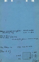
| Source Map | Map Date | Original Scale | Digitized Scale | Map Type |
| Company, 4103.W52 i5.1-30 | 9-29-1940 | 1:1200 | 1:1200 | Not final |
Annotated Bibliography (Data source - brief description of information)
| Coal Reports - Production, ownership, years of operation. |
| Directory of Illinois Coal Mines (Williamson County) - Mine names, mine index, ownership, years of operation. |
| Mine notes (Williamson County) - Mine type, slope location, seam, depth, thickness. |
| Company map, ISGS map library, 4103.W52 i5.1-30 - Slope location, mine outline, mining method. |
Mine Notes
Mine Images
![[[:Rushing|Rushing]]](https://wikiimage.isgs.illinois.edu/ilmines/williamson/thumbnails/m4076_th.jpg)
Photographs