4066: Difference between revisions
No edit summary |
No edit summary |
||
| (One intermediate revision by one other user not shown) | |||
| Line 8: | Line 8: | ||
|Mine Name Header=New Black Diamond No. 5 Mine | |Mine Name Header=New Black Diamond No. 5 Mine | ||
|mine_type=Underground | |mine_type=Underground | ||
|mined-out-area= | |mined-out-area=67 | ||
|indicated=No | |||
|county1=Williamson | |county1=Williamson | ||
|quad1=Crab Orchard | |quad1=Crab Orchard | ||
|year-start=1939 | |year-start=1939 | ||
|year-end=1949 | |year-end=1949 | ||
|Latitude= | |Latitude=37.73142835 | ||
|Longitude= | |Longitude=-88.82115445 | ||
|Zoom=15 | |Zoom=15 | ||
}} | }} | ||
| Line 60: | Line 61: | ||
|Date=1939-1949 | |Date=1939-1949 | ||
|Production=315,634 | |Production=315,634 | ||
|Sum=Yes | |||
| | |||
}} | }} | ||
===Production Notes=== | ===Production Notes=== | ||
| Line 74: | Line 70: | ||
{{Source map header}} | {{Source map header}} | ||
{{Source Map | {{Source Map | ||
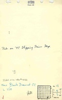
|Source Map= | |Source Map=State archive, IL_1536_01 | ||
|Map Date=9-5-1949 | |Map Date=9-5-1949 | ||
|Original Scale=1:1200 | |Original Scale=1:1200 | ||
|Digitized Scale=1: | |Digitized Scale=1:1200 | ||
|Map Type=Final | |Map Type=Final | ||
}} | }} | ||
| Line 91: | Line 87: | ||
}} | }} | ||
{{Annotated bibliography | {{Annotated bibliography | ||
|bibliography= | |bibliography=State archive map, IL_1536_01 - Slope and shaft locations, mine outline, mining method, seam. | ||
}} | }} | ||
==Mine Notes== | ==Mine Notes== | ||
Latest revision as of 15:16, June 23, 2023
Mine Index Number: 4066
| Company Name: | New Black Diamond Coal Company | ||
|---|---|---|---|
| Mine Name: | New Black Diamond No. 5 Mine | ||
| Start Date: | 1939 | End Date: | 1949 |
| Type of Mine: | Underground | ||
| Total acres shown: | 67 | ||
| Acres after map date: | General Area of mining acres shown: | ||
Shaft, Slope, Drift or Tipple Location(s)
| Type | County | Township-Range | Section | Part Section |
|---|
| Main slope | Williamson | 9S 3E | 13 | SW SE SE |
| Slope | Williamson | 9S 3E | 24 | NE NE NE Connected underground with B. & J. Mine (mine index 4071) |
| Air shaft | Williamson | 9S 3E | 13 | SW SE SE |
Geology
| Thickness (ft) | |||||
|---|---|---|---|---|---|
| Seam | Depth (ft) | Min | Max | Ave | Mining Method |
| Springfield | 100-110 | 4.17 | MRP |
Geological Problems Reported
Production
| Company | Mine Name | Date | Production (tons) |
| New Black Diamond Coal Company | New Black Diamond No. 5 | 1939-1949 | 315,634 |
| Total Production: 315,634 | |||
Production Notes
Coal Report production (if available)
Sources of Data
| Source Map | Map Date | Original Scale | Digitized Scale | Map Type |
| State archive, IL_1536_01 | 9-5-1949 | 1:1200 | 1:1200 | Final |
Annotated Bibliography (Data source - brief description of information)
| Coal Reports - Production, ownership, years of operation, depth, thickness |
| Directory of Illinois Coal Mines (Williamson County) - Mine names, mine index, ownership, years of operation. |
| Mine notes (Williamson County) - Mine type, slope location, seam, depth, thickness. |
| State archive map, IL_1536_01 - Slope and shaft locations, mine outline, mining method, seam. |
Mine Notes
Mine Images
![[[:New Black Diamond No. 5|New Black Diamond No. 5]]](https://wikiimage.isgs.illinois.edu/ilmines/williamson/thumbnails/m4066_IL_1536_01_th.jpg)
Photographs