4122: Difference between revisions
(Created page with "{{Sidebar Info Query}} {{Header |checked=1st Entry |unlocated=No |shown_on_map=Yes |Mine-index=4122 |Coal_co=Ozmun Coal Company |Mine Name Header=Ozmun Mine |mine_type=Undergr...") |
No edit summary |
||
| (2 intermediate revisions by 2 users not shown) | |||
| Line 1: | Line 1: | ||
{{Sidebar Info Query}} | {{Sidebar Info Query}} | ||
{{Header | {{Header | ||
|checked= | |checked=Checked OK | ||
|unlocated=No | |unlocated=No | ||
|shown_on_map=Yes | |shown_on_map=Yes | ||
| Line 8: | Line 8: | ||
|Mine Name Header=Ozmun Mine | |Mine Name Header=Ozmun Mine | ||
|mine_type=Underground | |mine_type=Underground | ||
|mined-out-area= | |mined-out-area=40 | ||
|indicated=No | |||
|county1=Williamson | |county1=Williamson | ||
|quad1=Crab Orchard | |quad1=Crab Orchard | ||
|year-start=1937 | |year-start=1937 | ||
|year-end=1948 | |year-end=1948 | ||
|Latitude= | |Latitude=37.70413888 | ||
|Longitude= | |Longitude=-88.80135245 | ||
|Zoom=15 | |Zoom=15 | ||
}} | }} | ||
| Line 53: | Line 54: | ||
|Date=1937-1938 | |Date=1937-1938 | ||
|Production=8,635 | |Production=8,635 | ||
|Sum=No | |||
}} | }} | ||
{{Production | {{Production | ||
| Line 59: | Line 61: | ||
|Date=1938-1940 | |Date=1938-1940 | ||
|Production=74,045 | |Production=74,045 | ||
|Sum=No | |||
}} | }} | ||
{{Production | {{Production | ||
| Line 65: | Line 68: | ||
|Date=1941-1942 | |Date=1941-1942 | ||
|Production=23,857 | |Production=23,857 | ||
|Sum=No | |||
}} | }} | ||
{{Production | {{Production | ||
| Line 72: | Line 76: | ||
|Date=1942-1945 {{#info: Idle 1944|note}} | |Date=1942-1945 {{#info: Idle 1944|note}} | ||
|Production=21,332 | |Production=21,332 | ||
|Sum=No | |||
}} | }} | ||
{{Production | {{Production | ||
| Line 78: | Line 83: | ||
|Date=1946-1946 | |Date=1946-1946 | ||
|Production=3,540 | |Production=3,540 | ||
|Sum=No | |||
}} | }} | ||
{{Production | {{Production | ||
| Line 84: | Line 90: | ||
|Date=1947-1948 | |Date=1947-1948 | ||
|Production=55,846 | |Production=55,846 | ||
|Sum=No | |||
| | |||
}} | }} | ||
{{Production | {{Production | ||
|Production=187,255 | |Production=187,255 | ||
|Sum=Yes | |||
}} | }} | ||
===Production Notes=== | ===Production Notes=== | ||
| Line 98: | Line 103: | ||
{{Source map header}} | {{Source map header}} | ||
{{Source Map | {{Source Map | ||
|Source Map= | |Source Map=State archive, IL_1528_01 | ||
|Map Date= | |Map Date=9-30-1948 | ||
|Original Scale=1:1200 | |Original Scale=1:1200 | ||
|Digitized | |Digitized Scale=1:1200 | ||
|Map Type=Final | |||
|Map Type= | |||
}} | }} | ||
{{Annotated bibliography header}} | {{Annotated bibliography header}} | ||
| Line 122: | Line 120: | ||
}} | }} | ||
{{Annotated bibliography | {{Annotated bibliography | ||
|bibliography= | |bibliography=State archive map, IL_1528_01 - Slope and shaft locations, mine outline, mining method. | ||
}} | }} | ||
==Mine Notes== | ==Mine Notes== | ||
Latest revision as of 16:26, June 26, 2023
Mine Index Number: 4122
| Company Name: | Ozmun Coal Company | ||
|---|---|---|---|
| Mine Name: | Ozmun Mine | ||
| Start Date: | 1937 | End Date: | 1948 |
| Type of Mine: | Underground | ||
| Total acres shown: | 40 | ||
| Acres after map date: | General Area of mining acres shown: | ||
Shaft, Slope, Drift or Tipple Location(s)
| Type | County | Township-Range | Section | Part Section |
|---|
| Main slope | Williamson | 9S 4E | 30 | SE SE SE |
| Air shaft | Williamson | 9S 4E | 30 | SE SE SE |
Geology
| Thickness (ft) | |||||
|---|---|---|---|---|---|
| Seam | Depth (ft) | Min | Max | Ave | Mining Method |
| Springfield | 75-150 | 4.06-4.5 | MRP |
Geological Problems Reported
Production
| Company | Mine Name | Date | Production (tons) |
| Sims and Harris Coal Company | Sims and Harris | 1937-1938 | 8,635 |
| Steel Tipple Coal Company | Steel Tipple | 1938-1940 | 74,045 |
| Angel and Harris | Angel and Harris | 1941-1942 | 23,857 |
| Steel Tipple Coal Company Changed ownership in 1943, but reported under the same name. | Steel Tipple | 1942-1945 Idle 1944 | 21,332 |
| Cosmic Coal Company | Cosmic No. 1 | 1946-1946 | 3,540 |
| Ozmun Coal Company | Ozmun | 1947-1948 | 55,846 |
| Total Production: 187,255 | |||
Production Notes
Coal Report production (if available)
Sources of Data
| Source Map | Map Date | Original Scale | Digitized Scale | Map Type |
| State archive, IL_1528_01 | 9-30-1948 | 1:1200 | 1:1200 | Final |
Annotated Bibliography (Data source - brief description of information)
| Coal Reports - Production, ownership, years of operation. |
| Directory of Illinois Coal Mines (Williamson County) - Mine names, mine index, ownership, years of operation. |
| Mine notes (Williamson County) - Mine type, slope location, seam, depth, thickness. |
| State archive map, IL_1528_01 - Slope and shaft locations, mine outline, mining method. |
Mine Notes
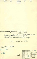
Mine Images
![[[:Ozmun|Ozmun]]](https://go.illinois.edu/ILMImages/williamson/thumbnails/m4122_IL_1528_01_th.jpg)
Photographs