4124: Difference between revisions
Alan.Myers (talk | contribs) No edit summary |
No edit summary |
||
| Line 8: | Line 8: | ||
|Mine Name Header=New Walnut Valley Mine | |Mine Name Header=New Walnut Valley Mine | ||
|mine_type=Underground | |mine_type=Underground | ||
|mined-out-area= | |mined-out-area=29 | ||
|after_map=3 | |after_map=3 | ||
|indicated=No | |||
|county1=Williamson | |county1=Williamson | ||
|quad1=Crab Orchard | |quad1=Crab Orchard | ||
| Line 95: | Line 96: | ||
{{Source map header}} | {{Source map header}} | ||
{{Source Map | {{Source Map | ||
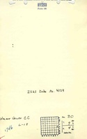
|Source Map= | |Source Map=State archive, IL_1601_01 | ||
|Map Date= | |Map Date=6-9-1951 | ||
|Original Scale=1:1200 | |Original Scale=1:1200 | ||
|Digitized | |Digitized Scale=1:1200 | ||
|Map Type=Final | |||
|Map Type= | |||
}} | }} | ||
{{Annotated bibliography header}} | {{Annotated bibliography header}} | ||
| Line 119: | Line 113: | ||
}} | }} | ||
{{Annotated bibliography | {{Annotated bibliography | ||
|bibliography= | |bibliography=State archive map, IL_1601_01 - Slope and shaft locations, mine outline, mining method. | ||
}} | }} | ||
==Mine Notes== | ==Mine Notes== | ||
Latest revision as of 16:37, June 26, 2023
Mine Index Number: 4124
| Company Name: | New Walnut Valley Coal Company | ||
|---|---|---|---|
| Mine Name: | New Walnut Valley Mine | ||
| Start Date: | 1935 | End Date: | 1951 |
| Type of Mine: | Underground | ||
| Total acres shown: | 29 | ||
| Acres after map date: | 3 | General Area of mining acres shown: | |
Shaft, Slope, Drift or Tipple Location(s)
| Type | County | Township-Range | Section | Part Section |
|---|
| Main slope | Williamson | 9S 4E | 30 | SE NE SE |
| Air shaft | Williamson | 9S 4E | 30 | NE SE SE |
Geology
| Thickness (ft) | |||||
|---|---|---|---|---|---|
| Seam | Depth (ft) | Min | Max | Ave | Mining Method |
| Springfield | 65-70 | 4.5 | MRP |
Geological Problems Reported
Production
| Company | Mine Name | Date | Production (tons) |
| Walnut Valley Coal Company | Walnut Valley | 1935-1941 | 32,754 |
| Valley Coal Company | Valley | 1942-1942 | 6,218 |
| Walnut Valley Coal Company | Walnut Valley | 1943-1947 | 20,598 |
| Walnut Valley Coal Company | Walnut Valley | 1947-1949 | 9,040 Production after map date. |
| New Walnut Valley Coal Company | New Walnut Valley | 1950-1951 | 2,941 Production after map date. |
| Total Production: 71,571 | |||
Production Notes
Coal Report production (if available)
Sources of Data
| Source Map | Map Date | Original Scale | Digitized Scale | Map Type |
| State archive, IL_1601_01 | 6-9-1951 | 1:1200 | 1:1200 | Final |
Annotated Bibliography (Data source - brief description of information)
| Coal Reports - Production, ownership, years of operation, depth, mining method. |
| Directory of Illinois Coal Mines (Williamson County) - Mine names, mine index, ownership, years of operation. |
| Mine notes (Williamson County) - Mine type, slope location, seam, depth, thickness. |
| State archive map, IL_1601_01 - Slope and shaft locations, mine outline, mining method. |
Mine Notes
Mine Images
![[[:New Walnut Valley|New Walnut Valley]]](https://go.illinois.edu/ILMImages/williamson/thumbnails/m4124_IL_1601_01_th.jpg)
Photographs