4140: Difference between revisions
Alan.Myers (talk | contribs) No edit summary |
No edit summary |
||
| (5 intermediate revisions by 2 users not shown) | |||
| Line 1: | Line 1: | ||
{{Sidebar Info Query}} | {{Sidebar Info Query}} | ||
{{Header | {{Header | ||
|checked= | |checked=Checked OK | ||
|unlocated=No | |unlocated=No | ||
|shown_on_map=Yes | |shown_on_map=Yes | ||
|reason_nsm=The area was later partially surface-mined by various operators. | |||
|Mine-index=4140 | |Mine-index=4140 | ||
|Coal_co=L. R. Gabriel | |Coal_co=L. R. Gabriel | ||
|Mine Name Header=Gabriel Mine | |Mine Name Header=Gabriel Mine | ||
|mine_type=Underground | |mine_type=Underground | ||
|mined-out-area=11 | |mined-out-area=11 | ||
|after_map= | |after_map=Less than 1 | ||
|indicated=No | |||
|county1=Williamson | |county1=Williamson | ||
|quad1=Crab Orchard | |quad1=Crab Orchard | ||
|year-start=1916 | |year-start=1916 | ||
|year-end=1943 | |year-end=1943 | ||
|Latitude= | |Latitude=37.70073509 | ||
|Longitude= | |Longitude=-88.78422698 | ||
|Zoom=15 | |Zoom=15 | ||
}} | }} | ||
| Line 54: | Line 56: | ||
|Date=1916-1917 | |Date=1916-1917 | ||
|Production=300 | |Production=300 | ||
|Sum=No | |||
}} | }} | ||
{{Production | {{Production | ||
| Line 60: | Line 63: | ||
|Date=1917-1920 | |Date=1917-1920 | ||
|Production=2,132 | |Production=2,132 | ||
|Sum=No | |||
}} | }} | ||
{{Production | {{Production | ||
|Company=Gabriel Brothers | |Company=Gabriel Brothers | ||
|Mine-Name=Gabriel | |Mine-Name=Gabriel | ||
|Date=1920-1922 | |Date=1920-1922 | ||
| | |Production=2,000 {{#info: Production not reported 1922 for mines producing less than 10,000 tons|note}} | ||
|Sum=No | |||
}} | }} | ||
{{Production | {{Production | ||
| Line 72: | Line 77: | ||
|Date=1922-1942 | |Date=1922-1942 | ||
|Production=14,782 | |Production=14,782 | ||
|Sum=No | |||
}} | }} | ||
{{Production | {{Production | ||
| Line 78: | Line 84: | ||
|Date=1942-1943 | |Date=1942-1943 | ||
|Production=902 {{#info: Production after map date|note}} | |Production=902 {{#info: Production after map date|note}} | ||
|Sum=No | |||
| | |||
}} | }} | ||
{{Production | {{Production | ||
|Production=20,116 | |Production=20,116 | ||
|Sum=Yes | |||
}} | }} | ||
===Production Notes=== | ===Production Notes=== | ||
| Line 92: | Line 97: | ||
{{Source map header}} | {{Source map header}} | ||
{{Source Map | {{Source Map | ||
|Source Map= | |Source Map=State archive, IL_1417_01 | ||
|Map Date=8-21-1942 | |Map Date=8-21-1942 | ||
|Original Scale=1:1200 | |Original Scale=1:1200 | ||
| Line 109: | Line 114: | ||
}} | }} | ||
{{Annotated bibliography | {{Annotated bibliography | ||
|bibliography= | |bibliography=State archive map, IL_1417_01 - Slope and shaft locations, mine outline, mining method. | ||
}} | }} | ||
==Mine Notes== | ==Mine Notes== | ||
Latest revision as of 14:00, June 27, 2023
Mine Index Number: 4140
| Company Name: | L. R. Gabriel | ||
|---|---|---|---|
| Mine Name: | Gabriel Mine | ||
| Start Date: | 1916 | End Date: | 1943 |
| Type of Mine: | Underground | ||
| Total acres shown: | 11 | ||
| Acres after map date: | Less than 1 | General Area of mining acres shown: | |
|
The area was later partially surface-mined by various operators. | |||
Shaft, Slope, Drift or Tipple Location(s)
| Type | County | Township-Range | Section | Part Section |
|---|
| Main slope | Williamson | 9S 4E | 32 | NW NE NE |
| Air shaft | Williamson | 9S 4E | 32 | SW NE NE Not shown on accompanying map due to later surface mining. |
Geology
| Thickness (ft) | |||||
|---|---|---|---|---|---|
| Seam | Depth (ft) | Min | Max | Ave | Mining Method |
| Springfield | 20 | 4.5 | MRP |
Geological Problems Reported
Production
| Company | Mine Name | Date | Production (tons) |
| C. M. Bridis | Bridis | 1916-1917 | 300 |
| Luther R. Gabriel | Gabriel | 1917-1920 | 2,132 |
| Gabriel Brothers | Gabriel | 1920-1922 | 2,000 Production not reported 1922 for mines producing less than 10,000 tons |
| L. R. Gabriel | Gabriel | 1922-1942 | 14,782 |
| L. R. Gabriel | Gabriel | 1942-1943 | 902 Production after map date |
| Total Production: 20,116 | |||
Production Notes
Coal Report production (if available)
Sources of Data
| Source Map | Map Date | Original Scale | Digitized Scale | Map Type |
| State archive, IL_1417_01 | 8-21-1942 | 1:1200 | 1:1200 | Not final |
Annotated Bibliography (Data source - brief description of information)
| Coal Reports - Production, ownership, years of operation. |
| Directory of Illinois Coal Mines (Williamson County) - Mine names, mine index, ownership, years of operation. |
| Mine notes (Williamson County) - Mine type, slope location, seam, depth, thickness. |
| State archive map, IL_1417_01 - Slope and shaft locations, mine outline, mining method. |
Mine Notes
Mine Images
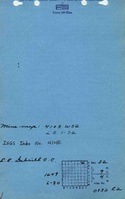
![[[:Gabriel|Gabriel]]](https://go.illinois.edu/ILMImages/williamson/thumbnails/m4140_il_1417_01_th.jpg)
Photographs