4092: Difference between revisions
(Created page with "{{Sidebar Info Query}} {{Header |checked=1st Entry |unlocated=No |shown_on_map=Yes |Mine-index=4092 |Coal_co=Egypt Coal Company |Mine Name Header=Egypt Mine |mine_type=Surface...") |
No edit summary |
||
| (4 intermediate revisions by 3 users not shown) | |||
| Line 1: | Line 1: | ||
{{Sidebar Info Query}} | {{Sidebar Info Query}} | ||
{{Header | {{Header | ||
|checked= | |checked=Checked OK | ||
|unlocated=No | |unlocated=No | ||
|shown_on_map=Yes | |shown_on_map=Yes | ||
|reason_nsm=Production indicates the Egypt Mine would have been about 4 acres. The area shown is too large for this single mine. It is likely that other small surface-mining operations enlarged the pit after 1939. | |||
|Mine-index=4092 | |Mine-index=4092 | ||
|Coal_co=Egypt Coal Company | |Coal_co=Egypt Coal Company | ||
|Mine Name Header=Egypt Mine | |Mine Name Header=Egypt Mine | ||
|mine_type=Surface | |mine_type=Surface | ||
|mined-out-area=4 | |mined-out-area=2, with an additional 22-acre general area of mining from the topographic map and aerial photos | ||
|after_map=4 | |||
|indicated=Yes | |||
|county1=Williamson | |county1=Williamson | ||
|quad1=Crab Orchard | |quad1=Crab Orchard | ||
|year-start=1938 | |year-start=1938 | ||
|year-end=1939 | |year-end=1939 | ||
|Latitude= | |Latitude=37.722594 | ||
|Longitude= | |Longitude=-88.813717 | ||
|Zoom=15 | |Zoom=15 | ||
}} | }} | ||
| Line 47: | Line 50: | ||
|Date=1938-1938 | |Date=1938-1938 | ||
|Production=7,922 | |Production=7,922 | ||
|Sum=No | |||
}} | }} | ||
{{Production | {{Production | ||
| Line 53: | Line 57: | ||
|Date=1938-1939 | |Date=1938-1939 | ||
|Production=26,778 {{#info: Production after map date|note}} | |Production=26,778 {{#info: Production after map date|note}} | ||
|Sum=No | |||
| | |||
}} | }} | ||
{{Production | {{Production | ||
|Production=34,700 | |Production=34,700 | ||
|Sum=Yes | |||
}} | }} | ||
===Production Notes=== | ===Production Notes=== | ||
| Line 78: | Line 81: | ||
|Original Scale=1:24000 | |Original Scale=1:24000 | ||
|Digitized Scale=1:24000 | |Digitized Scale=1:24000 | ||
|Map Type=Secondary source | |||
}} | |||
{{Source Map | |||
|Source Map=Department of Mines & Minerals | |||
|Map Date=Undated | |||
|Map Type=Secondary source | |Map Type=Secondary source | ||
}} | }} | ||
| Line 94: | Line 102: | ||
}} | }} | ||
{{Annotated bibliography | {{Annotated bibliography | ||
|bibliography=USGS topographic map, 1965, photorevised 1990 - Mine outline. | |bibliography=USGS topographic map, Crab Orchard Quadrangle, 1965, photorevised 1990 - Mine outline. | ||
}} | |||
{{Annotated bibliography | |||
|bibliography=Department of Mines & Minerals, 7a–02-13 and 7a-02-15, aerial photograph base with surface mines identified - Mine outline. | |||
}} | }} | ||
==Mine Notes== | ==Mine Notes== | ||
Latest revision as of 14:26, June 30, 2023
Mine Index Number: 4092
| Company Name: | Egypt Coal Company | ||
|---|---|---|---|
| Mine Name: | Egypt Mine | ||
| Start Date: | 1938 | End Date: | 1939 |
| Type of Mine: | Surface | ||
| Total acres shown: | 2, with an additional 22-acre general area of mining from the topographic map and aerial photos | ||
| Production Indicated Acres: | 4 | General Area of mining acres shown: | |
|
Production indicates the Egypt Mine would have been about 4 acres. The area shown is too large for this single mine. It is likely that other small surface-mining operations enlarged the pit after 1939. | |||
Shaft, Slope, Drift or Tipple Location(s)
| Type | County | Township-Range | Section | Part Section |
|---|
| Tipple | Williamson | 9S 4E | 19 | NW NW SW |
Geology
| Thickness (ft) | |||||
|---|---|---|---|---|---|
| Seam | Depth (ft) | Min | Max | Ave | Mining Method |
| Herrin | 20 | 5.33 | Surface |
Geological Problems Reported
Production
| Company | Mine Name | Date | Production (tons) |
| Egypt Coal Company The mine notes indicate R. P. Stubblefield is associated with this mine, possibly the owner. | Egypt | 1938-1938 | 7,922 |
| Egypt Coal Company | Egypt | 1938-1939 | 26,778 Production after map date |
| Total Production: 34,700 | |||
Production Notes
Coal Report production (if available)
Sources of Data
| Source Map | Map Date | Original Scale | Digitized Scale | Map Type |
| Microfilm, document 353135 | 8-1938 | 1:2400 | 1:2400 | Not final |
| USGS topographic map | 1965, PR 1990 | 1:24000 | 1:24000 | Secondary source |
| Department of Mines & Minerals | Undated | Secondary source |
Annotated Bibliography (Data source - brief description of information)
| Coal Reports - Production, ownership, years of operation. |
| Directory of Illinois Coal Mines (Williamson County) - Mine names, mine index, ownership, years of operation. |
| Mine notes (Williamson County) - Mine type, mine location, seam, depth, thickness. |
| Microfilm map, document 353135, reel 03142, frame 9 - Mine location, mine outline, mining method. |
| USGS topographic map, Crab Orchard Quadrangle, 1965, photorevised 1990 - Mine outline. |
| Department of Mines & Minerals, 7a–02-13 and 7a-02-15, aerial photograph base with surface mines identified - Mine outline. |
Mine Notes
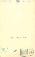
Mine Images
![[[:Egypt|Egypt]]](https://go.illinois.edu/ILMImages/williamson/thumbnails/m4092_th.jpg)


Photographs