3314: Difference between revisions
No edit summary |
No edit summary |
||
| (One intermediate revision by one other user not shown) | |||
| Line 10: | Line 10: | ||
|mined-out-area=None | |mined-out-area=None | ||
|after_map=15 | |after_map=15 | ||
|indicated=Yes | |||
|county1=Saline | |county1=Saline | ||
|quad1=Carrier Mills | |quad1=Carrier Mills | ||
|city1=Harrisburg | |||
|year-start=1963 | |year-start=1963 | ||
|year-end=June 1964 | |year-end=June 1964 | ||
|Latitude= | |Latitude=37.68365681 | ||
|Longitude= | |Longitude=-88.69028739 | ||
|Zoom=15 | |Zoom=15 | ||
}} | }} | ||
| Line 47: | Line 49: | ||
|Date=1963-1963 | |Date=1963-1963 | ||
|Production=10,803 | |Production=10,803 | ||
|Sum=No | |||
}} | }} | ||
{{Production | {{Production | ||
| Line 53: | Line 56: | ||
|Date=1964-1964 | |Date=1964-1964 | ||
|Production=100,200 | |Production=100,200 | ||
|Sum=No | |||
| | |||
}} | }} | ||
{{Production | {{Production | ||
|Production=111,003 | |Production=111,003 | ||
|Sum=Yes | |||
}} | }} | ||
===Production Notes=== | ===Production Notes=== | ||
Latest revision as of 15:24, March 12, 2024
Mine Index Number: 3314
| Company Name: | New Gallatin Coal Company | ||
|---|---|---|---|
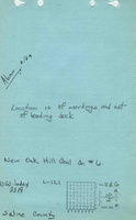
| Mine Name: | New Oak Hill No. 6 Mine | ||
| Start Date: | 1963 | End Date: | June 1964 |
| Type of Mine: | Surface | ||
| Total acres shown: | None | ||
| Production Indicated Acres: | 15 | General Area of mining acres shown: | |
Shaft, Slope, Drift or Tipple Location(s)
| Type | County | Township-Range | Section | Part Section |
|---|
| Pit | Saline | 10S 5E | 31 | NE |
Geology
| Thickness (ft) | |||||
|---|---|---|---|---|---|
| Seam | Depth (ft) | Min | Max | Ave | Mining Method |
| Springfield | 45 | 4.67 | Surface |
Geological Problems Reported
Production
| Company | Mine Name | Date | Production (tons) |
| New Oak Hill Coal Company | New Oak Hill No. 6 | 1963-1963 | 10,803 |
| New Gallatin Coal Company | New Oak Hill No. 6 | 1964-1964 | 100,200 |
| Total Production: 111,003 | |||
Production Notes
Coal Report production (if available)
Sources of Data
| Source Map | Map Date | Original Scale | Digitized Scale | Map Type |
| Personal communicationA copy of the relevant portion of an aerial photograph showing surface mine updates was sent, along with the information that New Oak Hill No. 6 Mine extended the southern boundary of the Blue Bird No. 1 Mine (mine index 610). As no map for Blue Bird No. 1 Mine exists, and the outline shown on the accompanying map is from topographic maps and aerial photographs, it is not possible to discern which portions were mined by New Oak Hill No. 6 Mine or Blue Bird No. 1 Mine. | 11-20-2016 | 1:48000 | 1:24000A copy of the relevant portion of an aerial photograph showing surface mine updates was sent, along with the information that New Oak Hill No. 6 Mine extended the southern boundary of the Blue Bird No. 1 Mine (mine index 610). As no map for Blue Bird No. 1 Mine exists, and the outline shown on the accompanying map is from topographic maps and aerial photographs, it is not possible to discern which portions were mined by New Oak Hill No. 6 Mine or Blue Bird No. 1 Mine. | Secondary source |
Annotated Bibliography (Data source - brief description of information)
| Coal Reports - Production, ownership, years of operation, depth, thickness. |
| Directory of Illinois Coal Mines (Saline County) - Mine names, mine index, ownership, years of operation. |
| Mine notes (Saline County) - Mine type, seam. |
| Personal communication via email from Joe Pelc of IDNR - Mine location. |
Mine Notes
Mine Images

Photographs