3316: Difference between revisions
Kate.O'Brien (talk | contribs) No edit summary |
No edit summary |
||
| (2 intermediate revisions by 2 users not shown) | |||
| Line 1: | Line 1: | ||
{{Sidebar Info Query}} | {{Sidebar Info Query}} | ||
{{Header | {{Header | ||
|checked= | |checked=Checked OK | ||
|unlocated=No | |unlocated=No | ||
|shown_on_map=Yes | |shown_on_map=Yes | ||
| Line 9: | Line 9: | ||
|mine_type=Underground | |mine_type=Underground | ||
|mined-out-area=8 | |mined-out-area=8 | ||
|indicated=No | |||
|county1=Saline | |county1=Saline | ||
|quad1=Carrier Mills | |quad1=Carrier Mills | ||
|city1=Carrier Mills | |||
|year-start=1938 | |year-start=1938 | ||
|year-end=1949 | |year-end=1949 | ||
|Latitude= | |Latitude=37.69278122 | ||
|Longitude= | |Longitude=-88.6532276 | ||
|Zoom=15 | |Zoom=15 | ||
}} | }} | ||
| Line 37: | Line 39: | ||
{{Geology seam header}} | {{Geology seam header}} | ||
{{Geology seam | |||
|Seam=Springfield | |||
|depth=50 | |||
|thick-ave=4.67 | |||
|mining-method=MRP | |||
}} | |||
===Geological Problems Reported=== | ===Geological Problems Reported=== | ||
Water entering the mine forced its abandonment. This mine was connected underground with Wasson A Mine (mine index | Water entering the mine forced its abandonment. This mine was connected underground with Wasson A Mine (mine index [[0130]]). | ||
==Production== | ==Production== | ||
| Line 48: | Line 56: | ||
|Date=1938-1939 | |Date=1938-1939 | ||
|Production=1,713 | |Production=1,713 | ||
|Sum=No | |||
}} | }} | ||
{{Production | {{Production | ||
| Line 54: | Line 63: | ||
|Date=1940-1940 | |Date=1940-1940 | ||
|Production=4,700 | |Production=4,700 | ||
|Sum=No | |||
}} | }} | ||
{{Production | {{Production | ||
| Line 60: | Line 70: | ||
|Date=1941-1941 | |Date=1941-1941 | ||
|Production=4,500 | |Production=4,500 | ||
|Sum=No | |||
}} | }} | ||
{{Production | {{Production | ||
| Line 67: | Line 78: | ||
|Date=1942-1942 | |Date=1942-1942 | ||
|Production=3,379 | |Production=3,379 | ||
|Sum=No | |||
}} | }} | ||
{{Production | {{Production | ||
| Line 73: | Line 85: | ||
|Date=1943-1946{{#info:Idle 1946|note}} | |Date=1943-1946{{#info:Idle 1946|note}} | ||
|Production=3,947 | |Production=3,947 | ||
|Sum=No | |||
}} | }} | ||
{{Production | {{Production | ||
| Line 80: | Line 93: | ||
|Date=1947-1948 | |Date=1947-1948 | ||
|Production=20,629 | |Production=20,629 | ||
|Sum=No | |||
}} | }} | ||
{{Production | {{Production | ||
| Line 86: | Line 100: | ||
|Date=1949-1949 | |Date=1949-1949 | ||
|Production=244 | |Production=244 | ||
|Sum=No | |||
| | |||
}} | }} | ||
{{Production | {{Production | ||
|Production=39,112 | |Production=39,112 | ||
|Sum=Yes | |||
}} | }} | ||
===Production Notes=== | ===Production Notes=== | ||
Latest revision as of 15:39, March 12, 2024
Mine Index Number: 3316
| Company Name: | Roger Knickerbocker | ||
|---|---|---|---|
| Mine Name: | Blue Blaze Mine | ||
| Start Date: | 1938 | End Date: | 1949 |
| Type of Mine: | Underground | ||
| Total acres shown: | 8 | ||
| Acres after map date: | General Area of mining acres shown: | ||
Shaft, Slope, Drift or Tipple Location(s)
| Type | County | Township-Range | Section | Part Section |
|---|
| Main slope | Saline | 9S 5E | 33 | NE NE SE |
| Air shaft | Saline | 9S 5E | 34 | NW NW SW |
Geology
| Thickness (ft) | |||||
|---|---|---|---|---|---|
| Seam | Depth (ft) | Min | Max | Ave | Mining Method |
| Springfield | 50 | 4.67 | MRP |
Geological Problems Reported
Water entering the mine forced its abandonment. This mine was connected underground with Wasson A Mine (mine index 0130).
Production
| Company | Mine Name | Date | Production (tons) |
| Blue Blaze Coal Company | Blue Blaze | 1938-1939 | 1,713 |
| W. K. Miller | Blue Eagle | 1940-1940 | 4,700 |
| Blue Blaze Coal Company | Blue Blaze | 1941-1941 | 4,500 |
| Blue Blaze Coal Company Operated by W. K. Miller | Blue Blaze | 1942-1942 | 3,379 |
| Blue Blaze Coal Company | Blue Blaze No. 1 | 1943-1946Idle 1946 | 3,947 |
| Blue Blaze Coal Company Operated by Roger Knickerbocker | Blue Blaze | 1947-1948 | 20,629 |
| Roger Knickerbocker | Blue Blaze | 1949-1949 | 244 |
| Total Production: 39,112 | |||
Production Notes
Coal Report production (if available)
Sources of Data
| Source Map | Map Date | Original Scale | Digitized Scale | Map Type |
| Microfilm, document 352801 | 1-15-1949 | 1:2400 | 1:1986 | Final |
Annotated Bibliography (Data source - brief description of information)
| Coal Reports - Production, ownership, years of operation, mining method. |
| Directory of Illinois Coal Mines (Saline County) - Mine names, mine index, ownership, years of operation. |
| Mine notes (Saline County) - Mine type, slope location, seam, depth, thickness. |
| Microfilm map, document 352801, reel 03140, frame 348 - Slope and shaft locations, mine outline, mining method, geologic problems. |
Mine Notes
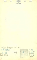
Mine Images
![[[:Blue Blaze|Blue Blaze]]](https://go.illinois.edu/ILMImages/saline/thumbnails/m3316_th.jpg)
Photographs