4103: Difference between revisions
(Created page with "{{Sidebar Info Query}} {{Header |checked=1st Entry |unlocated=No |shown_on_map=Yes |Mine-index=4103 |Coal_co=Black Diamond Coal Company |Mine Name Header=Black Diamond No. 122...") |
Alan.Myers (talk | contribs) No edit summary |
||
| (2 intermediate revisions by 2 users not shown) | |||
| Line 1: | Line 1: | ||
{{Sidebar Info Query}} | {{Sidebar Info Query}} | ||
{{Header | {{Header | ||
|checked= | |checked=Checked OK | ||
|unlocated=No | |unlocated=No | ||
|shown_on_map= | |shown_on_map=No | ||
|reason_nsm=Not shown on accompanying map because the area was later surface-mined by the Delta Mine (mine index [[0702]]). | |||
|Mine-index=4103 | |Mine-index=4103 | ||
|Coal_co=Black Diamond Coal Company | |Coal_co=Black Diamond Coal Company | ||
|Mine Name Header=Black Diamond No. 1227 Mine | |Mine Name Header=Black Diamond No. 1227 Mine | ||
|mine_type=Underground | |mine_type=Underground | ||
|mined-out-area=6 | |mined-out-area=6 | ||
|after_map=2 | |after_map=2 | ||
|indicated=No | |||
|county1=Williamson | |county1=Williamson | ||
|quad1=Carrier Mills | |quad1=Carrier Mills | ||
|city1=Carterville | |||
|year-start=1934 | |year-start=1934 | ||
|year-end=1946 | |year-end=1946 | ||
|Latitude= | |Latitude=37.71422936 | ||
|Longitude= | |Longitude=-88.73308121 | ||
|Zoom=15 | |Zoom=15 | ||
}} | }} | ||
| Line 53: | Line 56: | ||
|Date=1934-1942 | |Date=1934-1942 | ||
|Production=23,198 | |Production=23,198 | ||
|Sum=No | |||
}} | }} | ||
{{Production | {{Production | ||
| Line 59: | Line 63: | ||
|Date=1942-1946 | |Date=1942-1946 | ||
|Production=8,108 {{#info: Production after map date.|note}} | |Production=8,108 {{#info: Production after map date.|note}} | ||
|Sum=No | |||
| | |||
}} | }} | ||
{{Production | {{Production | ||
|Production=31,306 | |Production=31,306 | ||
|Sum=Yes | |||
}} | }} | ||
===Production Notes=== | ===Production Notes=== | ||
Latest revision as of 14:29, May 10, 2024
Mine Index Number: 4103
| Company Name: | Black Diamond Coal Company | ||
|---|---|---|---|
| Mine Name: | Black Diamond No. 1227 Mine | ||
| Start Date: | 1934 | End Date: | 1946 |
| Type of Mine: | Underground | ||
| Total acres shown: | 6 | ||
| Acres after map date: | 2 | General Area of mining acres shown: | |
|
Not Shown On Map. Not shown on accompanying map because the area was later surface-mined by the Delta Mine (mine index 0702). | |||
Shaft, Slope, Drift or Tipple Location(s)
| Type | County | Township-Range | Section | Part Section |
|---|
| Main drift | Williamson | 9S 4E | 26 | NW NW NE |
| Air shaft | Williamson | 9S 4E | 26 | NW NW NE |
Geology
| Thickness (ft) | |||||
|---|---|---|---|---|---|
| Seam | Depth (ft) | Min | Max | Ave | Mining Method |
| Herrin | MRP |
Geological Problems Reported
Production
| Company | Mine Name | Date | Production (tons) |
| Black Diamond Coal Company Charles Ramsey, owner. | Black Diamond No. 1227 | 1934-1942 | 23,198 |
| Black Diamond Coal Company | Black Diamond No. 1227 | 1942-1946 | 8,108 Production after map date. |
| Total Production: 31,306 | |||
Production Notes
Coal Report production (if available)
Sources of Data
| Source Map | Map Date | Original Scale | Digitized Scale | Map Type |
| Company, 4103.W52 i5.1-52 | 9-15-1942 | 1:1200 | 1:1200 | Not final |
Annotated Bibliography (Data source - brief description of information)
| Coal Reports - Production, ownership, years of operation. |
| Directory of Illinois Coal Mines (Williamson County) - Mine names, mine index, ownership, years of operation. |
| Mine notes (Williamson County) - Mine type, drift location, seam. |
| Company map, ISGS map library, 4103.W52 i5.1-52 - Drift and shaft locations, mine outline, mine type, mining method. |
Mine Notes
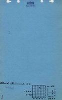
Mine Images

Photographs