1011: Difference between revisions
Alan.Myers (talk | contribs) No edit summary |
No edit summary |
||
| Line 1: | Line 1: | ||
{{Sidebar Info Query}} | {{Sidebar Info Query}} | ||
{{Header | {{Header | ||
|checked= | |checked=Entry Completed | ||
|unlocated=No | |unlocated=No | ||
|shown_on_map=Yes | |shown_on_map=Yes | ||
| Line 9: | Line 9: | ||
|mine_type=Underground | |mine_type=Underground | ||
|mined-out-area=106 | |mined-out-area=106 | ||
|indicated=No | |||
|county1=Saline | |county1=Saline | ||
|quad1=Harco | |quad1=Harco | ||
| Line 80: | Line 81: | ||
|Original Scale=1:12000 | |Original Scale=1:12000 | ||
|Digitized Scale=1:12000 | |Digitized Scale=1:12000 | ||
|Map Type=Final | |||
}} | |||
{{Source Map | |||
|Source Map=State archive, IL_566_01 | |||
|Map Date=8-31-1988 | |||
|Original Scale=1:4800 | |||
|Digitized Scale=1:4800 | |||
|Map Type=Final | |Map Type=Final | ||
}} | }} | ||
| Line 91: | Line 99: | ||
{{Annotated bibliography | {{Annotated bibliography | ||
|bibliography=Company map, ISGS map library, 4103.S32 i5.1-94 - Drift locations, mine outline, mining method. | |bibliography=Company map, ISGS map library, 4103.S32 i5.1-94 - Drift locations, mine outline, mining method. | ||
}} | |||
{{Annotated bibliography | |||
|bibliography=State archive, IL_566_01 - Drift locations, mine outline. | |||
}} | }} | ||
==Mine Notes== | ==Mine Notes== | ||
Latest revision as of 15:56, May 20, 2024
Mine Index Number: 1011
| Company Name: | Amax Coal Company | ||
|---|---|---|---|
| Mine Name: | Harco Mine | ||
| Start Date: | 1986 | End Date: | 1988 |
| Type of Mine: | Underground | ||
| Total acres shown: | 106 | ||
| Acres after map date: | General Area of mining acres shown: | ||
Shaft, Slope, Drift or Tipple Location(s)
| Type | County | Township-Range | Section | Part Section |
|---|
| Main driftThe entrance to the mine was in the highwall of the Delta Mine (mine index 702. | Saline | 9S 5E | 9 | NE SE NW |
| Air driftThe entrance to the mine was in the highwall of the Delta Mine (mine index 702). | Saline | 9S 5E | 9 | NE SE NW |
| Air driftThe entrance to the mine was in the highwall of the Delta Mine (mine index 702). | Saline | 9S 5E | 9 | NE SE NW |
| Air driftThe entrance to the mine was in the highwall of the Delta Mine (mine index 702). | Saline | 9S 5E | 9 | NW SE NW |
Geology
| Thickness (ft) | |||||
|---|---|---|---|---|---|
| Seam | Depth (ft) | Min | Max | Ave | Mining Method |
| Herrin | 120-140 | 5.25 | RP |
Geological Problems Reported
Production
| Company | Mine Name | Date | Production (tons) |
| Amax Coal Company | Harco | 1986-1988 | 484,549 |
| Total Production: 484,549 | |||
Production Notes
Coal Report production (if available)
Sources of Data
| Source Map | Map Date | Original Scale | Digitized Scale | Map Type |
| Company, 4103.S32 i5.1-94 | 2-15-1991 | 1:12000 | 1:12000 | Final |
| State archive, IL_566_01 | 8-31-1988 | 1:4800 | 1:4800 | Final |
Annotated Bibliography (Data source - brief description of information)
| Coal Reports - Production, ownership, years of operation, seam, depth, thickness, mining method. |
| Directory of Illinois Coal Mines (Saline County) - Mine names, mine index, ownership, years of operation. |
| Company map, ISGS map library, 4103.S32 i5.1-94 - Drift locations, mine outline, mining method. |
| State archive, IL_566_01 - Drift locations, mine outline. |
Mine Notes
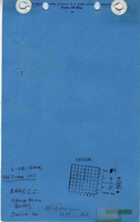
Mine Images
![[[:Harco|Harco]]](https://wikiimage.isgs.illinois.edu/ilmines/saline/thumbnails/m1011_th.jpg)
![[[:Harco|Harco]]](https://wikiimage.isgs.illinois.edu/ilmines/saline/thumbnails/m1011_IL_566_01_geo_th.jpg)
Photographs