4064: Difference between revisions
No edit summary |
Alan.Myers (talk | contribs) No edit summary |
||
| Line 4: | Line 4: | ||
|unlocated=No | |unlocated=No | ||
|shown_on_map=Yes | |shown_on_map=Yes | ||
|reason_nsm=The southern end of the mine was later partially surfaced mined by the Utility Mine (mine index 4041). | |reason_nsm=The southern end of the mine was later partially surfaced mined by the Utility Mine (mine index [[4041]]). | ||
|Mine-index=4064 | |Mine-index=4064 | ||
|Coal_co=Crystal Block Coal Company | |Coal_co=Crystal Block Coal Company | ||
| Line 15: | Line 15: | ||
|year-start=1936 | |year-start=1936 | ||
|year-end=April 1950 | |year-end=April 1950 | ||
|Latitude= | |Latitude=37.74728523 | ||
|Longitude= | |Longitude=-88.83720563 | ||
|Zoom=15 | |Zoom=15 | ||
}} | }} | ||
| Line 55: | Line 55: | ||
|Date=1936-1936 | |Date=1936-1936 | ||
|Production=5,920 | |Production=5,920 | ||
|Sum=No | |||
}} | }} | ||
{{Production | {{Production | ||
| Line 62: | Line 63: | ||
|Date=1937-1940 | |Date=1937-1940 | ||
|Production=11,339 | |Production=11,339 | ||
|Sum=No | |||
}} | }} | ||
{{Production | {{Production | ||
| Line 68: | Line 70: | ||
|Date=1940-1940 | |Date=1940-1940 | ||
|Production=1,437 | |Production=1,437 | ||
|Sum=No | |||
}} | }} | ||
{{Production | {{Production | ||
| Line 74: | Line 77: | ||
|Date=1941-1941 | |Date=1941-1941 | ||
|Production=2,000 | |Production=2,000 | ||
|Sum=No | |||
}} | }} | ||
{{Production | {{Production | ||
| Line 80: | Line 84: | ||
|Date=1941-1943 {{#info: Idle 1942 and 1943.|note}} | |Date=1941-1943 {{#info: Idle 1942 and 1943.|note}} | ||
|Production=579 | |Production=579 | ||
|Sum=No | |||
}} | }} | ||
{{Production | {{Production | ||
| Line 86: | Line 91: | ||
|Date=1944-1947 | |Date=1944-1947 | ||
|Production=167,406 | |Production=167,406 | ||
|Sum=No | |||
}} | }} | ||
{{Production | {{Production | ||
| Line 92: | Line 98: | ||
|Date=1947-1950 {{#info: Idle 1949.|note}} | |Date=1947-1950 {{#info: Idle 1949.|note}} | ||
|Production=120,560 {{#info: Production after map date.|note}} | |Production=120,560 {{#info: Production after map date.|note}} | ||
|Sum=No | |||
| | |||
}} | }} | ||
{{Production | {{Production | ||
|Production=309,241 | |Production=309,241 | ||
|Sum=Yes | |||
}} | }} | ||
===Production Notes=== | ===Production Notes=== | ||
Latest revision as of 15:34, April 14, 2022
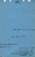
Mine Index Number: 4064
| Company Name: | Crystal Block Coal Company | ||
|---|---|---|---|
| Mine Name: | Crystal Block No. 2 Mine | ||
| Start Date: | 1936 | End Date: | April 1950 |
| Type of Mine: | Underground | ||
| Total acres shown: | 33 | ||
| Acres after map date: | 22 | General Area of mining acres shown: | |
|
The southern end of the mine was later partially surfaced mined by the Utility Mine (mine index 4041). | |||
Shaft, Slope, Drift or Tipple Location(s)
| Type | County | Township-Range | Section | Part Section |
|---|
| Main slope | Williamson | 9S 3E | 11 | NE SE SE |
| Air shaft | Williamson | 9S 3E | 11 | SE SE SE |
Geology
| Thickness (ft) | |||||
|---|---|---|---|---|---|
| Seam | Depth (ft) | Min | Max | Ave | Mining Method |
| Herrin | 52-65 | 5.67-6.0 | MRP |
Geological Problems Reported
Production
| Company | Mine Name | Date | Production (tons) |
| Blue Ribbon Coal Company | Blue Ribbon No. 1 | 1936-1936 | 5,920 |
| B. and L. Coal Company The 1939 map of this mine was labeled B. L. S. & G. Coal Company. | B. and L. | 1937-1940 | 11,339 |
| I. D. Gosnell | Gosnell | 1940-1940 | 1,437 |
| Merritt Coal Company | Merritt | 1941-1941 | 2,000 |
| Smith & Warner | Smith & Warner | 1941-1943 Idle 1942 and 1943. | 579 |
| Crystal Block Coal Company | Crystal Block No. 2 | 1944-1947 | 167,406 |
| Crystal Block Coal Company | Crystal Block No. 2 | 1947-1950 Idle 1949. | 120,560 Production after map date. |
| Total Production: 309,241 | |||
Production Notes
Coal Report production (if available)
Sources of Data
| Source Map | Map Date | Original Scale | Digitized Scale | Map Type |
| Microfilm, document 353274 | 1-9-1947 | 1:2400 | 1:2980 | Not final |
Annotated Bibliography (Data source - brief description of information)
| Coal Reports - Production, ownership, years of operation, thickness, depth. |
| Directory of Illinois Coal Mines (Williamson County) - Mine names, mine index, ownership, years of operation. |
| Mine notes (Williamson County) - Mine type, slope location, seam, depth, thickness. |
| Microfilm map, document 353274, reel 03142, frame 218 - Slope and shaft locations, mine outline, mining method. |
Mine Notes
Mine Images
![[[:Crystal Block No. 2|Crystal Block No. 2]]](https://wikiimage.isgs.illinois.edu/ilmines/williamson/thumbnails/m4064_th.jpg)
Photographs