0151: Difference between revisions
No edit summary |
No edit summary |
||
| Line 8: | Line 8: | ||
|Mine Name Header=Slogo Mine | |Mine Name Header=Slogo Mine | ||
|mine_type=132 {{#info: The outline shown on the accompanying map shows the White Ash Mine contiguous to the White Ash Mine (mine index 150) and Carterville No. 6 Mine (mine index 323). The boundaries between these mines may be approximate; the area shown is approximately what would have been mined by the combined production of the three mines. In addition, a general area of mining designates an area that could have been mined.|note}} | |mine_type=132 {{#info: The outline shown on the accompanying map shows the White Ash Mine contiguous to the White Ash Mine (mine index 150) and Carterville No. 6 Mine (mine index 323). The boundaries between these mines may be approximate; the area shown is approximately what would have been mined by the combined production of the three mines. In addition, a general area of mining designates an area that could have been mined.|note}} | ||
|indicated=No | |||
|county1=Williamson | |county1=Williamson | ||
|quad1=Johnston City | |quad1=Johnston City | ||
| Line 106: | Line 107: | ||
}} | }} | ||
{{Annotated bibliography | {{Annotated bibliography | ||
|bibliography= | |bibliography=ISGS map library, 4103.W52 i5.1-189, work map for Federal Land Bank Report map - Shaft location, mine outline. | ||
}} | }} | ||
{{Annotated bibliography | {{Annotated bibliography | ||
Latest revision as of 12:08, August 1, 2022
Mine Index Number: 0151
| Company Name: | Slogo Coal Corporation | ||
|---|---|---|---|
| Mine Name: | Slogo Mine | ||
| Start Date: | 1909 | End Date: | March 1927 |
| Type of Mine: | 132 The outline shown on the accompanying map shows the White Ash Mine contiguous to the White Ash Mine (mine index 150) and Carterville No. 6 Mine (mine index 323). The boundaries between these mines may be approximate; the area shown is approximately what would have been mined by the combined production of the three mines. In addition, a general area of mining designates an area that could have been mined. | ||
| Total acres shown: | |||
| Acres after map date: | General Area of mining acres shown: | ||
Shaft, Slope, Drift or Tipple Location(s)
| Type | County | Township-Range | Section | Part Section |
|---|
| Main shaft | Williamson | 8S 3E | 32 | NE NW SW |
Geology
| Thickness (ft) | |||||
|---|---|---|---|---|---|
| Seam | Depth (ft) | Min | Max | Ave | Mining Method |
| Herrin | 142 | 8.0 | 6.0-7.0 | RP |
Geological Problems Reported
The roof was gray shale. The coal contained pyrite in lenses and stringers, calcite and gypsum fracture fillings, and some thin charcoal lenses throughout the seam.
Production
| Company | Mine Name | Date | Production (tons) |
| Carterville District Coal Company | Carterville District No. 1 | 1909-1912 | 620,871 |
| Illinois Hocking Washed Coal Company | Illinois Hocking | 1912-1913 | 201,250 |
| Slogo Coal Corporation The Coal Section mine notes indicate that Lumaghi Brothers owned or operated Slogo Coal Company. The mine was also known under several names, such as Black Briar No. 1 Mine, White Ash Mine, and Goddard Mine. | Slogo | 1917-1927 Reported abandoned in 1913, reopened in 1917; idle 1925 | 765,647 |
| Total Production: 1,587,768 | |||
Production Notes
Coal Report production (if available)
Sources of Data
| Source Map | Map Date | Original Scale | Digitized Scale | Map Type |
| Composite, 4103.W52 i5.1-189 | 8-11-1934 | 1:63360 | 1:63360 | Secondary source |
| ISGS map library, 4103.W52 i5.1-125 | 3-2-1952 | 1:2400 | 1:2400 | Secondary source |
| Coal Section files, 6-429 | 4-15-1987 | 1:12000 | 1:12000 | Secondary source |
Annotated Bibliography (Data source - brief description of information)
| Coal Reports - Production, ownership, years of operation, mining method. |
| Directory of Illinois Coal Mines (Williamson County) - Mine names, mine index, ownership, years of operation. |
| Mine notes (Williamson County) - Mine type, shaft location, seam, depth, thickness, geologic problems. |
| ISGS map library, 4103.W52 i5.1-189, work map for Federal Land Bank Report map - Shaft location, mine outline. |
| ISGS map library, 4103.W52 i5.1-125, map of Schull and Moake (mine index 4042) - Mine outline (southern, eastern). |
| Coal Section files, 6-429, map of Orient No. 4 Mine (mine index 688) - Mine outline (northern). |
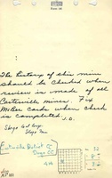
Mine Notes
Mine Images

![[[:Orient No. 4|Orient No. 4]]](https://wikiimage.isgs.illinois.edu/ilmines/williamson/thumbnails/m0688a_th.jpg)
Photographs