3700: Difference between revisions
No edit summary |
No edit summary |
||
| Line 1: | Line 1: | ||
{{Sidebar Info Query}} | {{Sidebar Info Query}} | ||
{{Header | {{Header | ||
|checked= | |checked=Checked OK | ||
|unlocated=No | |unlocated=No | ||
|shown_on_map=Yes | |shown_on_map=Yes | ||
| Line 9: | Line 9: | ||
|mine_type=Surface | |mine_type=Surface | ||
|mined-out-area=172 | |mined-out-area=172 | ||
|indicated=No | |||
|county1=Vermilion | |county1=Vermilion | ||
|quad1=Danville SW | |quad1=Danville SW | ||
Latest revision as of 10:53, September 16, 2022
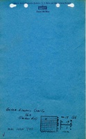
Mine Index Number: 3700
| Company Name: | United Electric Coal Company | ||
|---|---|---|---|
| Mine Name: | United Electric No. 5 Mine | ||
| Start Date: | 1915 | End Date: | April 1926 |
| Type of Mine: | Surface | ||
| Total acres shown: | 172 | ||
| Acres after map date: | General Area of mining acres shown: | ||
Shaft, Slope, Drift or Tipple Location(s)
| Type | County | Township-Range | Section | Part Section |
|---|
| Tipple | Vermilion | 19N 11W | 18 | SW NE NW Surface mining extended through sections 7 & 18 of T19N-R11W and sections 12 & 13 of T19N-R12W. |
Geology
| Thickness (ft) | |||||
|---|---|---|---|---|---|
| Seam | Depth (ft) | Min | Max | Ave | Mining Method |
| Danville | 30-66 | 5.5-6.0 | Surface |
Geological Problems Reported
Production
| Company | Mine Name | Date | Production (tons) |
| Carbon Hill Coal Company | Carbon Hill No. 5 | 1915-1918 | 403,706 |
| Electric Coal Company | Electric No. 5 | 1918-1921 | 408,944 |
| United Electric Coal Company | United Electric No. 5 | 1921-1926 | 534,669 |
| Total Production: 1,347,319 | |||
Production Notes
Coal Report production (if available)
Sources of Data
| Source Map | Map Date | Original Scale | Digitized Scale | Map Type |
| USGS topographic map | PR 1978; 1950 | 1:24000 | 1:24000 | Secondary source |
Annotated Bibliography (Data source - brief description of information)
| Coal Reports - Production, ownership, years of operation, depth, thickness, mining method. |
| Directory of Illinois Coal Mines (Vermilion County) - Mine names, mine index, ownership, years of operation. |
| Mine notes (Vermilion County) - Mine type, tipple location, seam, seam, depth, thickness, general location and shape of pit. |
| USGS topographic map, 1966, Photorevised 1978; 1950 - Mine outline, mining method. |
Mine Notes
Mine Images
Photographs