3706: Difference between revisions
No edit summary |
No edit summary |
||
| Line 1: | Line 1: | ||
{{Sidebar Info Query}} | {{Sidebar Info Query}} | ||
{{Header | {{Header | ||
|checked= | |checked=Checked OK | ||
|unlocated=No | |unlocated=No | ||
|shown_on_map=Yes | |shown_on_map=Yes | ||
| Line 9: | Line 9: | ||
|mine_type=Underground | |mine_type=Underground | ||
|mined-out-area=7 | |mined-out-area=7 | ||
|indicated=No | |||
|county1=Vermilion | |county1=Vermilion | ||
|quad1=Danville SW | |quad1=Danville SW | ||
Latest revision as of 11:09, September 16, 2022
Mine Index Number: 3706
| Company Name: | Daniel A. Jenkins | ||
|---|---|---|---|
| Mine Name: | Jenkins Mine | ||
| Start Date: | 1894 | End Date: | 1910 |
| Type of Mine: | Underground | ||
| Total acres shown: | 7 | ||
| Acres after map date: | General Area of mining acres shown: | ||
Shaft, Slope, Drift or Tipple Location(s)
| Type | County | Township-Range | Section | Part Section |
|---|
| Main drift | Vermilion | 19N 11W | 17 | SE SW NE |
| Drift | Vermilion | 19N 11W | 17 | SE SW NE |
| Drift | Vermilion | 19N 11W | 17 | SW SW NE |
| Drift | Vermilion | 19N 11W | 17 | NW NW SE |
| Drift | Vermilion | 19N 11W | 17 | NE NE SW |
Geology
| Thickness (ft) | |||||
|---|---|---|---|---|---|
| Seam | Depth (ft) | Min | Max | Ave | Mining Method |
| Danville | 60-75 | 5.5-6.0 | RP |
Geological Problems Reported
Production
| Company | Mine Name | Date | Production (tons) |
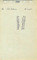
| Daniel A. Jenkins | Jenkins | 1894-1910 | 127,113 |
| Total Production: 127,113 | |||
Production Notes
Coal Report production (if available)
Sources of Data
| Source Map | Map Date | Original Scale | Digitized Scale | Map Type |
| Microfilm, document 352930 | 5-6-1903 The mined area shown on the accompanying map is the approximate size expected for the production reported. This suggests that the mine outline is complete. | 1:1200 | 1:1572 | Secondary source |
| WPA, T19N-R11W | 5-6-1903 (survey date) | 1:12000 | 1:62500 | Secondary source |
Annotated Bibliography (Data source - brief description of information)
| Coal Reports - Production, ownership, years of operation, seam depth, thickness, mining method. |
| Directory of Illinois Coal Mines (Vermilion County) - Mine names, mine index, ownership, years of operation. |
| Microfilm map, document 352930, reel 03141, frame 70 (Consolidated Coal Company of St. Louis, map of Danville Drifts) - Drift locations, mine outline, mining method. |
| WPA, T19N-R11W - Mine location (required to georegister the microfilm map). |
Mine Notes
Mine Images


Photographs