0443: Difference between revisions
No edit summary |
No edit summary |
||
| Line 1: | Line 1: | ||
{{Sidebar Info Query}} | {{Sidebar Info Query}} | ||
{{Header | {{Header | ||
|checked= | |checked=Checked OK | ||
|unlocated=No | |unlocated=No | ||
|shown_on_map=Yes | |shown_on_map=Yes | ||
| Line 9: | Line 9: | ||
|mine_type=Underground | |mine_type=Underground | ||
|mined-out-area=800 | |mined-out-area=800 | ||
|indicated=No | |||
|county1=St. Clair | |county1=St. Clair | ||
|quad1=French Village | |quad1=French Village | ||
|year-start=1901 | |year-start=1901 | ||
|year-end=1928 | |year-end=October 1928 | ||
|Latitude=38.5773589040001 | |Latitude=38.5773589040001 | ||
|Longitude=-90.010915954 | |Longitude=-90.010915954 | ||
Revision as of 10:59, September 23, 2022
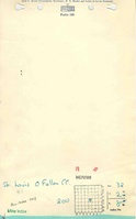
Mine Index Number: 0443
| Company Name: | St. Louis and O'Fallon Coal Company | ||
|---|---|---|---|
| Mine Name: | St. Louis and O'Fallon No. 1 Mine | ||
| Start Date: | 1901 | End Date: | October 1928 |
| Type of Mine: | Underground | ||
| Total acres shown: | 800 | ||
| Acres after map date: | General Area of mining acres shown: | ||
Shaft, Slope, Drift or Tipple Location(s)
| Type | County | Township-Range | Section | Part Section |
|---|
| Main shaft | St. Clair | 2N 8W | 32 | NW NW SE |
| Air shaft | St. Clair | 2N 8W | 32 | NW NW SE |
| Escape shaft | St. Clair | 2N 8W | 32 | NW NW SE |
Geology
| Thickness (ft) | |||||
|---|---|---|---|---|---|
| Seam | Depth (ft) | Min | Max | Ave | Mining Method |
| Herrin | 127 | 6.2 | RPP |
Geological Problems Reported
Production
| Company | Mine Name | Date | Production (tons) |
| St. Louis and O'Fallon Coal Company | St. Louis and O'Fallon No. 1 | 1901-1928 Idle 1914-1916, 1925 | 4,789,138 |
| Total Production: 4,789,138 | |||
Production Notes
Coal Report production (if available)
Sources of Data
| Source Map | Map Date | Original Scale | Digitized Scale | Map Type |
| Microfilm, document 350967 | 6-1929 | 1:2400 | 1:4464 | Final |
Annotated Bibliography (Data source - brief description of information)
| Coal Reports - Production, ownership, years of operation. |
| Directory of Illinois Coal Mines (St. Clair County) - Mine names, mine index, ownership, years of operation. |
| Microfilm map, document 350967, reel 03134, frames 14-19 - Shaft locations, mine outline, mining method. |
| Mine notes (St. Clair County) - Thickness, depth, seam, mine type. |
Mine Notes
Mine Images
![[[:St. Louis and O'Fallon No. 1|St. Louis and O'Fallon No. 1]]](https://wikiimage.isgs.illinois.edu/ilmines/st_clair/thumbnails/m0443_MSHA_1718_th.jpg)
Photographs